MyTopo
Clayton NE South Dakota US Topo Map
Couldn't load pickup availability
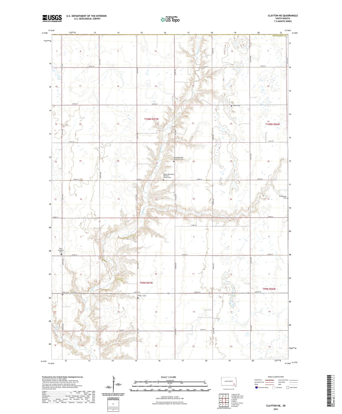
2021 topographic map quadrangle Clayton NE in the state of South Dakota. Scale: 1:24000. Based on the newly updated USGS 7.5' US Topo map series, this map is in the following counties: Hutchinson, McCook, Hanson. The map contains contour data, water features, and other items you are used to seeing on USGS maps, but also has updated roads and other features. This is the next generation of topographic maps. Printed on high-quality waterproof paper with UV fade-resistant inks.
Quads adjacent to this one:
West: Clayton
Northwest: Spencer SW
North: Bridgewater West
Northeast: Bridgewater East
East: Dolton
Southeast: Freeman
South: Wolf Creek
Southwest: Tschetter Colony
Contains the following named places: Elm Creek, Hofer Cemetery, Hofer Dam, Huber 1 Cemetery, Kleinkassell Cemetery, Neu Hutterthal Mennonite Cemetery, New Hutterthal Church, Salem Church, Salem Mennonite Brethren Church Cemetery, Stern Cemetery, Township of Pleasant, Township of Silver Lake, Township of Wolf Creek, Unity Church, Unity Lutheran Cemetery