MyTopo
Wolf Creek South Dakota US Topo Map
Couldn't load pickup availability
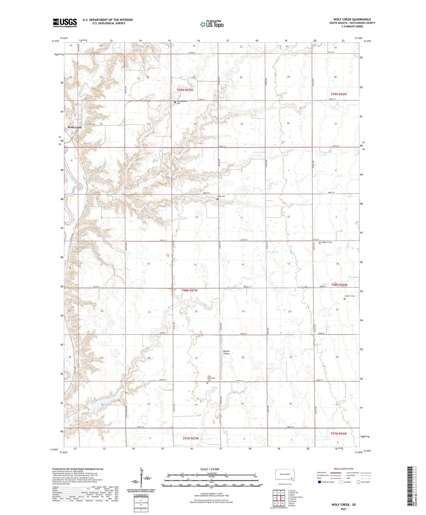
2021 topographic map quadrangle Wolf Creek in the state of South Dakota. Scale: 1:24000. Based on the newly updated USGS 7.5' US Topo map series, this map is in the following counties: Hutchinson. The map contains contour data, water features, and other items you are used to seeing on USGS maps, but also has updated roads and other features. This is the next generation of topographic maps. Printed on high-quality waterproof paper with UV fade-resistant inks.
Quads adjacent to this one:
West: Tschetter Colony
Northwest: Clayton
North: Clayton NE
Northeast: Dolton
East: Freeman
Southeast: Midway
South: Menno
Southwest: Scotland
This map covers the same area as the classic USGS quad with code o43097c5.
Contains the following named places: Delzer School, Huber 2 Cemetery, Huber 3 Cemetery, Huber School, Johannestahl Cemetery, Kassel Church, Kassel School, Lake Menno, Menno Dam, Mettler Airport, Mutchelknaus School, Riverside School, Township of Kassel, Trinity Church, Walz Cemetery, Walz School, Wolf Creek, Wolf Creek Colony Census Designated Place, Wolf Creek Colony Elementary School, Zion Church, Zion Reformed Cemetery