MyTopo
Cottonwood South Dakota US Topo Map
Couldn't load pickup availability
Also explore the Cottonwood Forest Service Topo of this same quad for updated USFS data
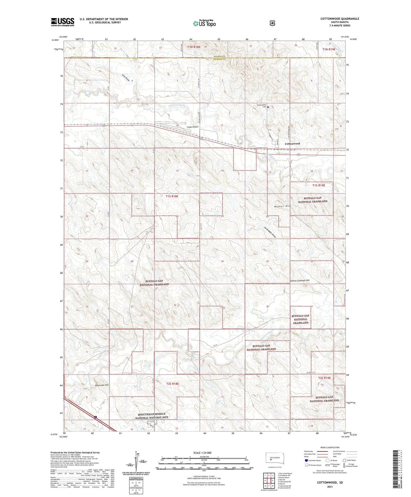
2021 topographic map quadrangle Cottonwood in the state of South Dakota. Scale: 1:24000. Based on the newly updated USGS 7.5' US Topo map series, this map is in the following counties: Jackson, Haakon. The map contains contour data, water features, and other items you are used to seeing on USGS maps, but also has updated roads and other features. This is the next generation of topographic maps. Printed on high-quality waterproof paper with UV fade-resistant inks.
Quads adjacent to this one:
West: Wall NE
Northwest: Elm Creek Ranch
North: Grindstone SW
Northeast: Bowen Ranch
East: Cottonwood NE
Southeast: Cottonwood SE
South: Cottonwood SW
Southwest: Wall SE
This map covers the same area as the classic USGS quad with code o43101h8.
Contains the following named places: Ackerman Hill, Cooks Airport, Cottonwood, Cottonwood Cemetery, Hinton-Coleman Hill, Hi-Way School, Lake Creek, Lost Draw, Temple Number 1 Dam, Town of Cottonwood, Unorganized Territory of Northwest Jackson, Walker Hill