
MyTopo
Dalzell NE South Dakota US Topo Map
Couldn't load pickup availability
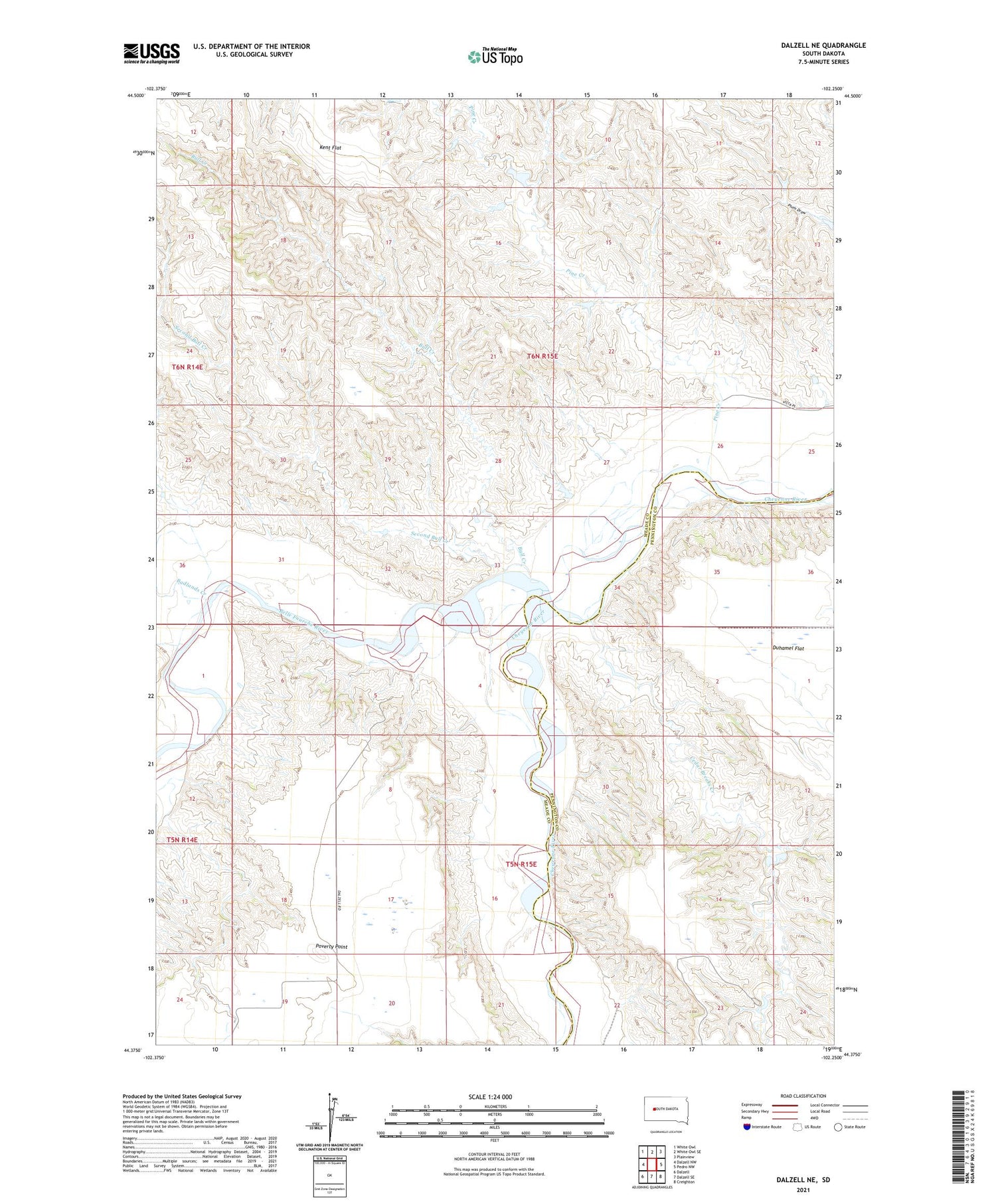
2021 topographic map quadrangle Dalzell NE in the state of South Dakota. Scale: 1:24000. Based on the newly updated USGS 7.5' US Topo map series, this map is in the following counties: Meade, Pennington. The map contains contour data, water features, and other items you are used to seeing on USGS maps, but also has updated roads and other features. This is the next generation of topographic maps. Printed on high-quality waterproof paper with UV fade-resistant inks.
Quads adjacent to this one:
West: Dalzell NW
Northwest: White Owl
North: White Owl SE
Northeast: Plainview
East: Pedro NW
Southeast: Creighton
South: Dalzell SE
Southwest: Dalzell
Contains the following named places: Badlands Creek, Belle Fourche River, Bull Creek, Cedar Breaks Creek, Crowell School, Duhamel Flat, Kent Flat, McCasland and Schiller Number 4 Dam, Pine Creek, Poverty Point, Second Bull Creek, Township of Cheyenne, Two Rivers Ranch


