MyTopo
Creighton South Dakota US Topo Map
Couldn't load pickup availability
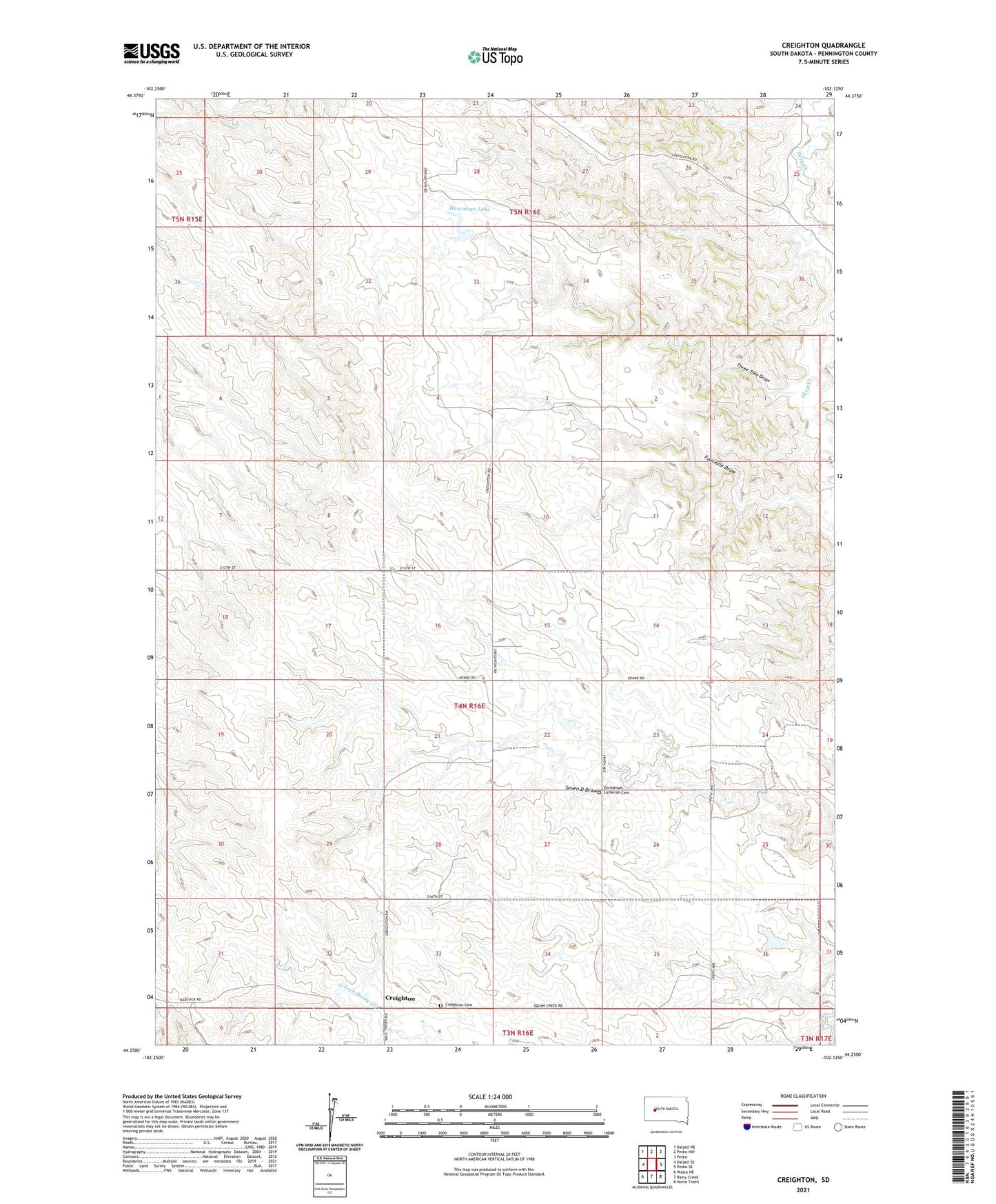
2023 topographic map quadrangle Creighton in the state of South Dakota. Scale: 1:24000. Based on the newly updated USGS 7.5' US Topo map series, this map is in the following counties: Pennington. The map contains contour data, water features, and other items you are used to seeing on USGS maps, but also has updated roads and other features. This is the next generation of topographic maps. Printed on high-quality waterproof paper with UV fade-resistant inks.
Quads adjacent to this one:
West: Dalzell SE
Northwest: Dalzell NE
North: Pedro NW
Northeast: Pedro
East: Pedro SE
Southeast: Horse Tooth
South: Rainy Creek
Southwest: Wasta NE
This map covers the same area as the classic USGS quad with code o44102c2.
Contains the following named places: Creighton, Creighton Cemetery, Crouch Ranch, Dale Ranch, Emmanuel Church, Emmanuel Lutheran Cemetery, Erwin Eisenbraun Dam, Fourmile Draw, Hammann Lake, Hammann School, Johnson Ranch, Lewis Dam, North Creighton School, Peno Grazing Association Dam, Schroeder Ranch, Selvin Johnson Dam, South Creighton School, Three Tree Draw, Township of Rainy Creek, Township of Rainy Creek/Cheyenne, Veryl Schroeder 1 Dam, Veryl Schroeder 2 Dam