MyTopo
Pedro NW South Dakota US Topo Map
Couldn't load pickup availability
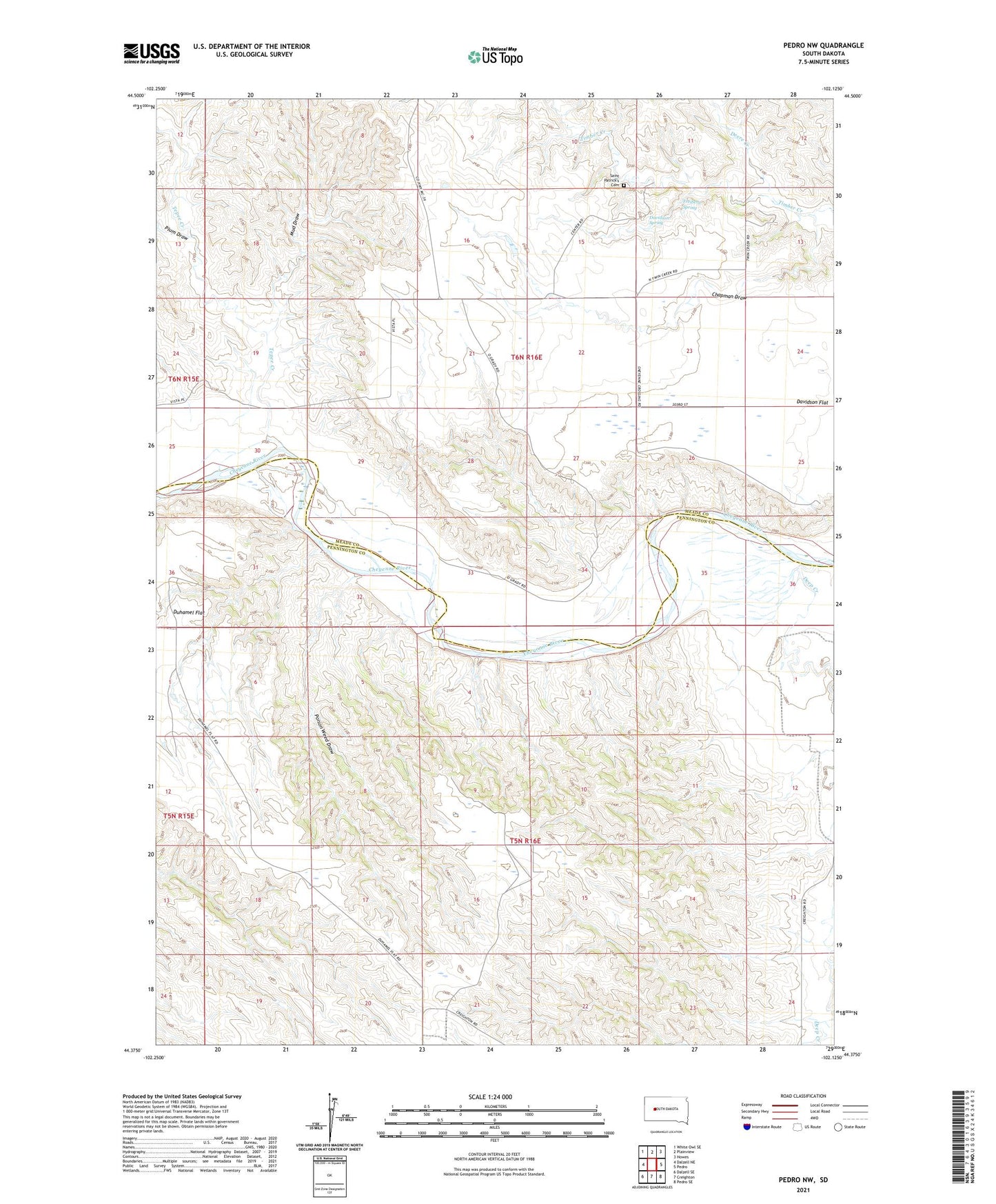
2021 topographic map quadrangle Pedro NW in the state of South Dakota. Scale: 1:24000. Based on the newly updated USGS 7.5' US Topo map series, this map is in the following counties: Pennington, Meade. The map contains contour data, water features, and other items you are used to seeing on USGS maps, but also has updated roads and other features. This is the next generation of topographic maps. Printed on high-quality waterproof paper with UV fade-resistant inks.
Quads adjacent to this one:
West: Dalzell NE
Northwest: White Owl SE
North: Plainview
Northeast: Howes
East: Pedro
Southeast: Pedro SE
South: Creighton
Southwest: Dalzell SE
This map covers the same area as the classic USGS quad with code o44102d2.
Contains the following named places: Chapman Draw, Davidson Flat, Davidson Spring, Deep Creek, Deere Creek, Denke Ranch, Freiberg Ranch, Freiberg Spring, Goff Ranch, Gumbo, King Ranch, McKay Ranch, Mud Draw, Newcombe Ranch, Pedro, Plum Draw, Poison Weed Draw, Rhiley Ranch, Saint Patrick's Cemetery, Saint Patricks Church, Tepee Creek, Timber Creek School