MyTopo
Doland SE South Dakota US Topo Map
Couldn't load pickup availability
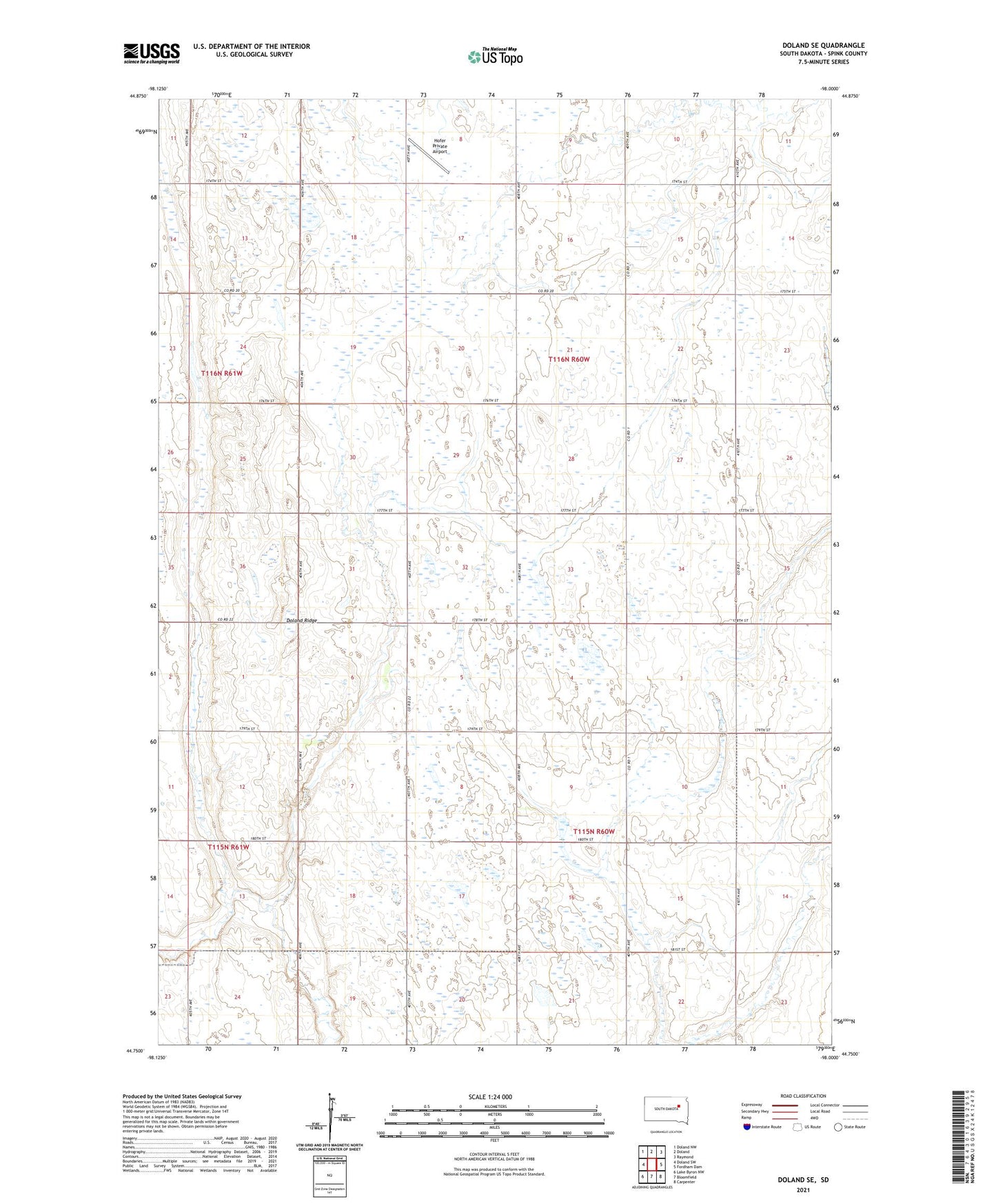
2021 topographic map quadrangle Doland SE in the state of South Dakota. Scale: 1:24000. Based on the newly updated USGS 7.5' US Topo map series, this map is in the following counties: Spink. The map contains contour data, water features, and other items you are used to seeing on USGS maps, but also has updated roads and other features. This is the next generation of topographic maps. Printed on high-quality waterproof paper with UV fade-resistant inks.
Quads adjacent to this one:
West: Doland SW
Northwest: Doland NW
North: Doland
Northeast: Raymond
East: Fordham Dam
Southeast: Carpenter
South: Bloomfield
Southwest: Lake Byron NW
This map covers the same area as the classic USGS quad with code o44098g1.
Contains the following named places: Doland Ridge, Hofer Private Airport, Mirage Dam, Mirage Lake, Township of Capitola, Township of Richfield, ZIP Code: 57436