MyTopo
Dupree NE South Dakota US Topo Map
Couldn't load pickup availability
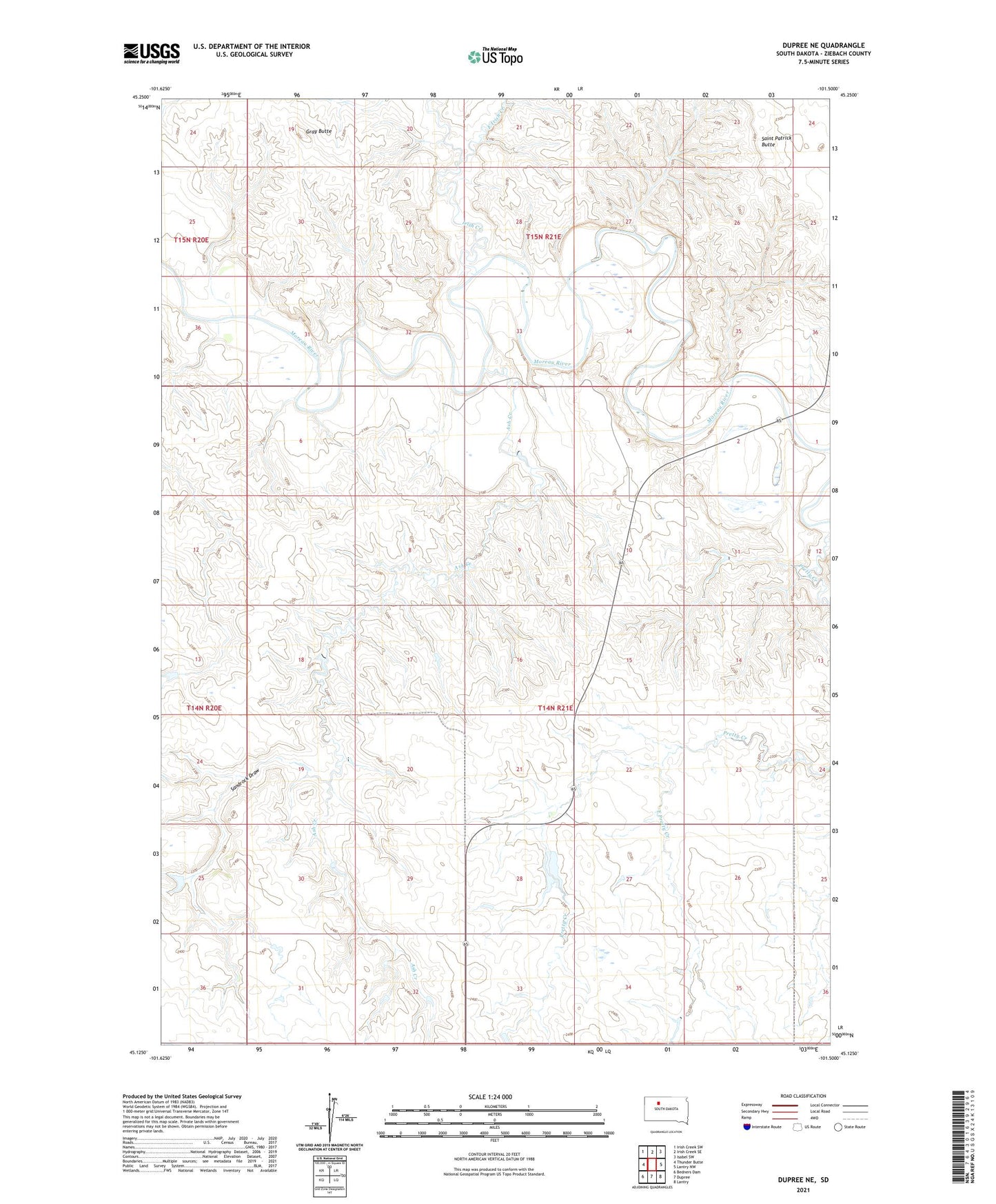
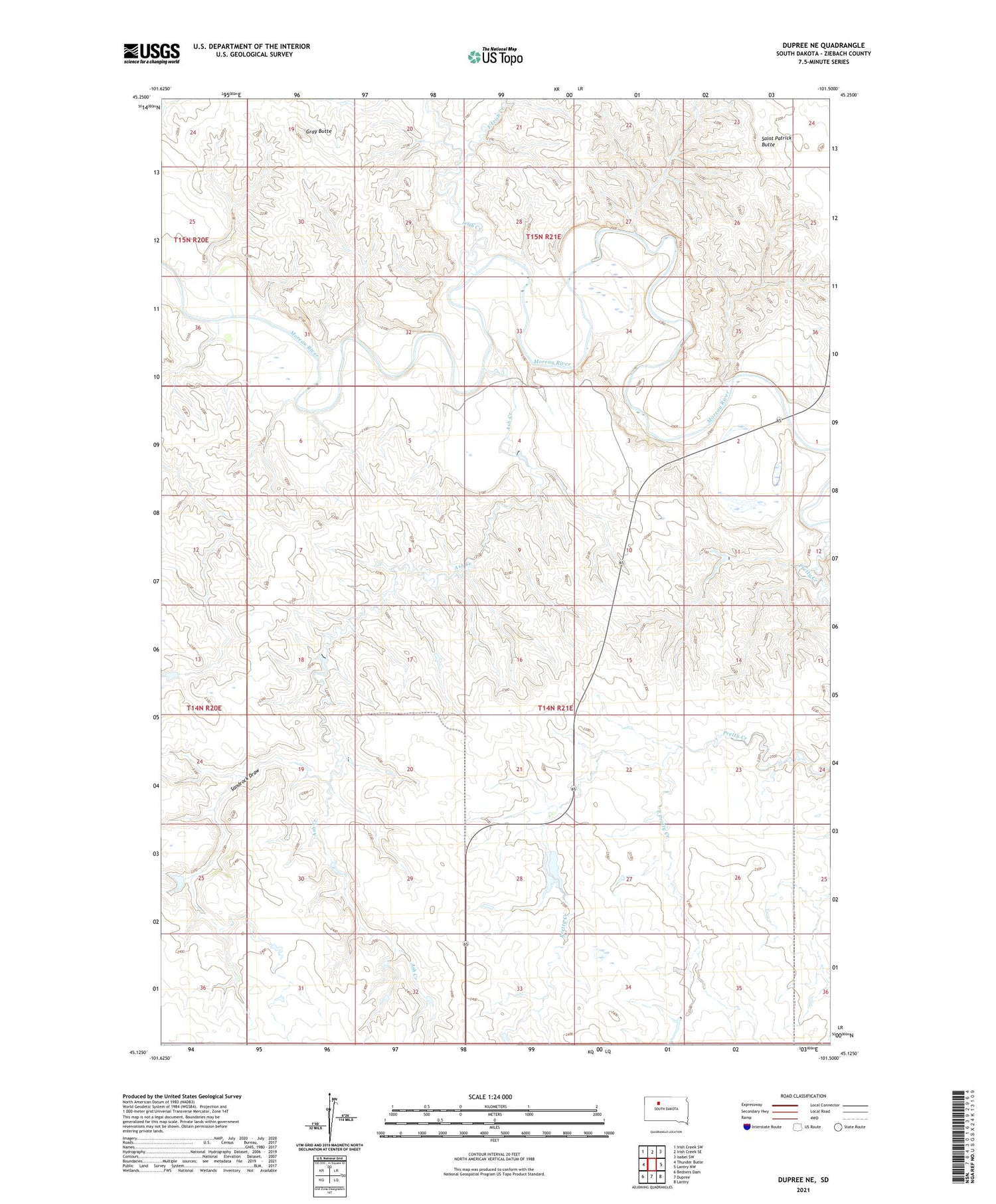
2021 topographic map quadrangle Dupree NE in the state of South Dakota. Scale: 1:24000. Based on the newly updated USGS 7.5' US Topo map series, this map is in the following counties: Ziebach. The map contains contour data, water features, and other items you are used to seeing on USGS maps, but also has updated roads and other features. This is the next generation of topographic maps. Printed on high-quality waterproof paper with UV fade-resistant inks.
Quads adjacent to this one:
West: Thunder Butte
Northwest: Irish Creek SW
North: Irish Creek SE
Northeast: Isabel SW
East: Lantry NW
Southeast: Lantry
South: Dupree
Southwest: Bedners Dam
Contains the following named places: Ash Creek, B Silverman Dam, East Irish Creek, East Pretty Creek, Gray Butte, Irish Creek, M Mraz Dam, Mraz Brothers Dam, Pretty Creek School, Saint Patrick Butte, Sammons Dam, Sammons Number 2 Dam, Sandrock Draw, Tribe Number 4 Dam