MyTopo
Lantry South Dakota US Topo Map
Couldn't load pickup availability
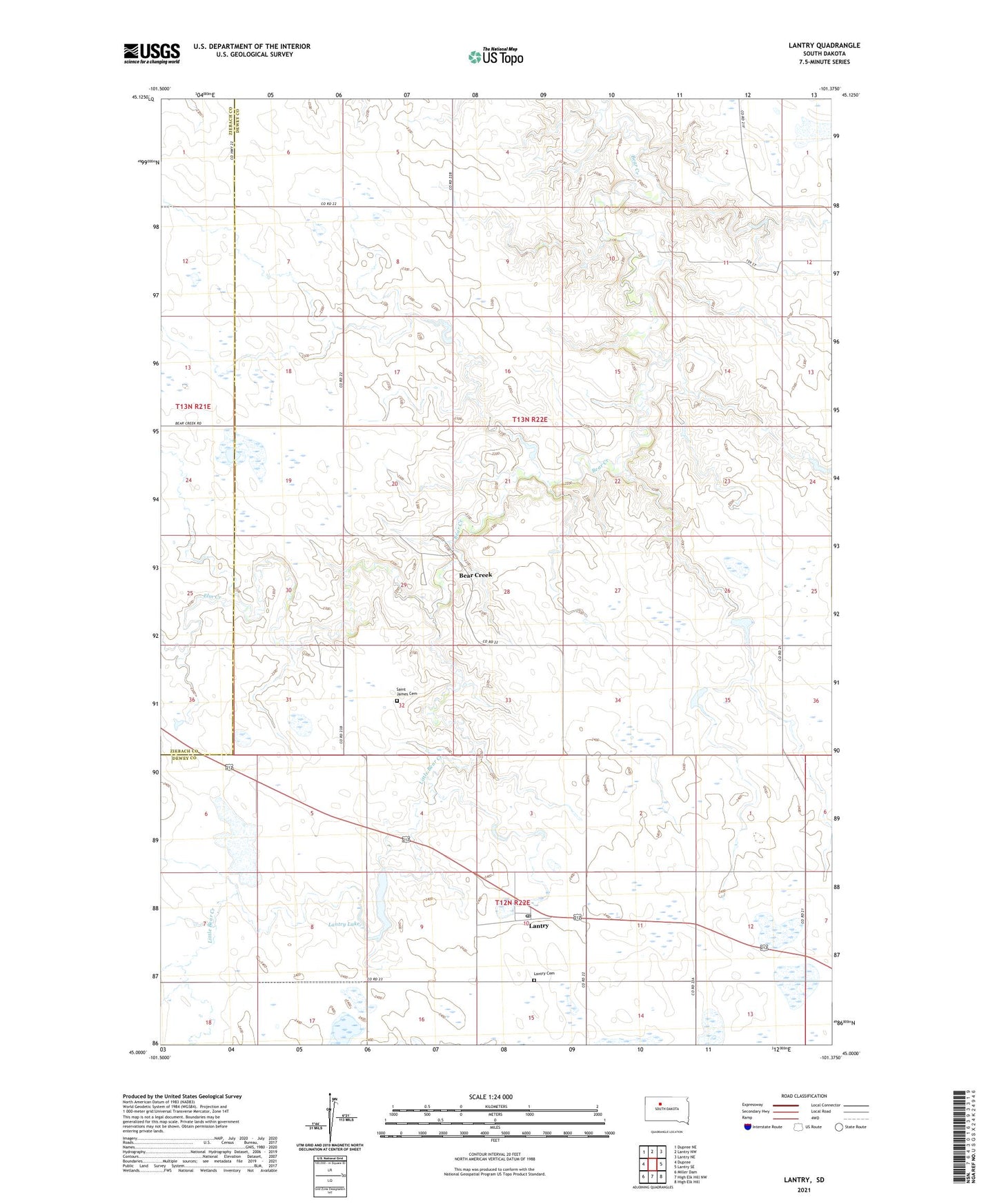
2021 topographic map quadrangle Lantry in the state of South Dakota. Scale: 1:24000. Based on the newly updated USGS 7.5' US Topo map series, this map is in the following counties: Dewey, Ziebach. The map contains contour data, water features, and other items you are used to seeing on USGS maps, but also has updated roads and other features. This is the next generation of topographic maps. Printed on high-quality waterproof paper with UV fade-resistant inks.
Quads adjacent to this one:
West: Dupree
Northwest: Dupree NE
North: Lantry NW
Northeast: Lantry NE
East: Lantry SE
Southeast: High Elk Hill
South: High Elk Hill NW
Southwest: Miller Dam
This map covers the same area as the classic USGS quad with code o45101a4.
Contains the following named places: Bear Creek, Bear Creek Day School, Don Farlee Dam, Elm Creek, G Holloway Dam, Glen Holloway Dam, H C Seymore East Dam, L Koch Dam, Lantry, Lantry Cemetery, Lantry Census Designated Place, Lantry Lake, Lantry Post Office, Little Bear Creek, M Schremp Dam, McDaniel Landing Strip, O Counting Dam, R Schrempp Dam, Rock Cowan Number 1 Dam, Rock Cowan Number 2 Dam, Rock Cowan Number 3 Dam, Rock Cowan Number 4 Dam, Saint James Cemetery, W F Collins Dam, ZIP Code: 57636