
MyTopo
Dupree South Dakota US Topo Map
Couldn't load pickup availability
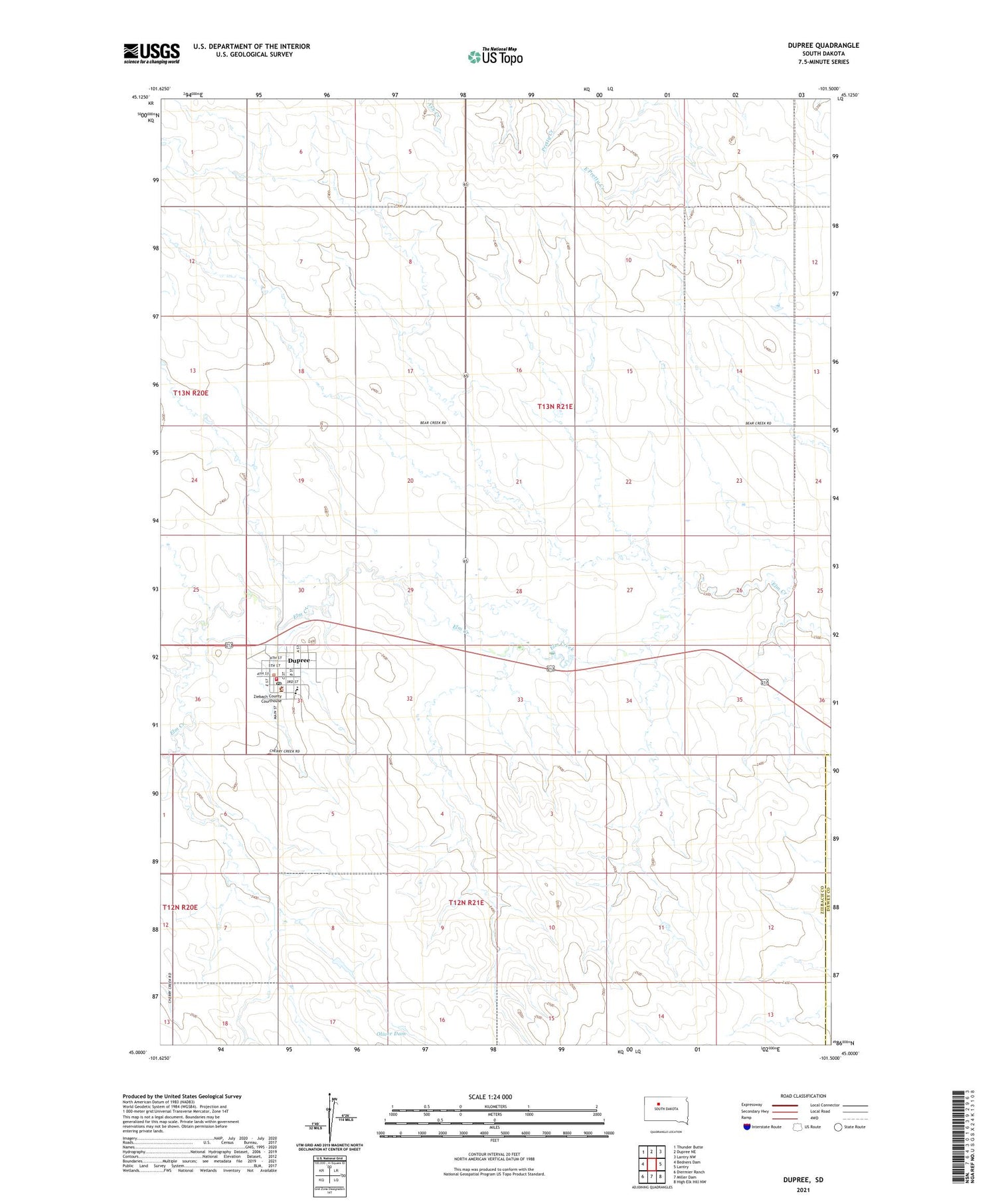
2021 topographic map quadrangle Dupree in the state of South Dakota. Scale: 1:24000. Based on the newly updated USGS 7.5' US Topo map series, this map is in the following counties: Ziebach, Dewey. The map contains contour data, water features, and other items you are used to seeing on USGS maps, but also has updated roads and other features. This is the next generation of topographic maps. Printed on high-quality waterproof paper with UV fade-resistant inks.
Quads adjacent to this one:
West: Bedners Dam
Northwest: Thunder Butte
North: Dupree NE
Northeast: Lantry NW
East: Lantry
Southeast: High Elk Hill NW
South: Miller Dam
Southwest: Diermier Ranch
Contains the following named places: A Dosch Dam, C Mraz Dam, City of Dupree, Dupree, Dupree City Office, Dupree Community Hall, Dupree Elementary School, Dupree High School, Dupree Junior High School, Dupree Municipal Airport, Dupree Post Office, Dupree Volunteer Fire Department, L Woodward Dam, Oliver Dam, Unorganized Territory of Dupree, Ziebach County Courthouse, Ziebach County Sheriffs Office


