MyTopo
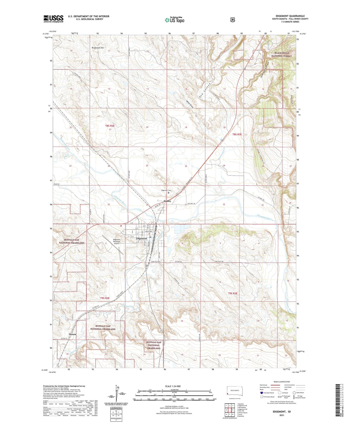
Edgemont South Dakota US Topo Map
Couldn't load pickup availability
Also explore the Edgemont Forest Service Topo of this same quad for updated USFS data
2021 topographic map quadrangle Edgemont in the state of South Dakota. Scale: 1:24000. Based on the newly updated USGS 7.5' US Topo map series, this map is in the following counties: Fall River. The map contains contour data, water features, and other items you are used to seeing on USGS maps, but also has updated roads and other features. This is the next generation of topographic maps. Printed on high-quality waterproof paper with UV fade-resistant inks.
Quads adjacent to this one:
West: Edgemont SW
Northwest: Burdock
North: Edgemont NE
Northeast: Minnekahta
East: Flint Hill
Southeast: Rumford
South: Provo
Southwest: Phister Ranch
This map covers the same area as the classic USGS quad with code o43103c7.
Contains the following named places: Bell Ranch, Breakneck Hill, Cascade Post Office, City of Edgemont, Coal Creek, Cottonwood Creek, Dennis, Dry Creek, Dudley, Dudley Census Designated Place, Edgemont, Edgemont Ambulance Service, Edgemont Cemetery, Edgemont City Hall, Edgemont City Police Department, Edgemont Elementary School, Edgemont Fire Department, Edgemont High School, Edgemont Municipal Airport, Edgemont Post Office, Edgemont Public Library, Red Canyon, Red Canyon Creek, Red Canyon Station, Sheep Canyon, Stone Quarry Canyon, Township of Cottonwood, Trails Trains and Pioneers Museum, White Draw, ZIP Code: 57735