MyTopo
Estelline SE South Dakota US Topo Map
Couldn't load pickup availability
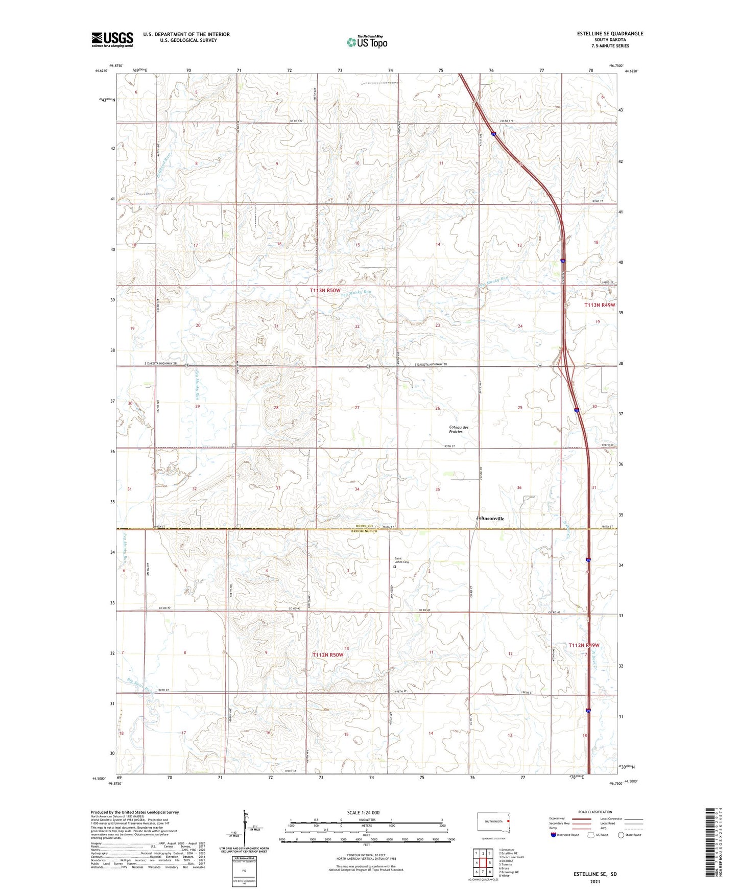
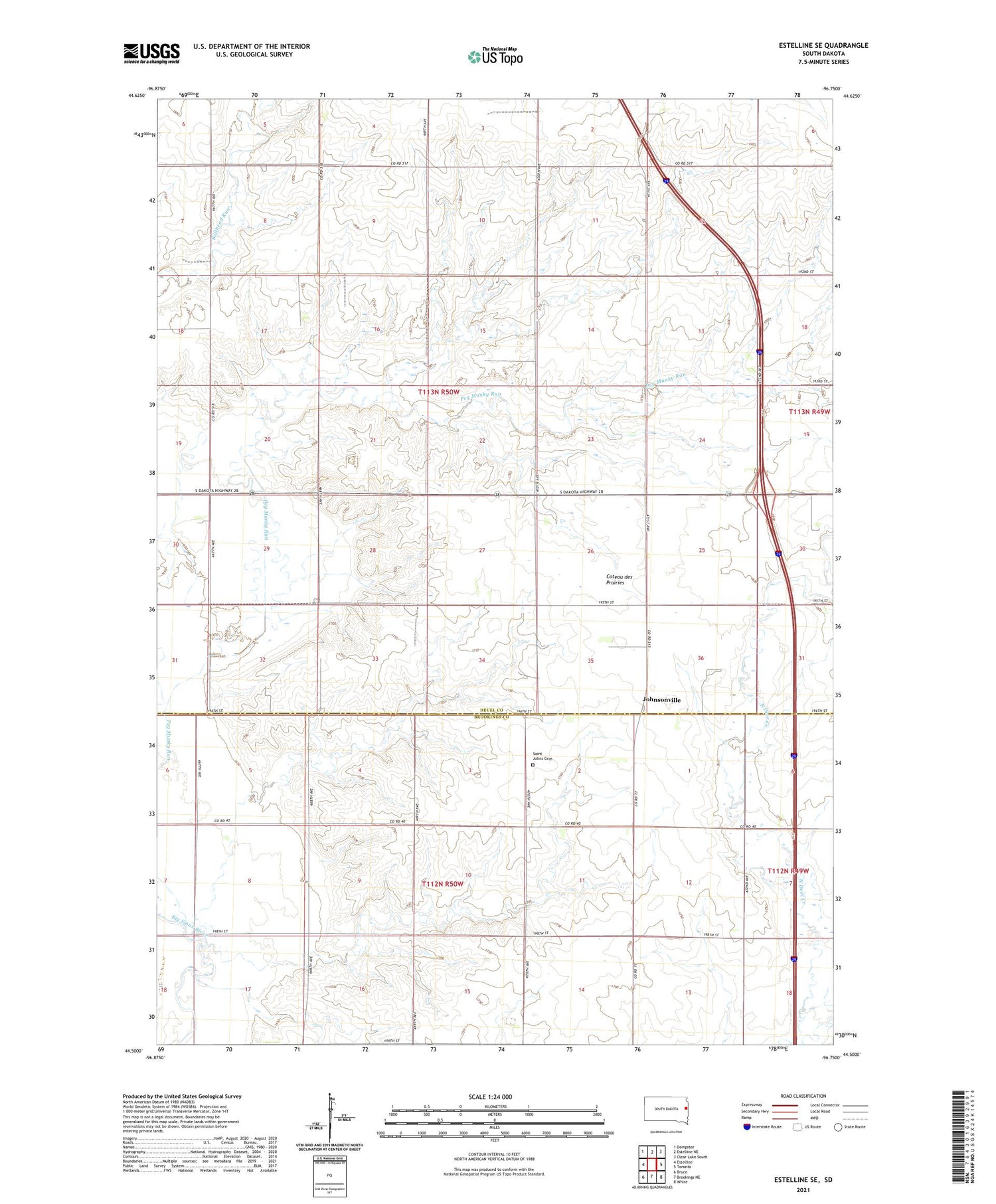
2021 topographic map quadrangle Estelline SE in the state of South Dakota. Scale: 1:24000. Based on the newly updated USGS 7.5' US Topo map series, this map is in the following counties: Deuel, Brookings. The map contains contour data, water features, and other items you are used to seeing on USGS maps, but also has updated roads and other features. This is the next generation of topographic maps. Printed on high-quality waterproof paper with UV fade-resistant inks.
Quads adjacent to this one:
West: Estelline
Northwest: Dempster
North: Estelline NE
Northeast: Clear Lake South
East: Toronto
Southeast: White
South: Brookings NE
Southwest: Bruce
Contains the following named places: Grant, Gravning School, Johnsonville, Johnsonville Corner, Longman School, Pleasant View School, Saint Johns Cemetery, Sunny Slope School, Township of Eureka, Township of Grange