MyTopo
Estelline South Dakota US Topo Map
Couldn't load pickup availability
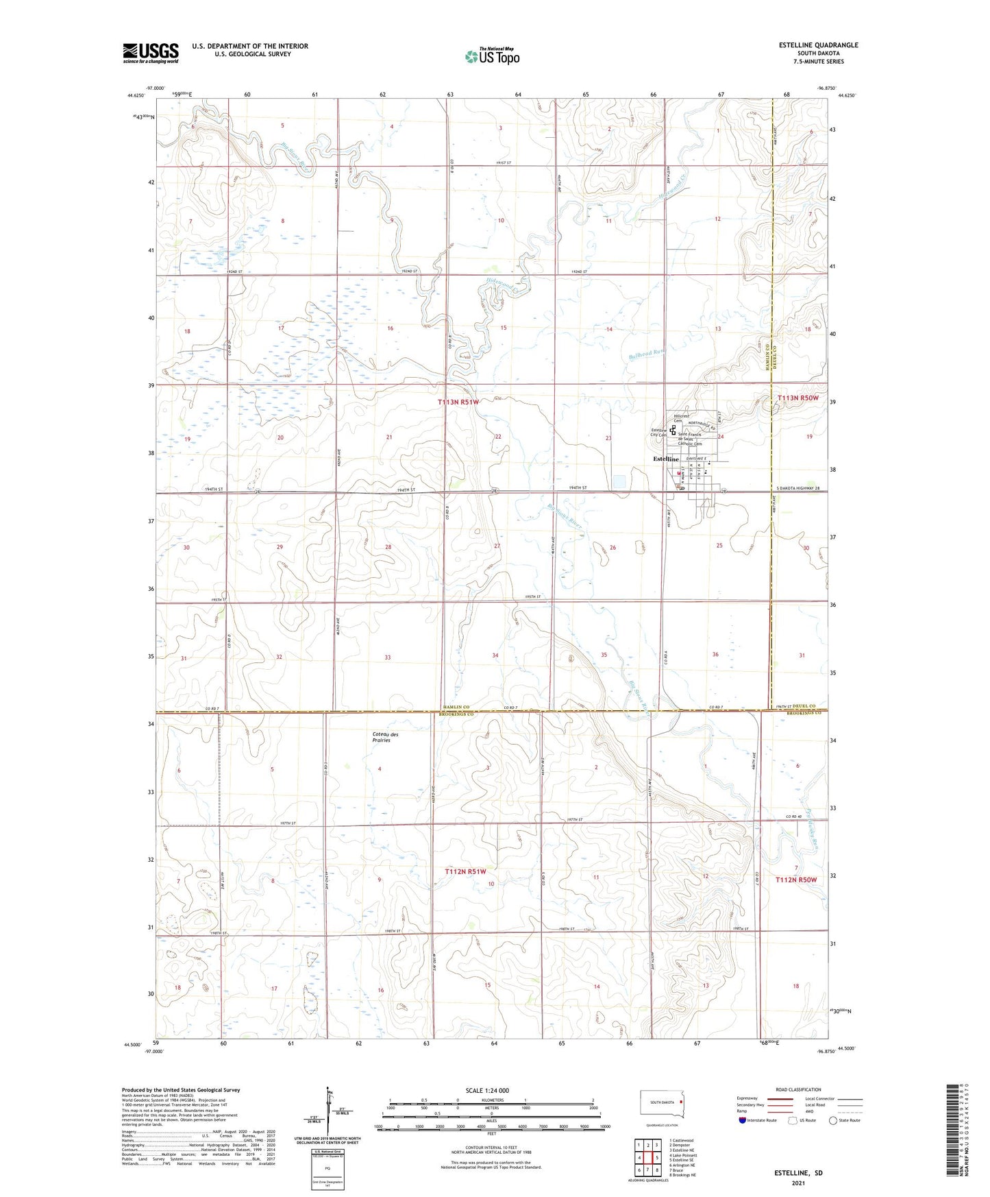
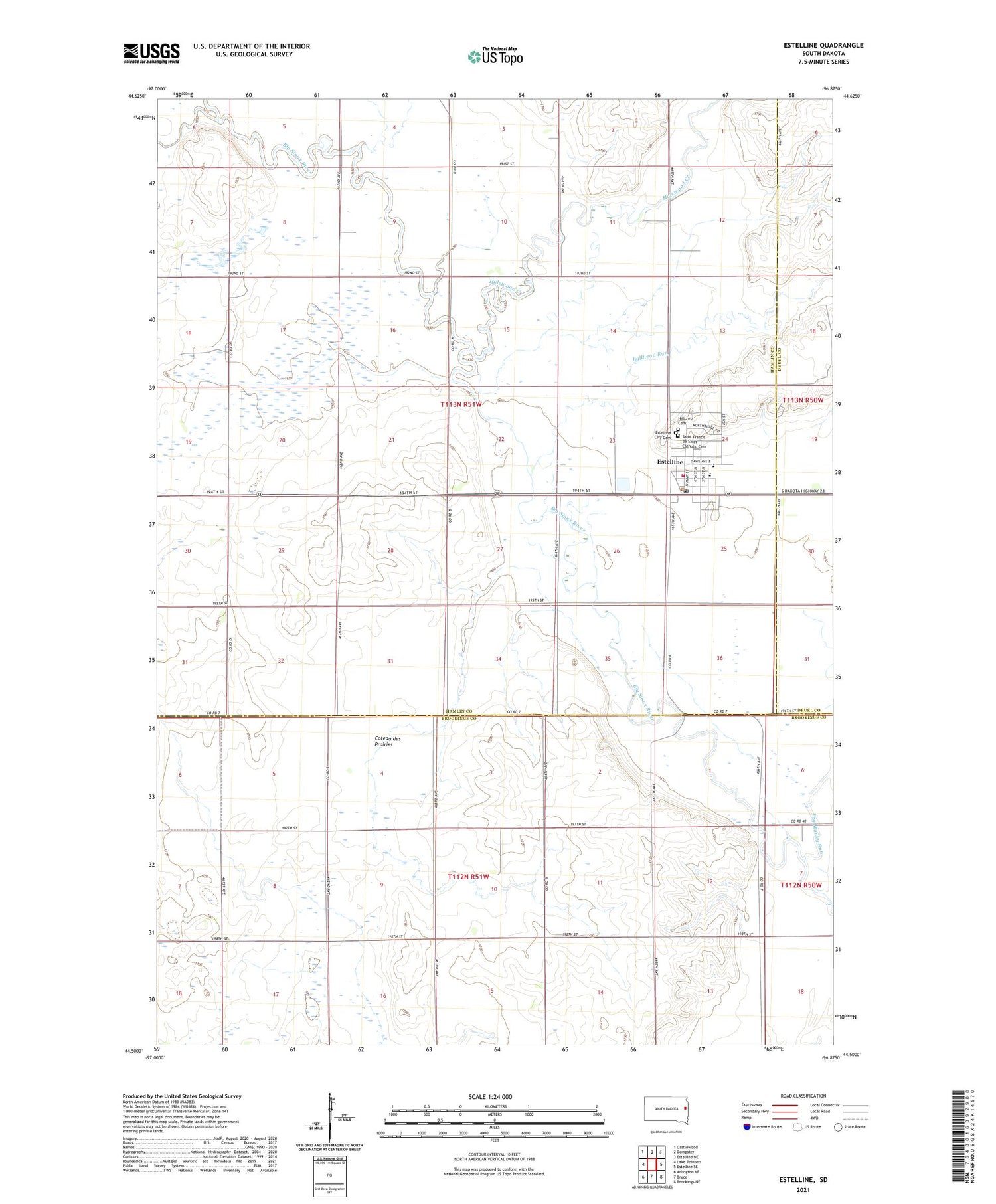
2021 topographic map quadrangle Estelline in the state of South Dakota. Scale: 1:24000. Based on the newly updated USGS 7.5' US Topo map series, this map is in the following counties: Hamlin, Brookings, Deuel. The map contains contour data, water features, and other items you are used to seeing on USGS maps, but also has updated roads and other features. This is the next generation of topographic maps. Printed on high-quality waterproof paper with UV fade-resistant inks.
Quads adjacent to this one:
West: Lake Poinsett
Northwest: Castlewood
North: Dempster
Northeast: Estelline NE
East: Estelline SE
Southeast: Brookings NE
South: Bruce
Southwest: Arlington NE
Contains the following named places: Bullhead Run, City of Estelline, Dempster Census Designated Place, Estelline, Estelline Ambulance Service, Estelline City Cemetery, Estelline City Hall, Estelline Elementary School, Estelline Fire Department, Estelline High School, Estelline Junior High School, Estelline Police Department, Estelline Post Office, Hidewood Creek, Hillcrest Cemetery, Peg Munky Run, Saint Francis de Sales Catholic Cemetery, Spaulding, Township of Estelline, ZIP Code: 57234