MyTopo
Castlewood South Dakota US Topo Map
Couldn't load pickup availability
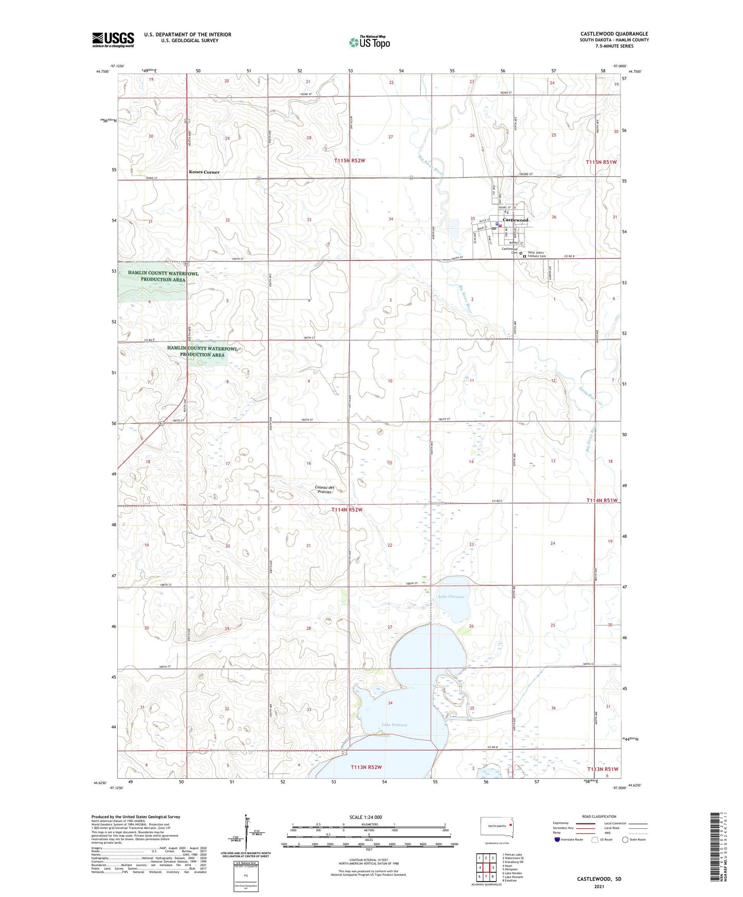
2021 topographic map quadrangle Castlewood in the state of South Dakota. Scale: 1:24000. Based on the newly updated USGS 7.5' US Topo map series, this map is in the following counties: Hamlin. The map contains contour data, water features, and other items you are used to seeing on USGS maps, but also has updated roads and other features. This is the next generation of topographic maps. Printed on high-quality waterproof paper with UV fade-resistant inks.
Quads adjacent to this one:
West: Hayti
Northwest: Pelican Lake
North: Watertown SE
Northeast: Kranzburg SW
East: Dempster
Southeast: Estelline
South: Lake Poinsett
Southwest: Lake Norden
This map covers the same area as the classic USGS quad with code o44097f1.
Contains the following named places: Boswell Diversion Ditch, Castlewood, Castlewood Ambulance District, Castlewood Cemetery, Castlewood City Hall, Castlewood Elementary School, Castlewood Fire Department, Castlewood High School, Castlewood Junior High School, Castlewood Police Department, Castlewood Post Office, Castlewood Public Library, City of Castlewood, Dry Lake, Kones Corner, Lake Florence, Saint John's Catholic Cemetery, Stray Horse Creek, Township of Castlewood, Township of Florence, ZIP Code: 57223