MyTopo
Fort Randall Dam South Dakota US Topo Map
Couldn't load pickup availability
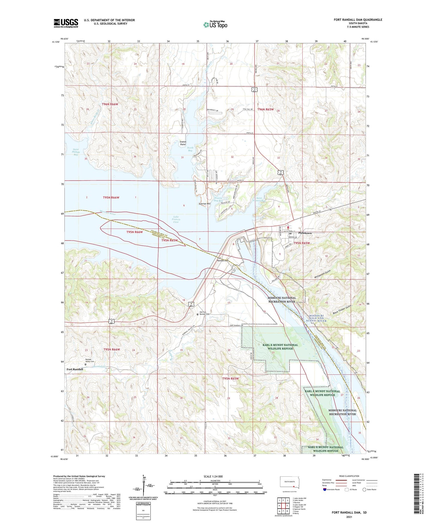
2021 topographic map quadrangle Fort Randall Dam in the state of South Dakota. Scale: 1:24000. Based on the newly updated USGS 7.5' US Topo map series, this map is in the following counties: Charles Mix, Gregory. The map contains contour data, water features, and other items you are used to seeing on USGS maps, but also has updated roads and other features. This is the next generation of topographic maps. Printed on high-quality waterproof paper with UV fade-resistant inks.
Quads adjacent to this one:
West: Lake Andes SW
Northwest: Lake Andes NW
North: Lake Andes
Northeast: Ravinia
East: Wagner SW
Southeast: Marty
South: Gross
Southwest: Spencer North
Contains the following named places: Black Timber Gulch, Fort Randall, Fort Randall Dam, Fort Randall Eagle Roost, Fort Randall Historic Site, Garden Creek, Handys Point, Karl E Mundt National Wildlife Refuge, Little Bird School, North Bay, North Point Recreation Area, Old Fort Randall Cemetery, Pickstown, Pickstown Fire Department, Pickstown Post Office, Pickstown Town Hall, Prairie Dog Bay, Randall Creek, Randall Creek Recreation Area, Randall Island, Randall Valley Cemetery, Saint Francis Bay, Saint Francis Church, Saint Phillips Bay, Saint Phillips Church, South Shore Recreation Area, Sunrise Hill, Svatos Point, Town of Pickstown, Township of Randall, Township of White Swan, Unorganized Territory of Southeast Gregory, White Swan Bottom, White Swan Creek, Williamson Gulch, ZIP Code: 57367