MyTopo
Gross Nebraska US Topo Map
Couldn't load pickup availability
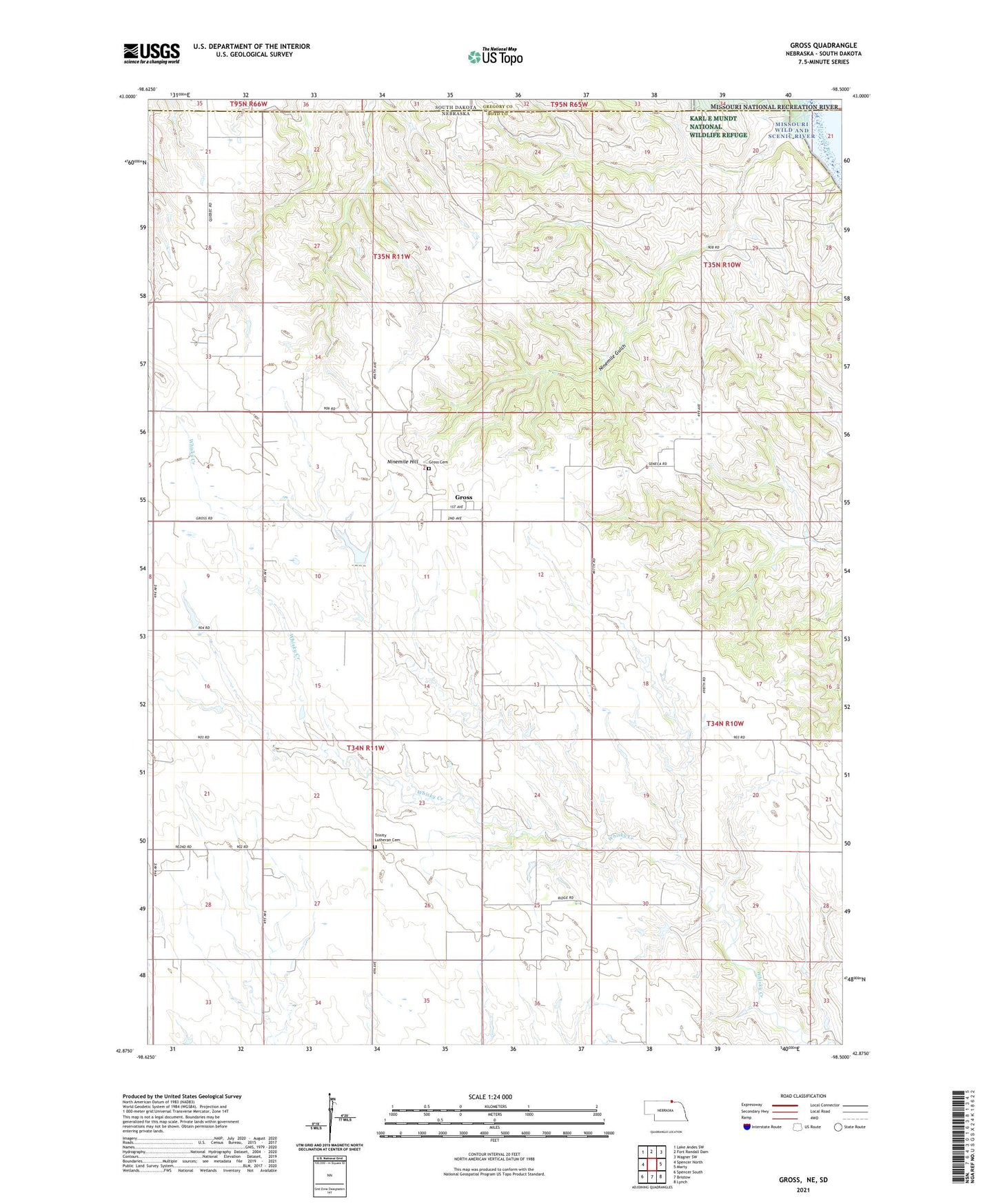
2021 topographic map quadrangle Gross in the state of Nebraska. Scale: 1:24000. Based on the newly updated USGS 7.5' US Topo map series, this map is in the following counties: Boyd, Gregory. The map contains contour data, water features, and other items you are used to seeing on USGS maps, but also has updated roads and other features. This is the next generation of topographic maps. Printed on high-quality waterproof paper with UV fade-resistant inks.
Quads adjacent to this one:
West: Spencer North
Northwest: Lake Andes SW
North: Fort Randall Dam
Northeast: Wagner SW
East: Marty
Southeast: Lynch
South: Bristow
Southwest: Spencer South
Contains the following named places: Gross, Gross Cemetery, Gross Post Office, Ninemile Gulch, Ninemile Hill, Pleasant View School, Rosedale, Rosedale Church, Rosedale Post Office, Rosedale School, Township of Morton, Trinity Lutheran Cemetery, Village of Gross, ZIP Code: 68719