MyTopo
Lake Andes South Dakota US Topo Map
Couldn't load pickup availability
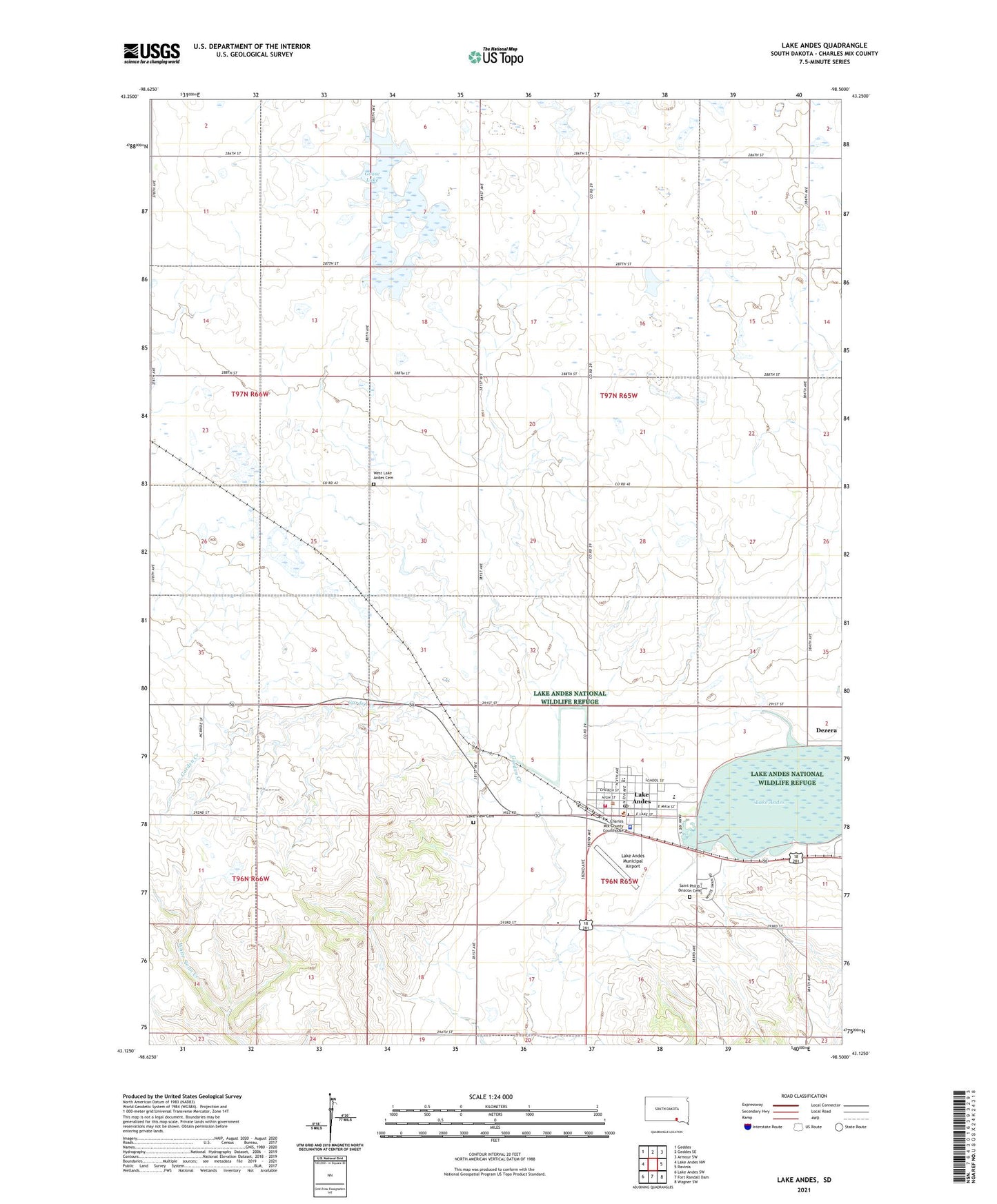
2021 topographic map quadrangle Lake Andes in the state of South Dakota. Scale: 1:24000. Based on the newly updated USGS 7.5' US Topo map series, this map is in the following counties: Charles Mix. The map contains contour data, water features, and other items you are used to seeing on USGS maps, but also has updated roads and other features. This is the next generation of topographic maps. Printed on high-quality waterproof paper with UV fade-resistant inks.
Quads adjacent to this one:
West: Lake Andes NW
Northwest: Geddes
North: Geddes SE
Northeast: Armour SW
East: Ravinia
Southeast: Wagner SW
South: Fort Randall Dam
Southwest: Lake Andes SW
This map covers the same area as the classic USGS quad with code o43098b5.
Contains the following named places: Andes Central Elementary School, Andes Central High School, Andes Central Junior High School, Charles Mix County, Charles Mix County Courthouse, Charles Mix County Jail, Charles Mix County Sheriff's Office, City of Lake Andes, Dezera, Goose Lake, Lake Andes, Lake Andes Carnegie Library, Lake Andes City Hall, Lake Andes Municipal Airport, Lake Andes Post Office, Lake Andes Volunteer Fire Department, Lake View Cemetery, Saint Philip Deacon Cemetery, Saint Phillips Church, School Number 20, School Number 21, School Number 25, School Number 86, Township of Goose Lake, Wagner - Lake Andes Ambulance District Main Station, West Lake Andes Cemetery, ZIP Code: 57356