MyTopo
Gertson Slough South Dakota US Topo Map
Couldn't load pickup availability
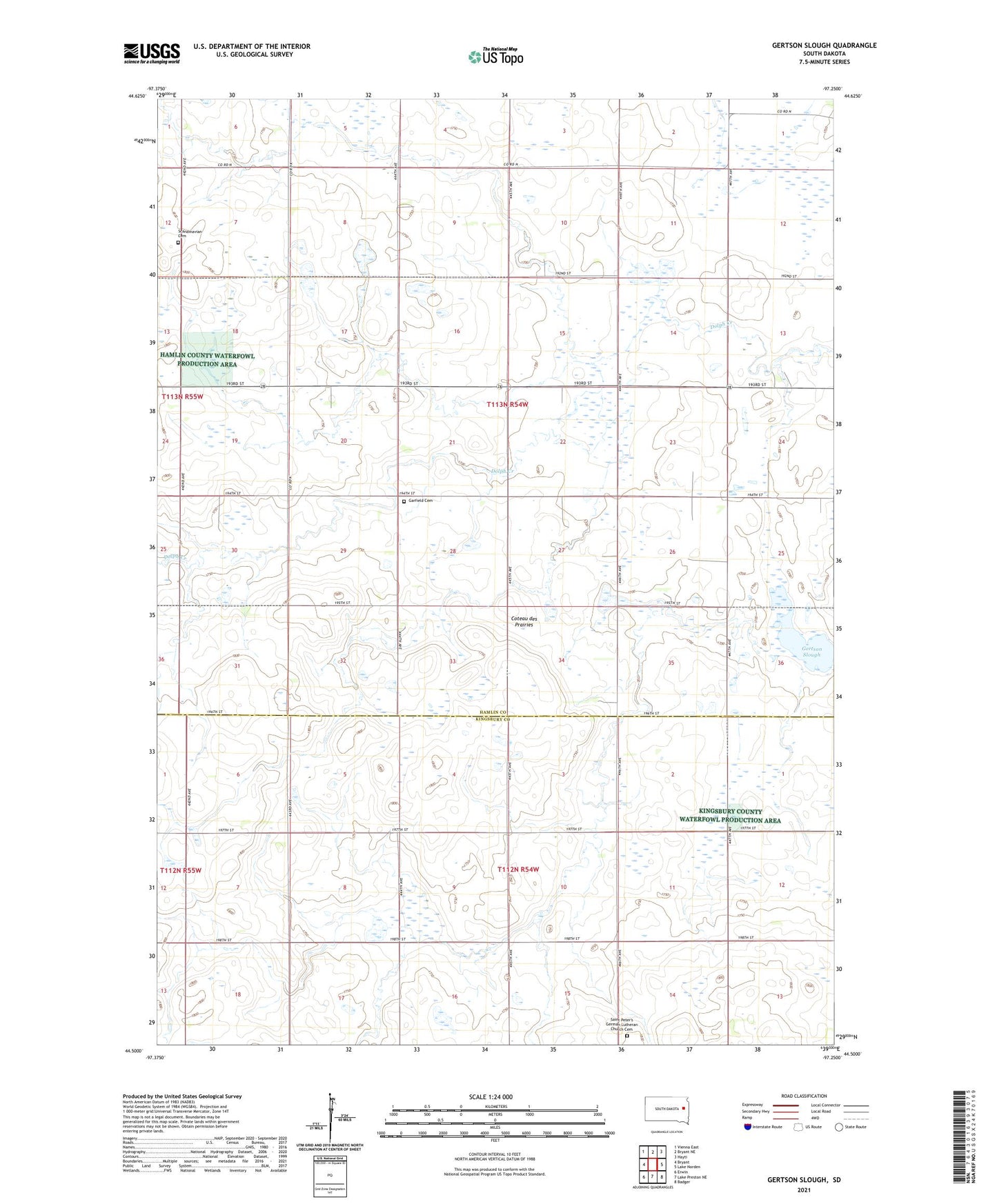
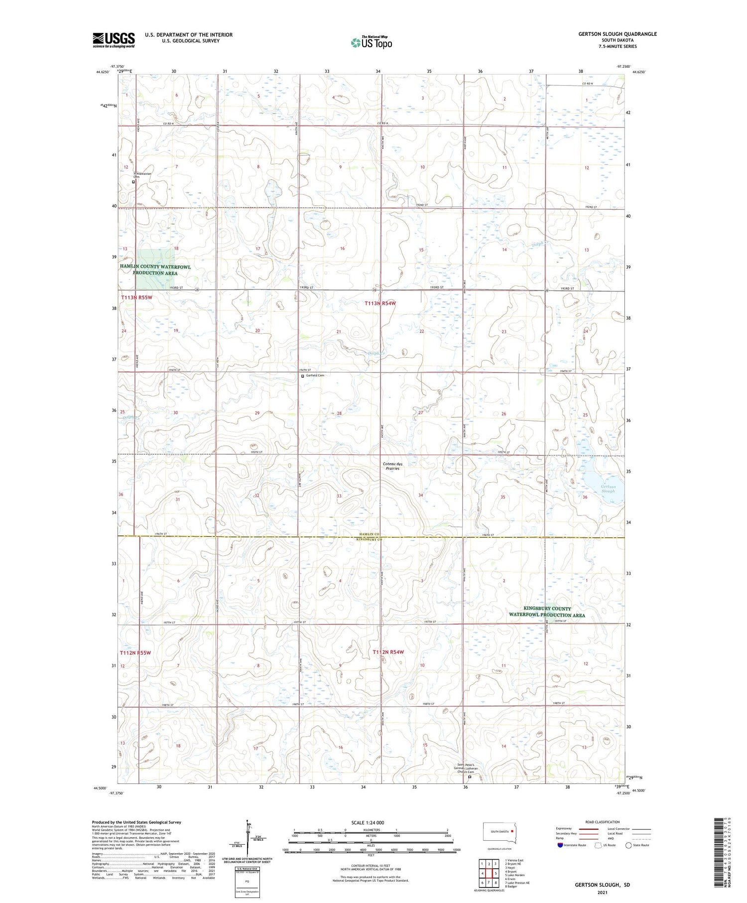
2021 topographic map quadrangle Gertson Slough in the state of South Dakota. Scale: 1:24000. Based on the newly updated USGS 7.5' US Topo map series, this map is in the following counties: Hamlin, Kingsbury. The map contains contour data, water features, and other items you are used to seeing on USGS maps, but also has updated roads and other features. This is the next generation of topographic maps. Printed on high-quality waterproof paper with UV fade-resistant inks.
Quads adjacent to this one:
West: Bryant
Northwest: Vienna East
North: Bryant NE
Northeast: Hayti
East: Lake Norden
Southeast: Badger
South: Lake Preston NE
Southwest: Erwin
Contains the following named places: Arnold State Public Shooting Area, Garfield Cemetery, Garfield Church, Gertson Slough, Gertson Slough State Public Shooting Area, Harju State Public Shooting Area, Saint Peter's German Lutheran Church Cemetery, Scandinavian Cemetery, School Number 17, School Number 36, Township of Cleveland