MyTopo
Hayti South Dakota US Topo Map
Couldn't load pickup availability
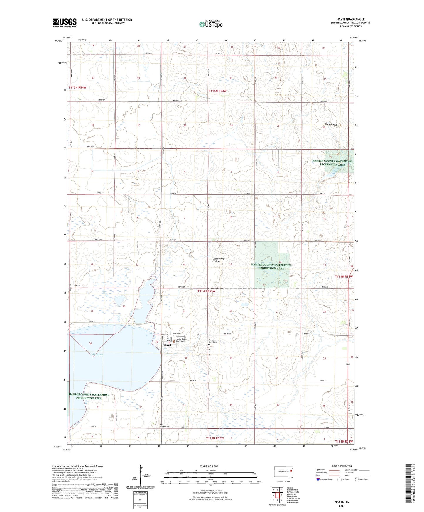
2021 topographic map quadrangle Hayti in the state of South Dakota. Scale: 1:24000. Based on the newly updated USGS 7.5' US Topo map series, this map is in the following counties: Hamlin. The map contains contour data, water features, and other items you are used to seeing on USGS maps, but also has updated roads and other features. This is the next generation of topographic maps. Printed on high-quality waterproof paper with UV fade-resistant inks.
Quads adjacent to this one:
West: Bryant NE
Northwest: Grover
North: Pelican Lake
Northeast: Watertown SE
East: Castlewood
Southeast: Lake Poinsett
South: Lake Norden
Southwest: Gertson Slough
This map covers the same area as the classic USGS quad with code o44097f2.
Contains the following named places: Hamlin County, Hamlin County Courthouse, Hamlin County Sheriff's Office, Hayti, Hayti Fire Department, Hayti Post Office, Lake Marsh, Park Slough, Pleasant View Cemetery, The Coteaus, Town of Hayti, Township of Hayti, Township of Oxford, West Norden Cemetery, West Norden Lutheran Church, ZIP Code: 57241