MyTopo
Gettysburg South Dakota US Topo Map
Couldn't load pickup availability
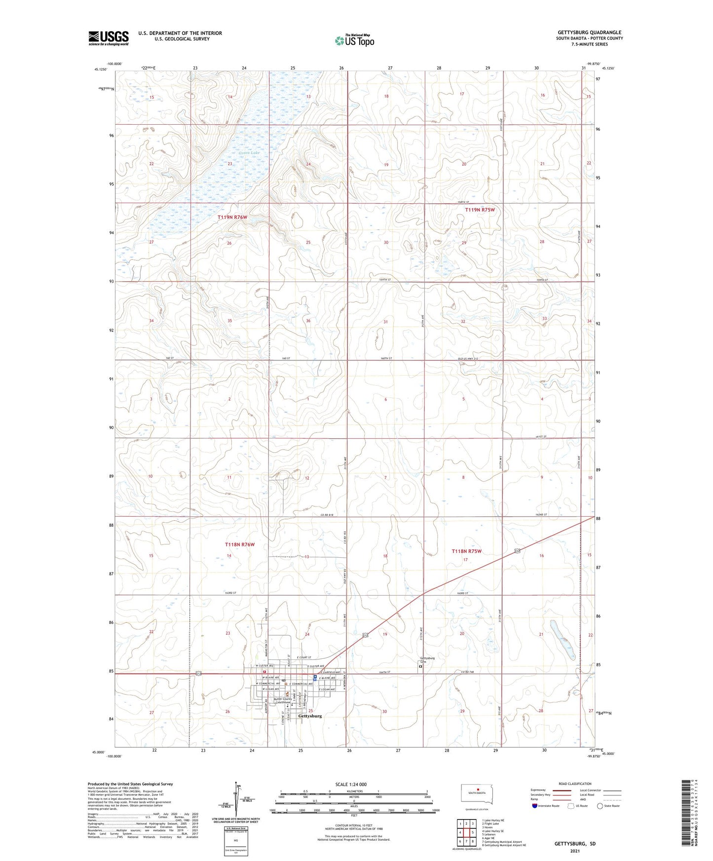
2021 topographic map quadrangle Gettysburg in the state of South Dakota. Scale: 1:24000. Based on the newly updated USGS 7.5' US Topo map series, this map is in the following counties: Potter. The map contains contour data, water features, and other items you are used to seeing on USGS maps, but also has updated roads and other features. This is the next generation of topographic maps. Printed on high-quality waterproof paper with UV fade-resistant inks.
Quads adjacent to this one:
West: Lake Hurley SE
Northwest: Lake Hurley NE
North: Flight Lake
Northeast: Hoven
East: Lebanon
Southeast: Gettysburg Municipal Airport NE
South: Gettysburg Municipal Airport
Southwest: Agar NE
This map covers the same area as the classic USGS quad with code o45099a8.
Contains the following named places: Avera Gettysburg Hospital, City of Gettysburg, Dakota Sunset Museum, Gettysburg, Gettysburg Air Force Station, Gettysburg Ambulance Service, Gettysburg Cemetery, Gettysburg City Hall, Gettysburg Elementary School, Gettysburg High School, Gettysburg Junior High School, Gettysburg Police Department, Gettysburg Post Office, Gettysburg Radar Station, Gettysburg Volunteer Fire Department, Green Lake, Green Lake State Public Shooting Area, Potter County, Potter County Courthouse, Potter County Free Public Library, Potter County Sheriff, Township of Gettysburg, Township of Lincoln, Unorganized Territory of Central Potter