MyTopo
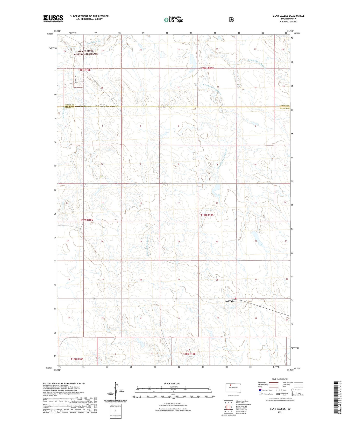
Glad Valley South Dakota US Topo Map
Couldn't load pickup availability
Also explore the Glad Valley Forest Service Topo of this same quad for updated USFS data
2021 topographic map quadrangle Glad Valley in the state of South Dakota. Scale: 1:24000. Based on the newly updated USGS 7.5' US Topo map series, this map is in the following counties: Ziebach, Corson. The map contains contour data, water features, and other items you are used to seeing on USGS maps, but also has updated roads and other features. This is the next generation of topographic maps. Printed on high-quality waterproof paper with UV fade-resistant inks.
Quads adjacent to this one:
West: Glad Valley NW
Northwest: Black Horse Butte
North: Twin Butte
Northeast: Cottonwood Creek SW
East: Irish Creek NW
Southeast: Irish Creek SW
South: Glad Valley SE
Southwest: Glad Valley SW
This map covers the same area as the classic USGS quad with code o45101d7.
Contains the following named places: Butterview School, Glad Valley, Glad Valley Dam, Glad Valley Fire Department, Hulm Dam, L Barnica Dam, M A Lynch Dam, M Matthews Dam, Schnasse County, Tribe Number 3 Dam, West Fork East Twin Butte Creek