MyTopo
Hoven South Dakota US Topo Map
Couldn't load pickup availability
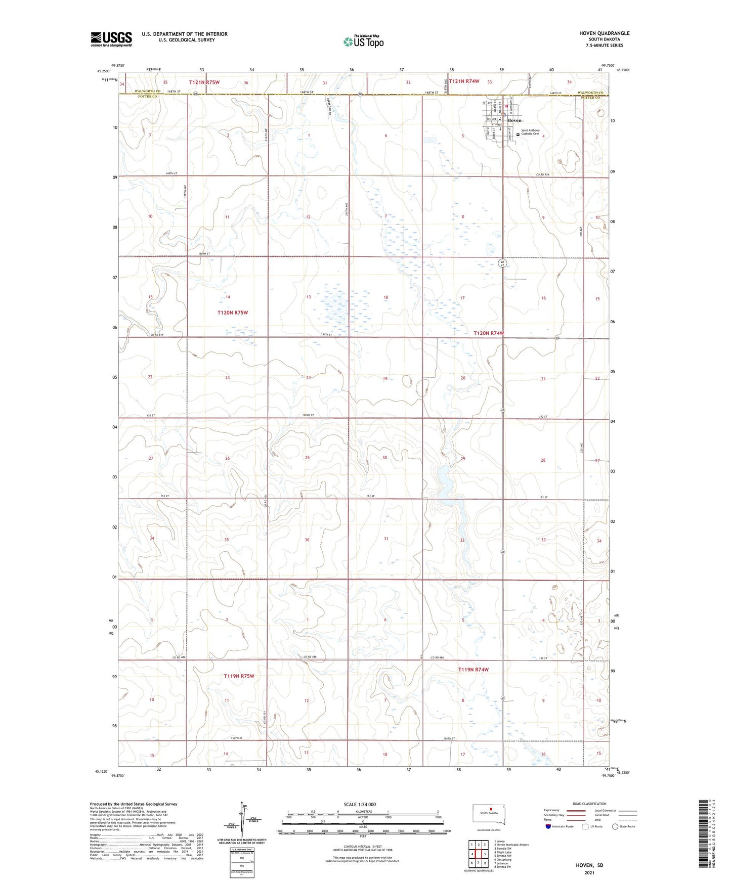
2021 topographic map quadrangle Hoven in the state of South Dakota. Scale: 1:24000. Based on the newly updated USGS 7.5' US Topo map series, this map is in the following counties: Potter, Walworth. The map contains contour data, water features, and other items you are used to seeing on USGS maps, but also has updated roads and other features. This is the next generation of topographic maps. Printed on high-quality waterproof paper with UV fade-resistant inks.
Quads adjacent to this one:
West: Flight Lake
Northwest: Lowry
North: Hoven Municipal Airport
Northeast: Bowdle SW
East: Seneca NW
Southeast: Seneca SW
South: Lebanon
Southwest: Gettysburg
Contains the following named places: Holy Infant Hospital, Hoven, Hoven Ambulance Service, Hoven City Hall, Hoven City Police, Hoven Elementary School, Hoven High School, Hoven Junior High School, Hoven Post Office, Hoven Volunteer Fire Department, Monty Harer Airstrip, Pembroke, Saint Anthony Catholic Cemetery, Simon Dam, Simons Dam, Town of Hoven, Township of Arena, William P Ransch Dam, ZIP Code: 57450