MyTopo
Ipswich South Dakota US Topo Map
Couldn't load pickup availability
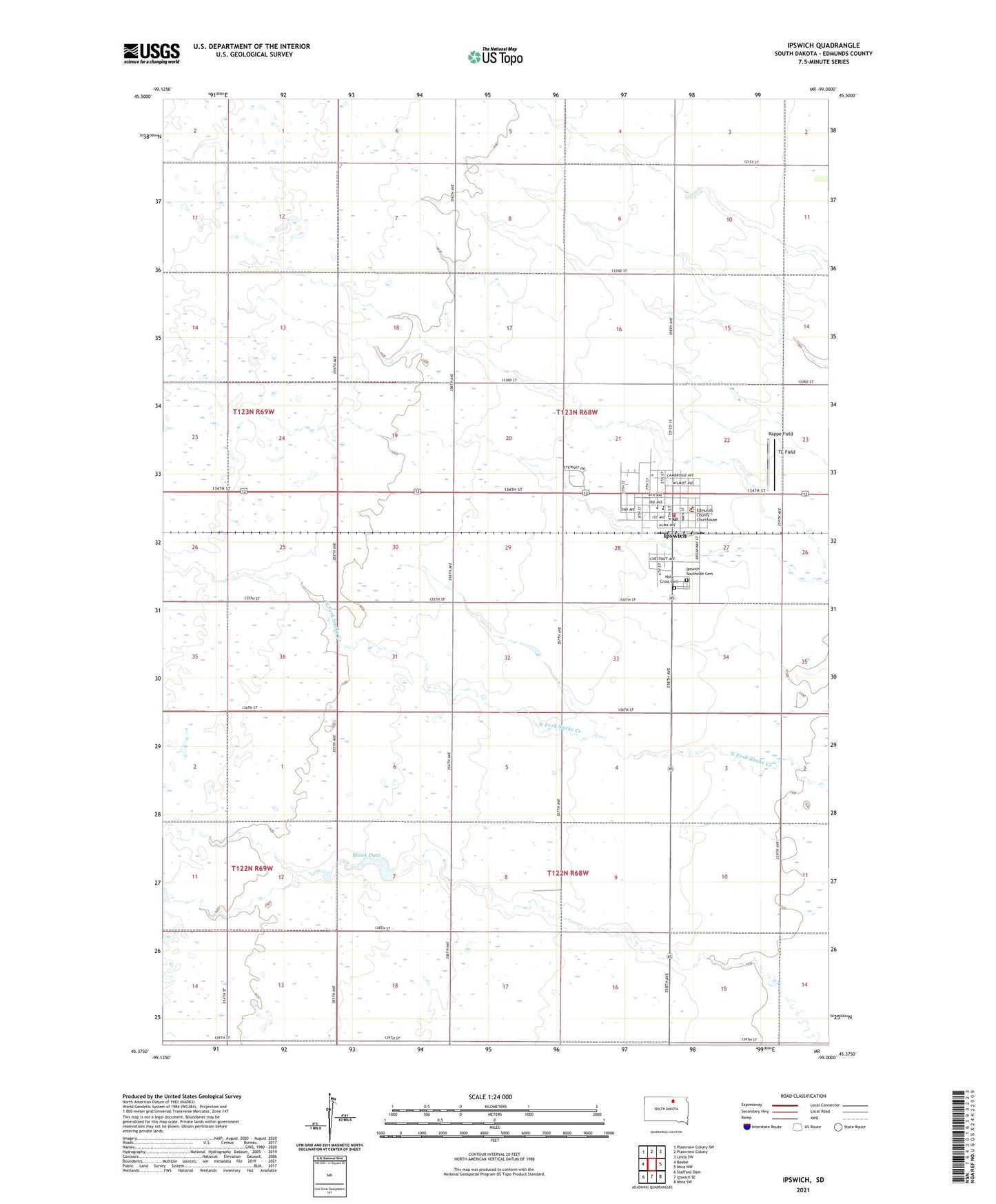
2021 topographic map quadrangle Ipswich in the state of South Dakota. Scale: 1:24000. Based on the newly updated USGS 7.5' US Topo map series, this map is in the following counties: Edmunds. The map contains contour data, water features, and other items you are used to seeing on USGS maps, but also has updated roads and other features. This is the next generation of topographic maps. Printed on high-quality waterproof paper with UV fade-resistant inks.
Quads adjacent to this one:
West: Beebe
Northwest: Plainview Colony SW
North: Plainview Colony
Northeast: Leola SW
East: Mina NW
Southeast: Mina SW
South: Ipswich SE
Southwest: Stafford Dam
This map covers the same area as the classic USGS quad with code o45099d1.
Contains the following named places: Blank Dam, City of Ipswich, Edmunds, Edmunds County Courthouse, Edmunds County Jail, Edmunds County Sheriff's Office, Holy Cross Cemetery, Holy Cross Elementary School, Ipswich, Ipswich Ambulance Service, Ipswich City Hall, Ipswich Elementary School, Ipswich High School, Ipswich Middle School, Ipswich Post Office, Ipswich Southside Cemetery, Ipswich Volunteer Fire Department, Marcus P Beebe Memorial Library, Pembrook Colony, Rappe Field, TC Field, Township of Harmony, Township of Ipswich