MyTopo
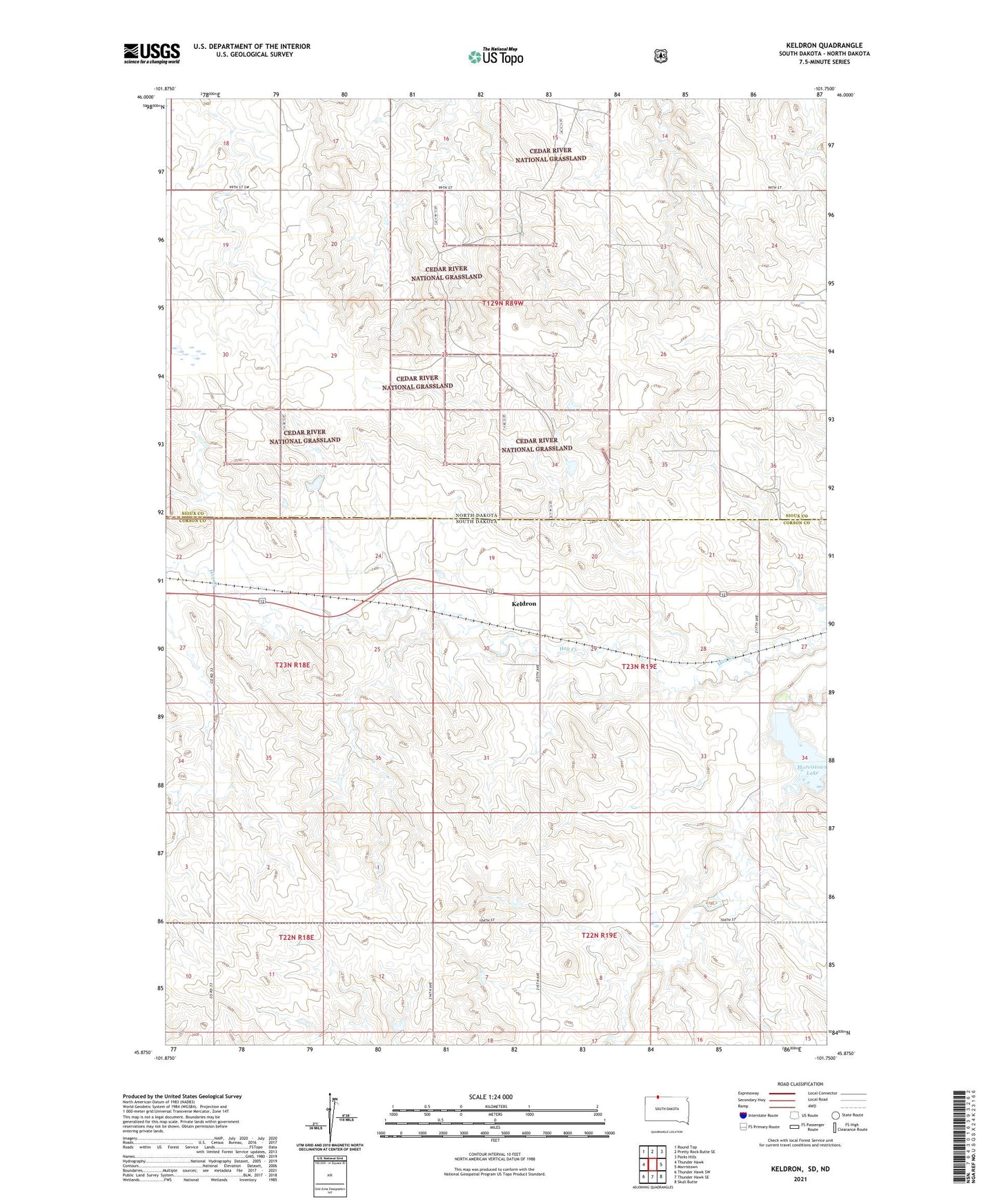
Keldron South Dakota US Topo Map
Couldn't load pickup availability
Also explore the Keldron Forest Service Topo of this same quad for updated USFS data
2021 topographic map quadrangle Keldron in the states of South Dakota, North Dakota. Scale: 1:24000. Based on the newly updated USGS 7.5' US Topo map series, this map is in the following counties: Corson, Sioux. The map contains contour data, water features, and other items you are used to seeing on USGS maps, but also has updated roads and other features. This is the next generation of topographic maps. Printed on high-quality waterproof paper with UV fade-resistant inks.
Quads adjacent to this one:
West: Thunder Hawk
Northwest: Round Top
North: Pretty Rock Butte SE
Northeast: Parks Hills
East: Morristown
Southeast: Skull Butte
South: Thunder Hawk SE
Southwest: Thunder Hawk SW
This map covers the same area as the classic USGS quad with code o45101h7.
Contains the following named places: Keldron, Knoke School, Leonard Wenck Dam, Morristown Lake, Township of Custer