MyTopo
Lake City South Dakota US Topo Map
Couldn't load pickup availability
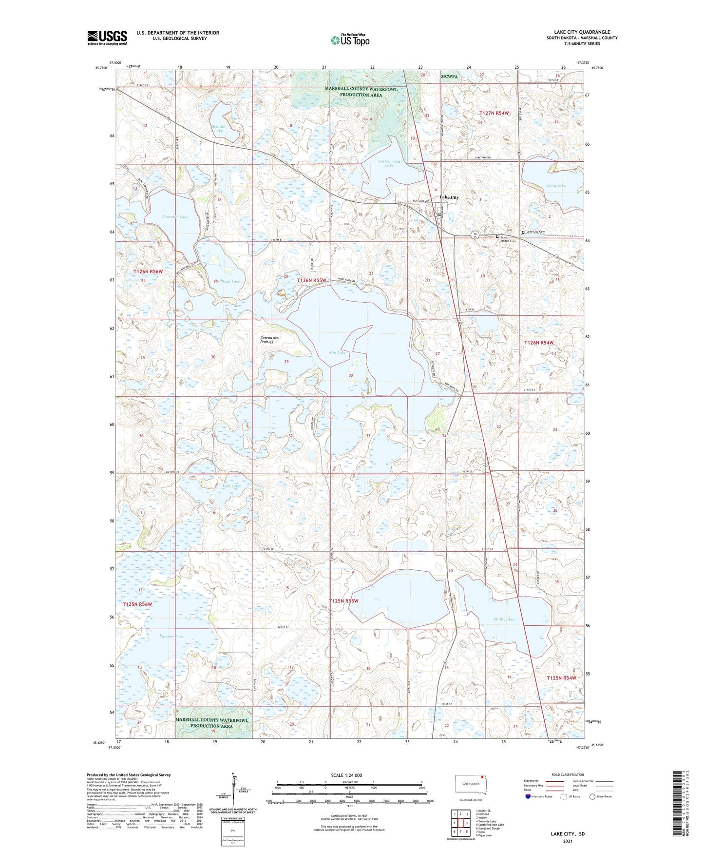
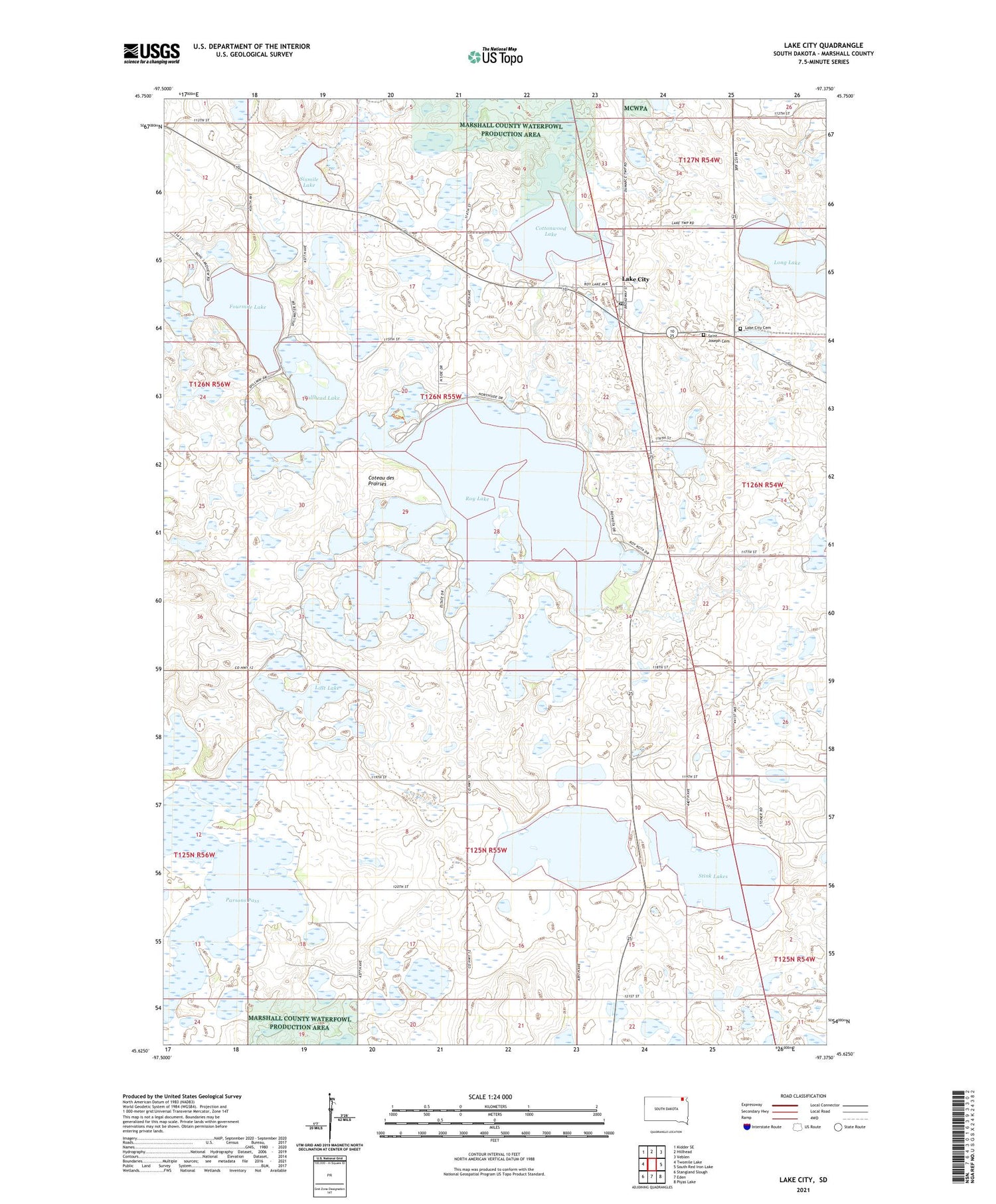
2021 topographic map quadrangle Lake City in the state of South Dakota. Scale: 1:24000. Based on the newly updated USGS 7.5' US Topo map series, this map is in the following counties: Marshall. The map contains contour data, water features, and other items you are used to seeing on USGS maps, but also has updated roads and other features. This is the next generation of topographic maps. Printed on high-quality waterproof paper with UV fade-resistant inks.
Quads adjacent to this one:
West: Twomile Lake
Northwest: Kidder SE
North: Hillhead
Northeast: Veblen
East: South Red Iron Lake
Southeast: Piyas Lake
South: Eden
Southwest: Stangland Slough
Contains the following named places: Bullhead Lake, Cattail Lake, Chokecherry Island Slough, Cottonwood Lake, Fourmile Lake, Lake City, Lake City Cemetery, Lake City Post Office, Little Cottonwood Lake, Long Lake, Lost Lake, Marshall County Waterfowl Production Area, Parsons Pass, Roy Lake, Roy Lake State Park Number 1, Roy Lake State Park Number 2, Saint Joseph Cemetery, Sixmile Lake, Stink Lakes, Sunnyside, Town of Lake City, Township of Lake, Township of Lake City, ZIP Code: 57247