MyTopo
Hillhead South Dakota US Topo Map
Couldn't load pickup availability
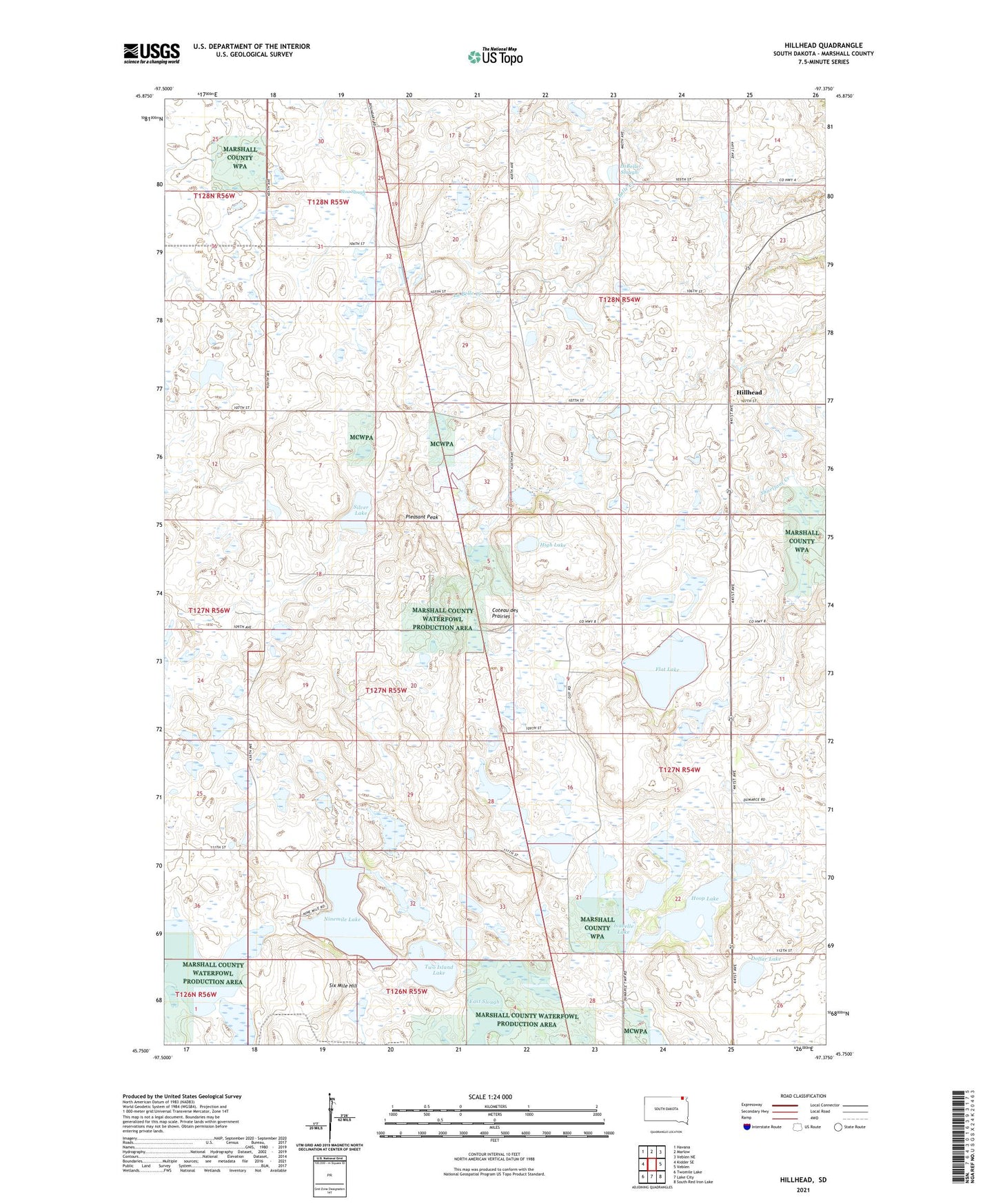
2021 topographic map quadrangle Hillhead in the state of South Dakota. Scale: 1:24000. Based on the newly updated USGS 7.5' US Topo map series, this map is in the following counties: Marshall. The map contains contour data, water features, and other items you are used to seeing on USGS maps, but also has updated roads and other features. This is the next generation of topographic maps. Printed on high-quality waterproof paper with UV fade-resistant inks.
Quads adjacent to this one:
West: Kidder SE
Northwest: Havana
Northeast: Veblen NE
East: Veblen
Southeast: South Red Iron Lake
South: Lake City
Southwest: Twomile Lake
This map covers the same area as the classic USGS quad with code o45097g4.
Contains the following named places: Dollar Lake, East Slough, Flat Lake, High Lake, Hillhead, Hoop Lake, Horseshoe Lake, Isabelle Lake, LaBelle Slough, Ninemile Lake, Pleasant Peak, School Number 1, School Number 2, School Number 3, Silver Lake, Six Mile Hill, Stink Slough, Stoa Slough, Storm, Sunnyside School, Township of Dumarce, Trondhjem Church, Two Island Lake, Wise Spirit Lake