MyTopo
Veblen South Dakota US Topo Map
Couldn't load pickup availability
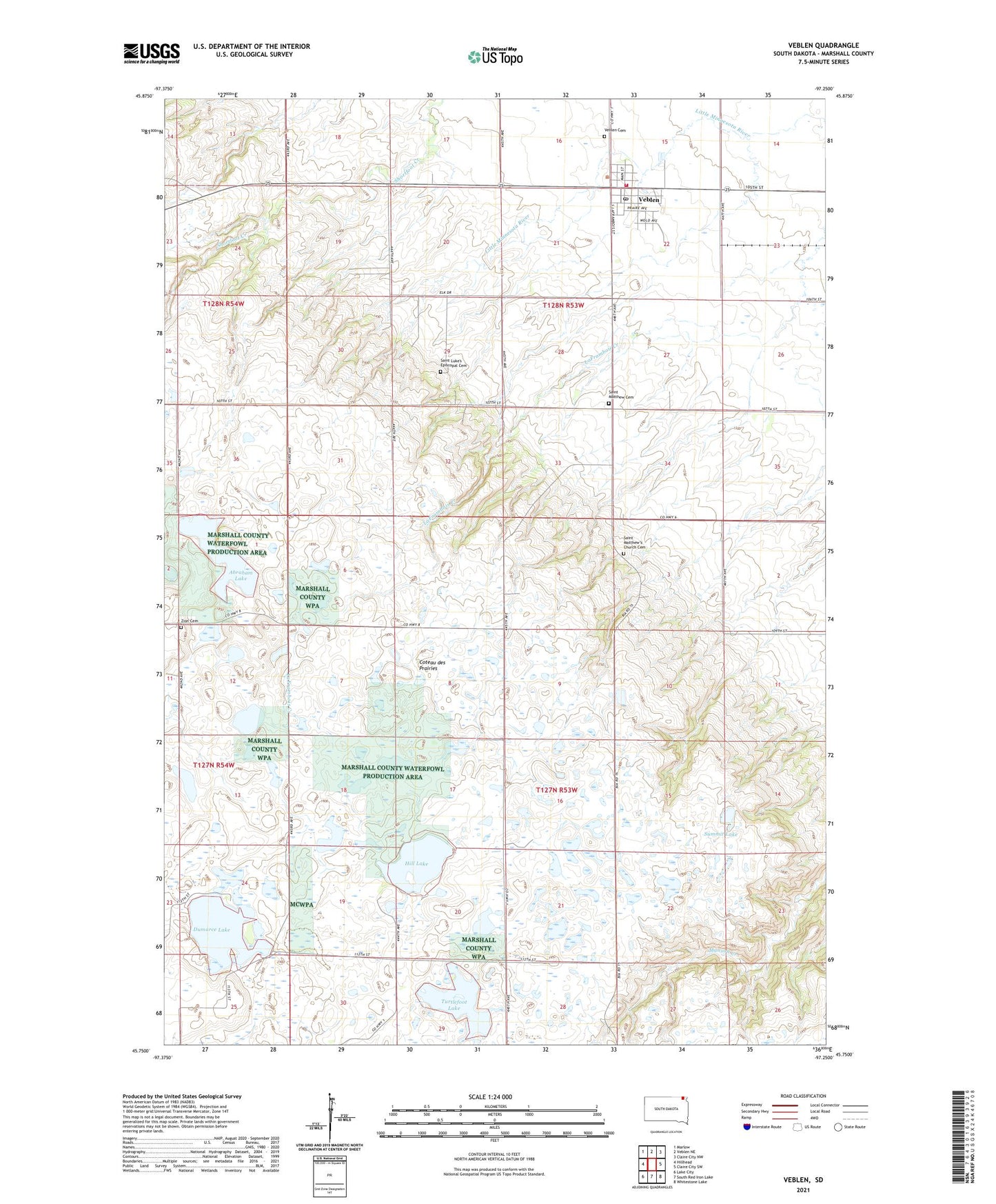
2021 topographic map quadrangle Veblen in the state of South Dakota. Scale: 1:24000. Based on the newly updated USGS 7.5' US Topo map series, this map is in the following counties: Marshall. The map contains contour data, water features, and other items you are used to seeing on USGS maps, but also has updated roads and other features. This is the next generation of topographic maps. Printed on high-quality waterproof paper with UV fade-resistant inks.
Quads adjacent to this one:
West: Hillhead
North: Veblen NE
Northeast: Claire City NW
East: Claire City SW
Southeast: Whitestone Lake
South: South Red Iron Lake
Southwest: Lake City
This map covers the same area as the classic USGS quad with code o45097g3.
Contains the following named places: Abraham Lake, City of Veblen, Cottonwood Lake, Dumarce Lake, Hill Lake, Saint Luke Church, Saint Luke's Episcopal Cemetery, Saint Matthew Cemetery, Saint Matthew Church, Saint Matthew's Church Cemetery, School Number 1, School Number 2, Summit Lake, Township of Dumarce, Township of McKinley, Turtlefoot Lake, Veblen, Veblen Cemetery, Veblen City Hall, Veblen Fire and Rescue, Veblen Post Office, Zion Cemetery, Zion Church, ZIP Code: 57270