MyTopo
Lake Francis South Dakota US Topo Map
Couldn't load pickup availability
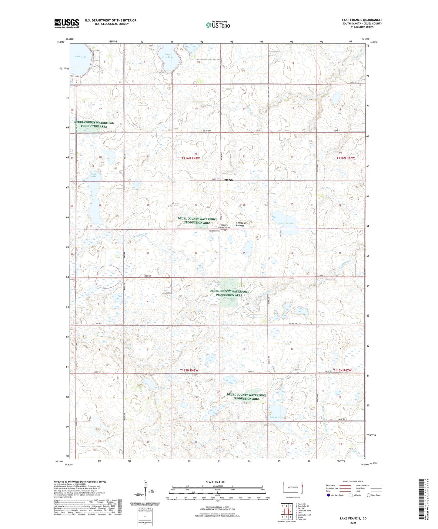
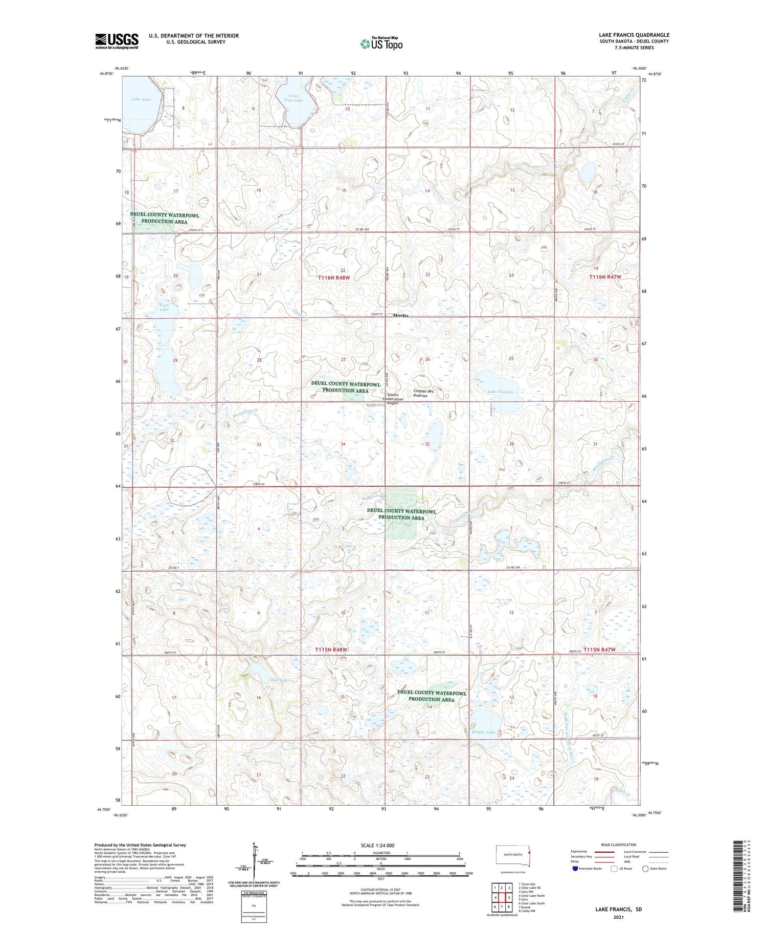
2021 topographic map quadrangle Lake Francis in the state of South Dakota. Scale: 1:24000. Based on the newly updated USGS 7.5' US Topo map series, this map is in the following counties: Deuel. The map contains contour data, water features, and other items you are used to seeing on USGS maps, but also has updated roads and other features. This is the next generation of topographic maps. Printed on high-quality waterproof paper with UV fade-resistant inks.
Quads adjacent to this one:
West: Clear Lake North
Northwest: Tunerville
North: Clear Lake NE
Northeast: Gary NW
East: Gary
Southeast: Canby NW
South: Brandt
Southwest: Clear Lake South
Contains the following named places: Briggs Lake, Briggs Lake State Public Shooting Area, Cadwell School, Lake Francis, Lake Francis State Public Shooting Area, Lone Tree Lake, Moritz, Moritz School, Mud Lake, Mud Lake State Public Shooting Area, Rush Lake, Rush Lake State Public Shooting Area, Stone's Conservation Airport, Township of Glenwood, Township of Herrick, ZIP Code: 57237