MyTopo
Lake Preston East South Dakota US Topo Map
Couldn't load pickup availability
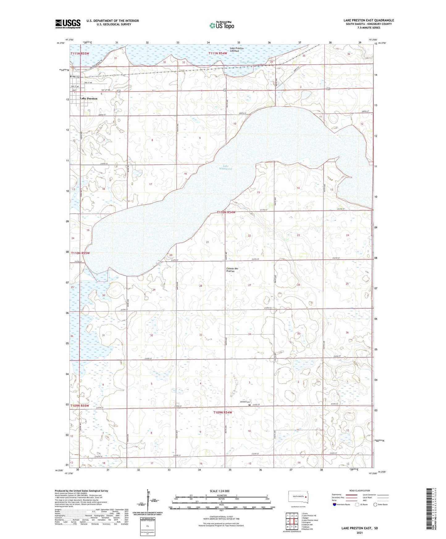
2021 topographic map quadrangle Lake Preston East in the state of South Dakota. Scale: 1:24000. Based on the newly updated USGS 7.5' US Topo map series, this map is in the following counties: Kingsbury. The map contains contour data, water features, and other items you are used to seeing on USGS maps, but also has updated roads and other features. This is the next generation of topographic maps. Printed on high-quality waterproof paper with UV fade-resistant inks.
Quads adjacent to this one:
West: Lake Preston West
Northwest: Erwin
North: Lake Preston NE
Northeast: Badger
East: Arlington
Southeast: Madison NW
South: Oldham
Southwest: Oldham NW
Contains the following named places: County Ditch Number 4, Lake Preston Elementary School, Lake Preston High School, Lake Preston Junior High School, Lake Whitewood, School Number 1, School Number 2, School Number 3, School Number 4, School Number 47, School Number 5, United Cemetery