MyTopo
Leola South Dakota US Topo Map
Couldn't load pickup availability
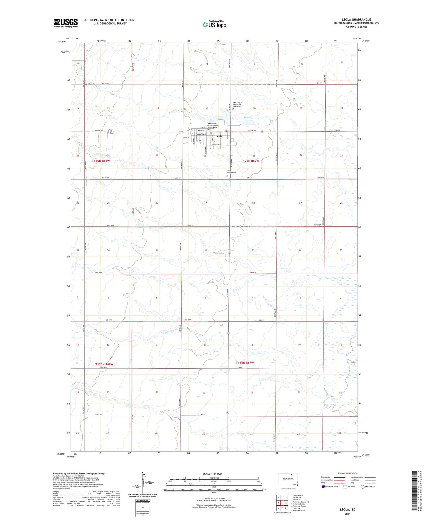
2021 topographic map quadrangle Leola in the state of South Dakota. Scale: 1:24000. Based on the newly updated USGS 7.5' US Topo map series, this map is in the following counties: McPherson. The map contains contour data, water features, and other items you are used to seeing on USGS maps, but also has updated roads and other features. This is the next generation of topographic maps. Printed on high-quality waterproof paper with UV fade-resistant inks.
Quads adjacent to this one:
West: Plainview Colony NE
Northwest: Long Lake SE
North: Forbes SW
Northeast: Forbes SE
East: Wetonka North
Southeast: Wetonka South
South: Leola SW
Southwest: Plainview Colony
This map covers the same area as the classic USGS quad with code o45098f8.
Contains the following named places: City of Leola, Green Mound Cemetery, Lake Lundquist, Leola, Leola Ambulance Service, Leola City Hall, Leola Dam, Leola Elementary School, Leola Fire Department, Leola High School, Leola Junior High School, Leola Police Department, Leola Post Office, Leola Public Library, McPherson County Courthouse, McPherson County Sheriff's Office, Our Lady of Perpetual Help Cemetery, Township of Leola, Township of Washington, ZIP Code: 57456