MyTopo
Ludlow South Dakota US Topo Map
Couldn't load pickup availability
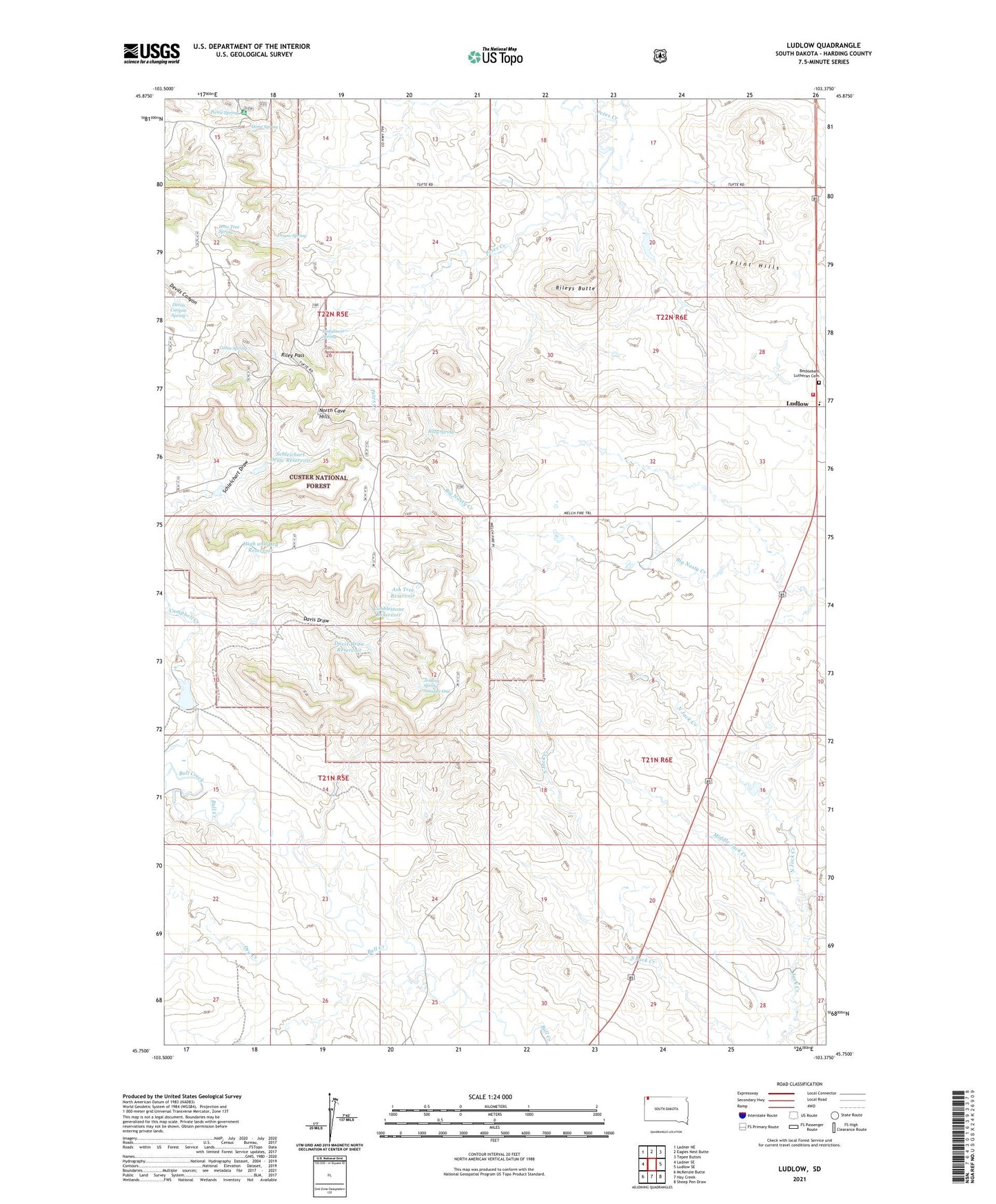
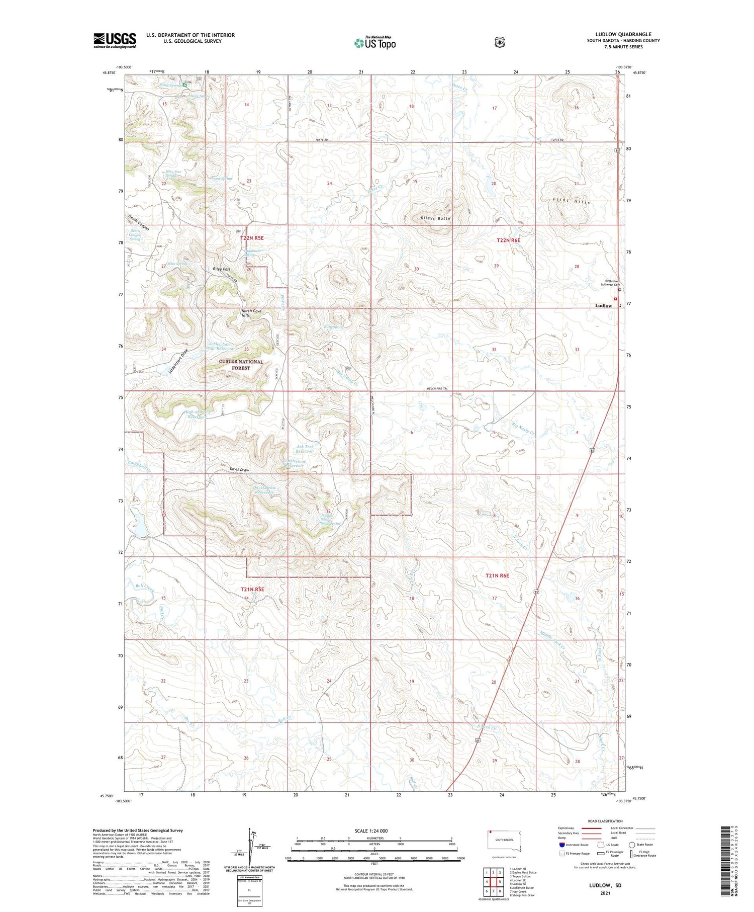
2021 topographic map quadrangle Ludlow in the state of South Dakota. Scale: 1:24000. Based on the newly updated USGS 7.5' US Topo map series, this map is in the following counties: Harding. The map contains contour data, water features, and other items you are used to seeing on USGS maps, but also has updated roads and other features. This is the next generation of topographic maps. Printed on high-quality waterproof paper with UV fade-resistant inks.
Quads adjacent to this one:
West: Ladner SE
Northwest: Ladner NE
North: Eagles Nest Butte
Northeast: Tepee Buttes
East: Ludlow SE
Southeast: Sheep Pen Draw
South: Hay Creek
Southwest: McKenzie Butte
Contains the following named places: Ash Tree Reservoir, Bethlehem Lutheran Cemetery, Cabin Spring, Campbell Creek, Cobblestone Reservoir, Davis Draw, Davis Draw Reservoir, Devils Canyon Spring, Doane Spring, Dry Creek, Flint Hills, High and Dry Reservoir, Hime Spring, Jacobi Dam, Jenkins Spring Number One, K and R Well, Ketchum Well, Lone Tree Spring, Ludlow, Ludlow Elementary School, Middle Jack Creek, N Ketchum Ranch, North Cave Hills, North Jack Creek, Padalower Spring, Picnic Spring, Picnic Spring Campground, R Ham Ranch, Riley Pass, Riley Spring, Rileys Butte, Schleichart Draw Reservoir, Tufte Dam, Volunteer Fire Department