MyTopo
Lynch NE South Dakota US Topo Map
Couldn't load pickup availability
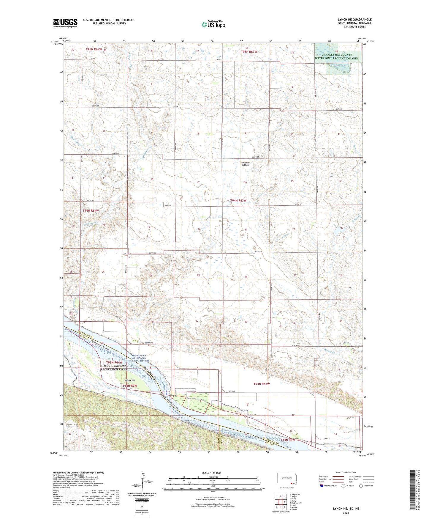
2021 topographic map quadrangle Lynch NE in the states of South Dakota, Nebraska. Scale: 1:24000. Based on the newly updated USGS 7.5' US Topo map series, this map is in the following counties: Charles Mix, Boyd, Knox. The map contains contour data, water features, and other items you are used to seeing on USGS maps, but also has updated roads and other features. This is the next generation of topographic maps. Printed on high-quality waterproof paper with UV fade-resistant inks.
Quads adjacent to this one:
West: Marty
Northwest: Wagner SW
North: Wagner
Northeast: Dante
East: Niobrara NW
Southeast: Verdel
South: Monowi
Southwest: Lynch
Contains the following named places: Mosquito Creek, School Number 61, School Number 62, School Number 63, School Number 64, Slaughter Creek, Song Hawk Lake, Tobacco Bottom, Township of Ree, White Lake, Willow Bar