MyTopo
Wagner South Dakota US Topo Map
Couldn't load pickup availability
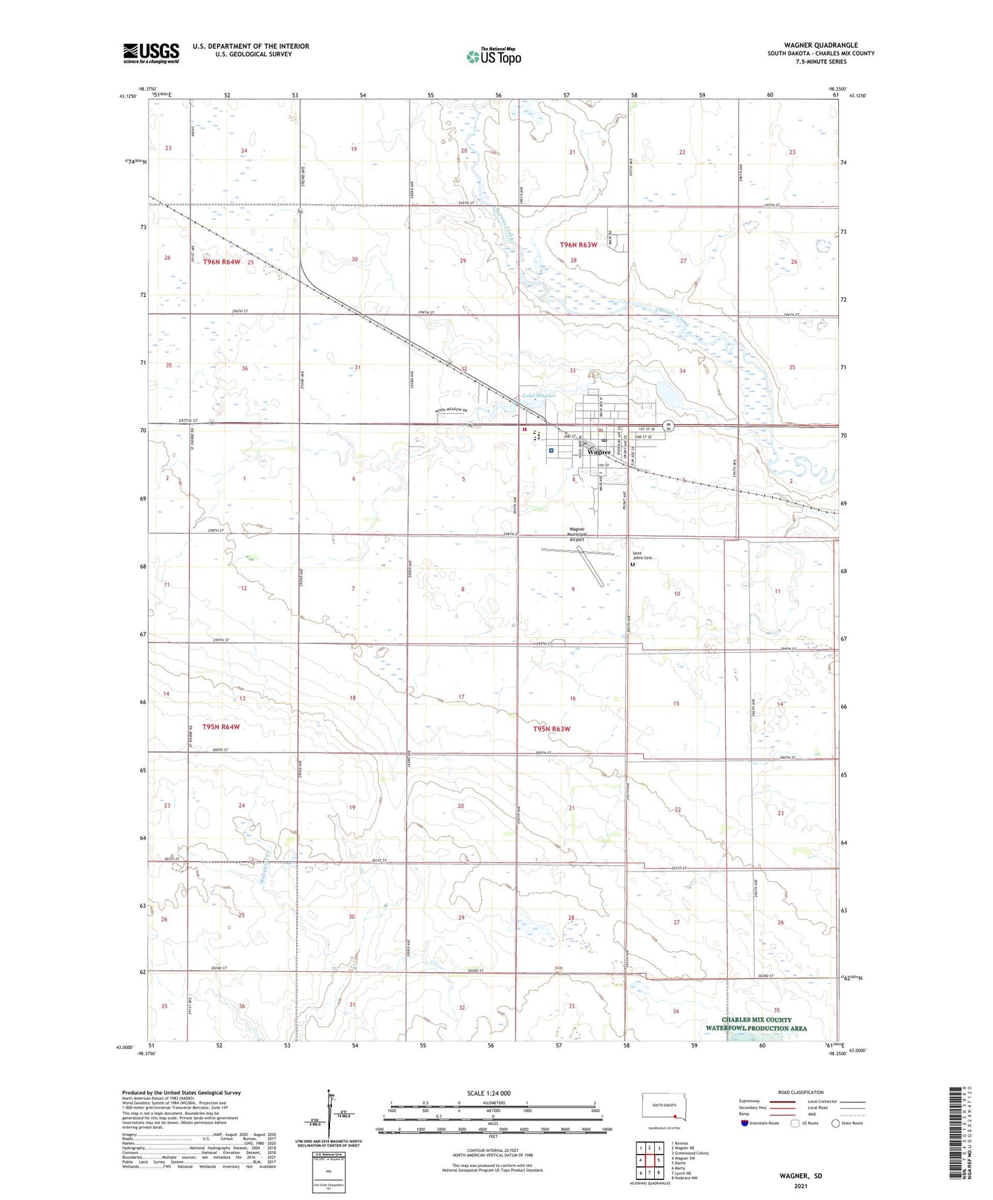
2021 topographic map quadrangle Wagner in the state of South Dakota. Scale: 1:24000. Based on the newly updated USGS 7.5' US Topo map series, this map is in the following counties: Charles Mix. The map contains contour data, water features, and other items you are used to seeing on USGS maps, but also has updated roads and other features. This is the next generation of topographic maps. Printed on high-quality waterproof paper with UV fade-resistant inks.
Quads adjacent to this one:
West: Wagner SW
Northwest: Ravinia
North: Wagner NE
Northeast: Greenwood Colony
East: Dante
Southeast: Niobrara NW
South: Lynch NE
Southwest: Marty
This map covers the same area as the classic USGS quad with code o43098a3.
Contains the following named places: City of Wagner, Highland Township Hall, Lake Wagner, Saint Johns Cemetery, School Number 30, School Number 4, School Number 50, School Number 51, School Number 52, School Number 53, Township of Lawrence, Wagner, Wagner - Lake Andes Ambulance District Station 2, Wagner City Hall, Wagner Community Memorial Hospital, Wagner Elementary School, Wagner High School, Wagner Lake Dam, Wagner Middle School, Wagner Municipal Airport, Wagner Park, Wagner Police Department, Wagner Post Office, Wagner Primary School, Wagner Public Library, Wagner Volunteer Fire Department, ZIP Code: 57380