MyTopo
Lyonville South Dakota US Topo Map
Couldn't load pickup availability
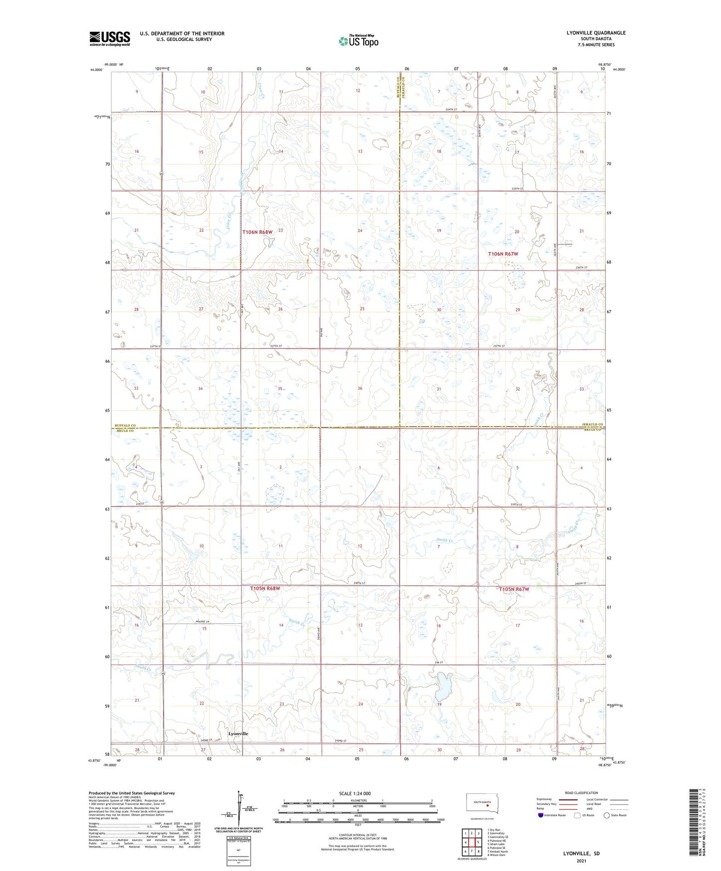
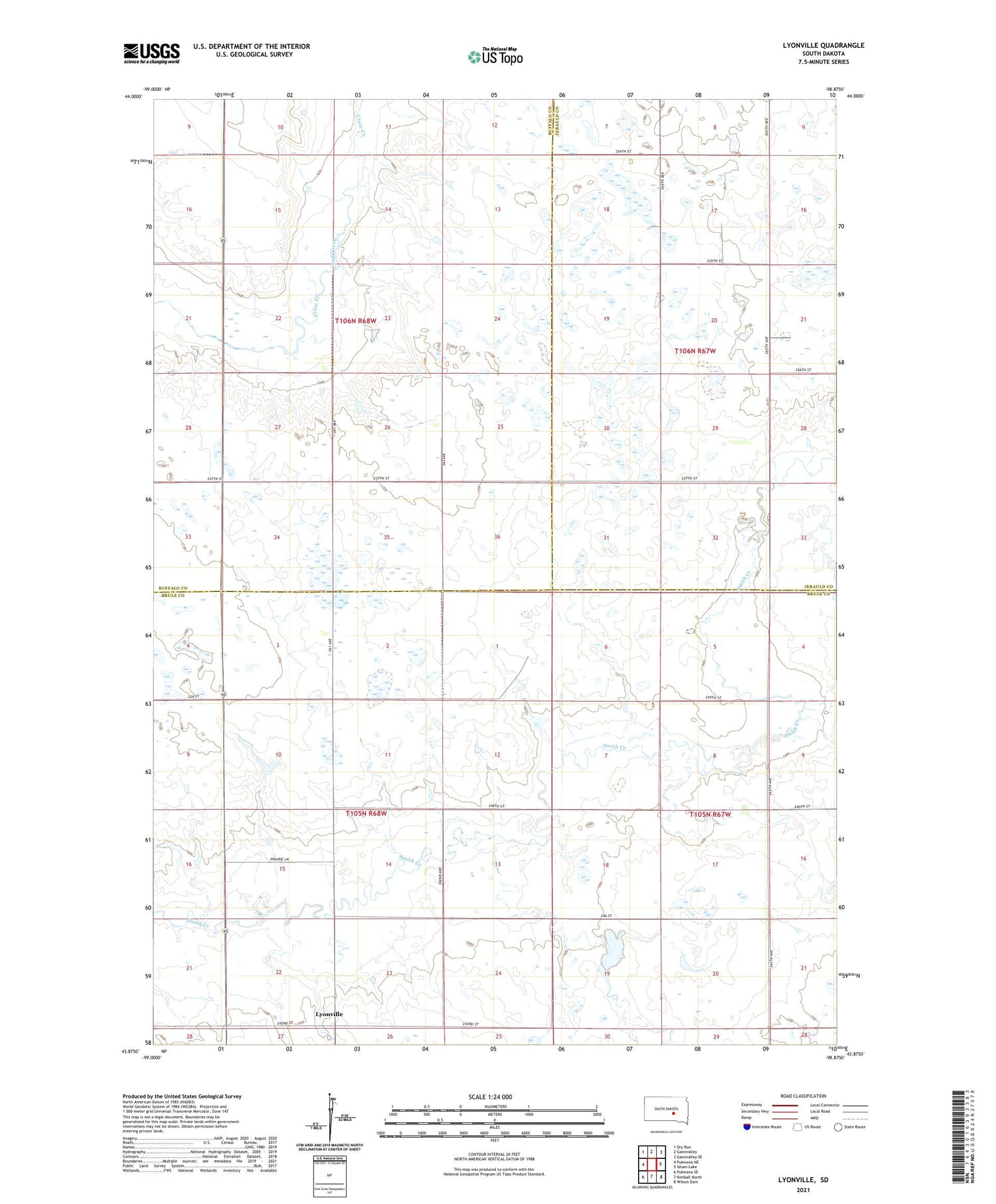
2021 topographic map quadrangle Lyonville in the state of South Dakota. Scale: 1:24000. Based on the newly updated USGS 7.5' US Topo map series, this map is in the following counties: Brule, Buffalo, Jerauld. The map contains contour data, water features, and other items you are used to seeing on USGS maps, but also has updated roads and other features. This is the next generation of topographic maps. Printed on high-quality waterproof paper with UV fade-resistant inks.
Quads adjacent to this one:
West: Pukwana NE
Northwest: Dry Run
North: Gannvalley
Northeast: Gannvalley SE
East: Isham Lake
Southeast: Wilson Dam
South: Kimball North
Southwest: Pukwana SE
Contains the following named places: Baker School Number 4, Balster School, Brooks School, Fuegan Brothers Dam, Hall School, Jones Lake, Jones Lake Dam, Lyon School, Lyonville, Plainview School, Prairie Belle School, Township of Lyon