MyTopo
Isham Lake South Dakota US Topo Map
Couldn't load pickup availability
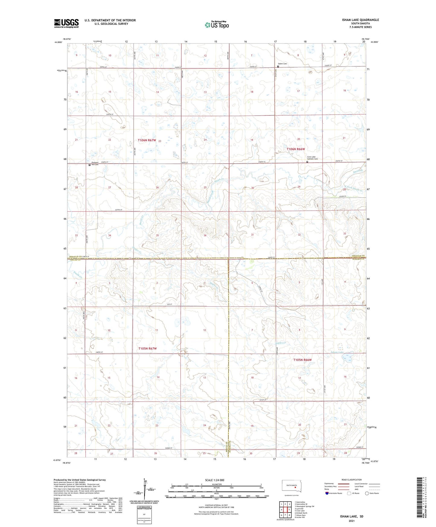
2021 topographic map quadrangle Isham Lake in the state of South Dakota. Scale: 1:24000. Based on the newly updated USGS 7.5' US Topo map series, this map is in the following counties: Jerauld, Brule, Aurora. The map contains contour data, water features, and other items you are used to seeing on USGS maps, but also has updated roads and other features. This is the next generation of topographic maps. Printed on high-quality waterproof paper with UV fade-resistant inks.
Quads adjacent to this one:
West: Lyonville
Northwest: Gannvalley
North: Gannvalley SE
Northeast: Wessington Springs SW
East: Crow Lake
Southeast: Archer Hill
South: Wilson Dam
Southwest: Kimball North
Contains the following named places: Boeson School, Crow Lake Catholic Cemetery, Crow Lake Church, East Fork Smith Creek, Fagerhaug School, Isham Lake, Paddock School Number 12, Pflamm School Number 2, Pleasant Hill Cemetery, Salem Cemetery, Sayles Creek, Township of Logan, Township of Plummer