MyTopo
May Ranch South Dakota US Topo Map
Couldn't load pickup availability
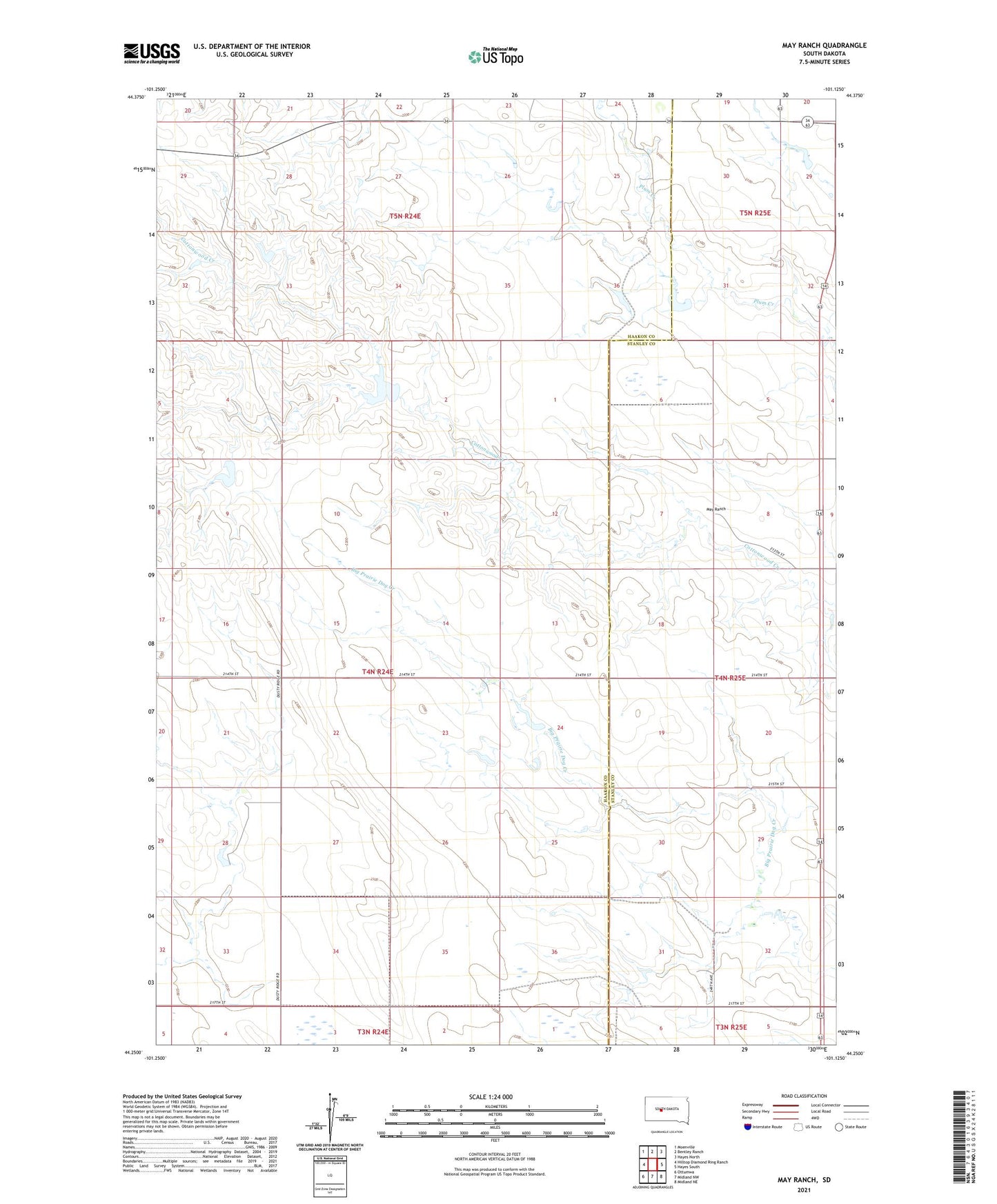
2021 topographic map quadrangle May Ranch in the state of South Dakota. Scale: 1:24000. Based on the newly updated USGS 7.5' US Topo map series, this map is in the following counties: Haakon, Stanley. The map contains contour data, water features, and other items you are used to seeing on USGS maps, but also has updated roads and other features. This is the next generation of topographic maps. Printed on high-quality waterproof paper with UV fade-resistant inks.
Quads adjacent to this one:
West: Hilltop Diamond Ring Ranch
Northwest: Moenville
North: Bentley Ranch
Northeast: Hayes North
East: Hayes South
Southeast: Midland NE
South: Midland NW
Southwest: Ottumwa
Contains the following named places: Brothers Ranch, Diamond Ring Ranch, Gene Armstrong Landing Strip, John Saucerman Number 1 Dam, May Ranch, Nemec Ranch, Saucerman Ranch, Silvage Ranch, Standiford Ranch, Tolton Ranch, Township of Maximilian, ZIP Code: 57552