MyTopo
Mayfield South Dakota US Topo Map
Couldn't load pickup availability
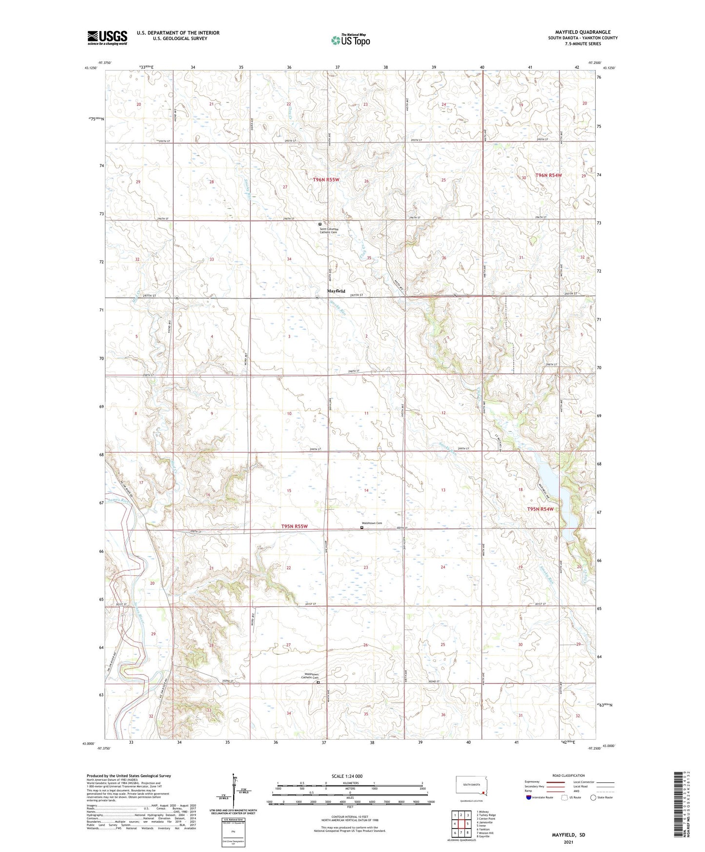
2021 topographic map quadrangle Mayfield in the state of South Dakota. Scale: 1:24000. Based on the newly updated USGS 7.5' US Topo map series, this map is in the following counties: Yankton. The map contains contour data, water features, and other items you are used to seeing on USGS maps, but also has updated roads and other features. This is the next generation of topographic maps. Printed on high-quality waterproof paper with UV fade-resistant inks.
Quads adjacent to this one:
West: Jamesville
Northwest: Midway
North: Turkey Ridge
Northeast: Center Point
East: Irene
Southeast: Gayville
South: Mission Hill
Southwest: Yankton
Contains the following named places: Clay Valley School, Cornbelt School, Knodel School, Marindahl, Marindahl Dam, Marindahl Lake, Mayfield, McFarland School, Mud Creek, Nazarene Church, Plainview School, Saint Columba Catholic Cemetery, Saint Columba Church, Sunrise School, Township of Walshtown, Walshtown, Walshtown Catholic Cemetery, Walshtown Cemetery, Walshtown School, West Prairie School, Whittier School