MyTopo
Turkey Ridge South Dakota US Topo Map
Couldn't load pickup availability
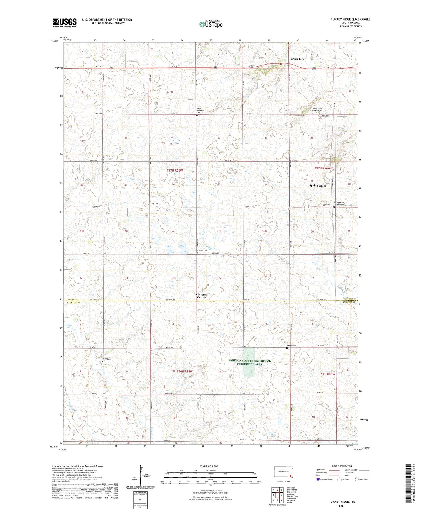
2021 topographic map quadrangle Turkey Ridge in the state of South Dakota. Scale: 1:24000. Based on the newly updated USGS 7.5' US Topo map series, this map is in the following counties: Turner, Yankton. The map contains contour data, water features, and other items you are used to seeing on USGS maps, but also has updated roads and other features. This is the next generation of topographic maps. Printed on high-quality waterproof paper with UV fade-resistant inks.
Quads adjacent to this one:
West: Midway
Northwest: Freeman
North: Freeman SE
Northeast: Parker SW
East: Center Point
Southeast: Irene
South: Mayfield
Southwest: Jamesville
This map covers the same area as the classic USGS quad with code o43097b3.
Contains the following named places: Bang Cemetery, Cameron Colony, Cameron Colony Census Designated Place, Cameron Colony Elementary School, Carlson Cemetery, Elim Cemetery, Grandview School, Hurley Fire Department Turkey Ridge Station, Idlewild, Idylwilde Church, Lowell School, Mayfield, Norwegian Lutheran Church, Ogstad Cemetery, Pearsons Corner, Saint Boniface Cemetery, School Number 27, School Number 47, School Number 81, School Number 82, School Number 99, Spring Valley, Spring Valley Baptist Cemetery, Spring Valley Church, Spring Valley Lutheran Cemetery, Township of Mayfield, Township of Salem, Turkey Ridge