MyTopo
Mission Hill South Dakota US Topo Map
Couldn't load pickup availability
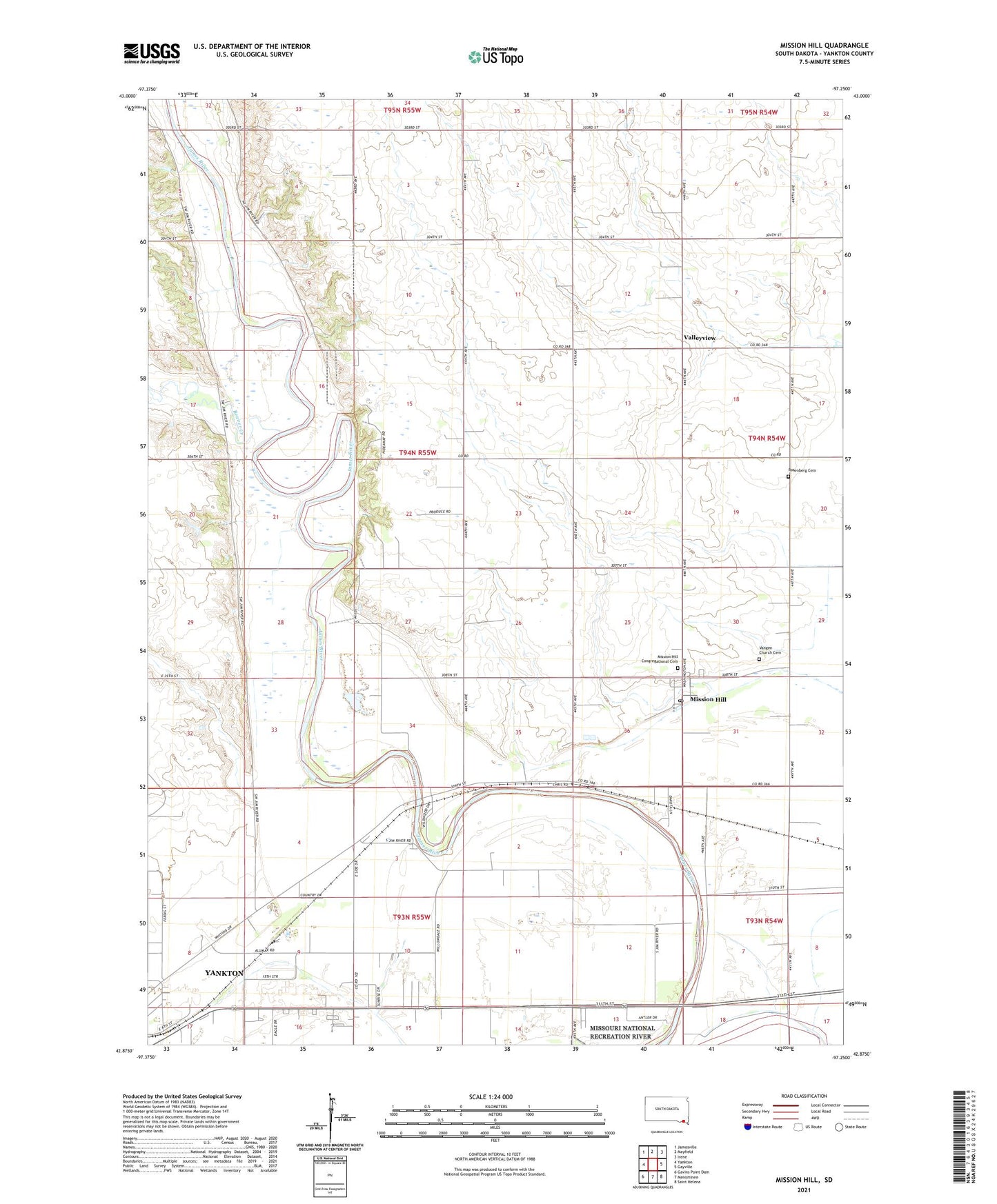
2021 topographic map quadrangle Mission Hill in the state of South Dakota. Scale: 1:24000. Based on the newly updated USGS 7.5' US Topo map series, this map is in the following counties: Yankton. The map contains contour data, water features, and other items you are used to seeing on USGS maps, but also has updated roads and other features. This is the next generation of topographic maps. Printed on high-quality waterproof paper with UV fade-resistant inks.
Quads adjacent to this one:
West: Yankton
Northwest: Jamesville
North: Mayfield
Northeast: Irene
East: Gayville
Southeast: Saint Helena
South: Menominee
Southwest: Gavins Point Dam
This map covers the same area as the classic USGS quad with code o42097h3.
Contains the following named places: Beaver Creek, Beaver Creek School, Bruget School, De Vol School, Grove School, Howard School, LaGrange, Lincoln Park, Mission Hill, Mission Hill Congregational Cemetery, Mission Hill Post Office, Rempp School, Rosenberg Cemetery, Town of Mission Hill, Township of Mission Hill, Unorganized Territory of Southeast Yankton, Valleyview, Vangen Church, Vangen Church Cemetery, Welby School, Willowdale School, WNAX-AM (Yankton), Yankton County Poor Farm, ZIP Code: 57046