MyTopo
Mellette South Dakota US Topo Map
Couldn't load pickup availability
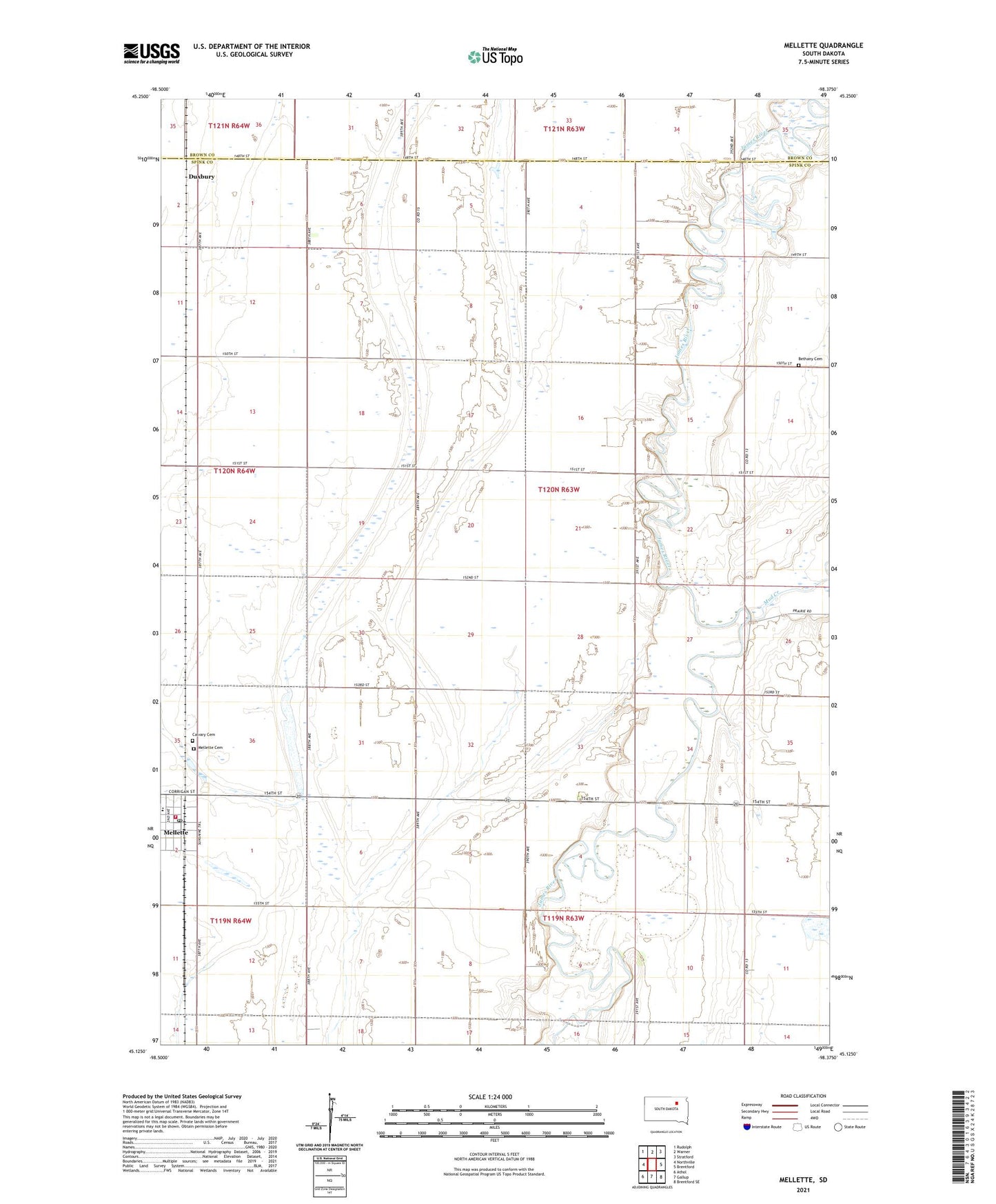
2021 topographic map quadrangle Mellette in the state of South Dakota. Scale: 1:24000. Based on the newly updated USGS 7.5' US Topo map series, this map is in the following counties: Spink, Brown. The map contains contour data, water features, and other items you are used to seeing on USGS maps, but also has updated roads and other features. This is the next generation of topographic maps. Printed on high-quality waterproof paper with UV fade-resistant inks.
Quads adjacent to this one:
West: Northville
Northwest: Rudolph
North: Warner
Northeast: Stratford
East: Brentford
Southeast: Brentford SE
South: Gallup
Southwest: Athol
This map covers the same area as the classic USGS quad with code o45098b4.
Contains the following named places: Armadale, Armadale Grove, Armadale Park, Bethany Cemetery, Bethany Church, Borge School, Calvary Cemetery, City of Mellette, Dunker School, Duxbury, Mellette, Mellette Cemetery, Mellette Fire Department, Mellette Post Office, Morgan School, Mud Creek, Township of Mellette, ZIP Code: 57461