MyTopo
Mission Ridge South Dakota US Topo Map
Couldn't load pickup availability
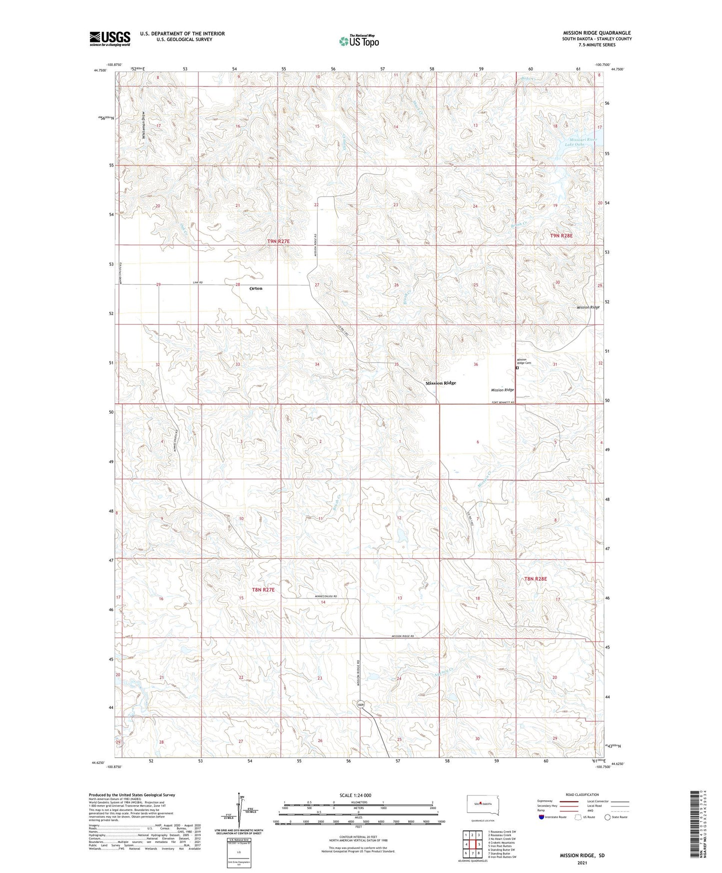
2021 topographic map quadrangle Mission Ridge in the state of South Dakota. Scale: 1:24000. Based on the newly updated USGS 7.5' US Topo map series, this map is in the following counties: Stanley. The map contains contour data, water features, and other items you are used to seeing on USGS maps, but also has updated roads and other features. This is the next generation of topographic maps. Printed on high-quality waterproof paper with UV fade-resistant inks.
Quads adjacent to this one:
West: Crokett Mountains
Northwest: Rousseau Creek SW
North: Rousseau Creek
Northeast: No Heart Creek SW
East: Iron Post Buttes
Southeast: Iron Post Buttes SW
South: Standing Butte
Southwest: Standing Butte SW
Contains the following named places: Ancel Tibbs Ranch, Anderson Number 1 Dam, Chisholm Number 1 Dam, Chisholm Ranch Landing Field, Dick Deal Landing Strip, Doc Tibbs Ranch, Donelan Ranch, J E Sheehan Estate Number 1 Dam, J E Sheehan Estate Number 2 Dam, Mission Ridge, Mission Ridge Cemetery, Orton, Orton Flat, Orton School