MyTopo
Iron Post Buttes SW South Dakota US Topo Map
Couldn't load pickup availability
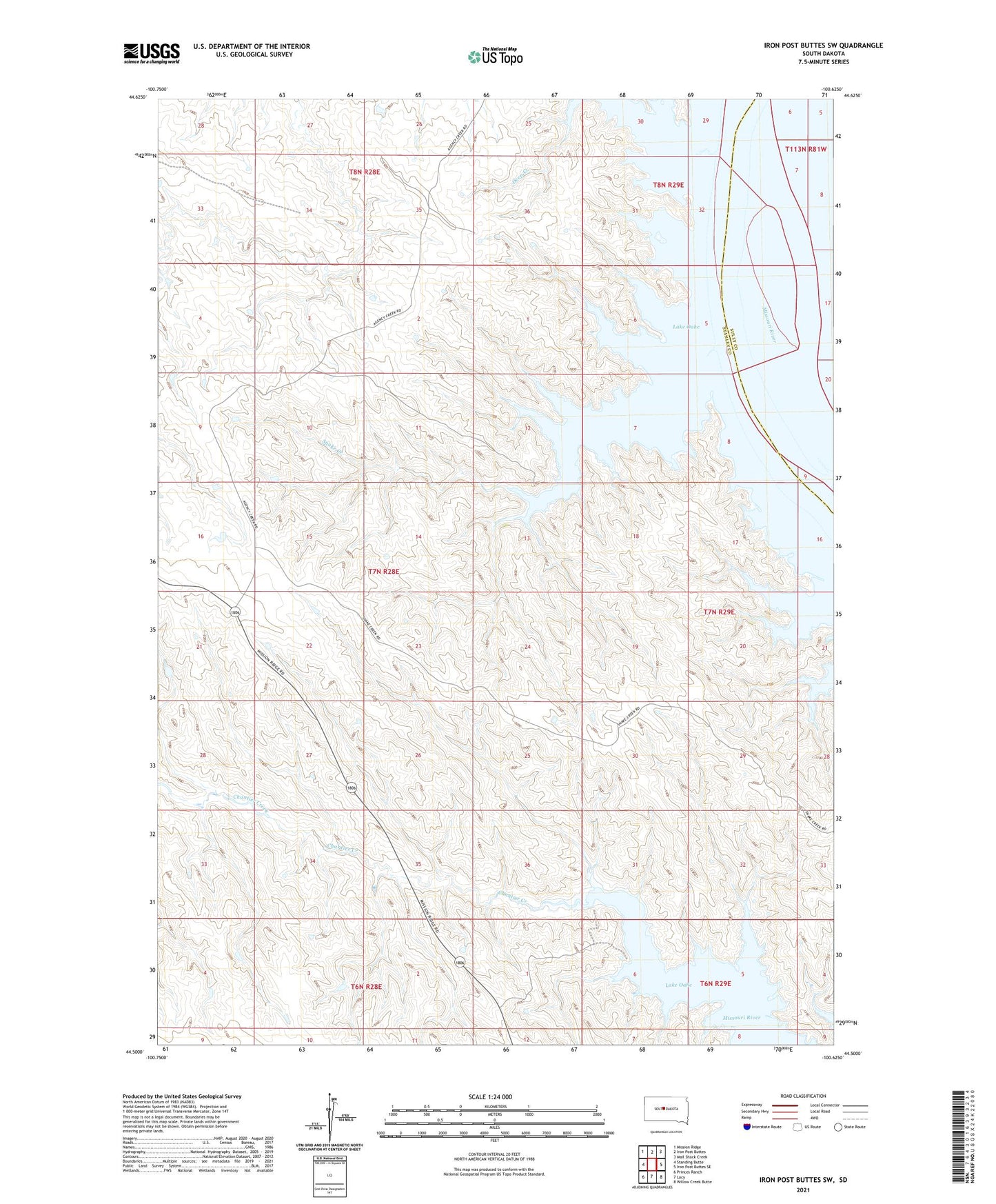
2021 topographic map quadrangle Iron Post Buttes SW in the state of South Dakota. Scale: 1:24000. Based on the newly updated USGS 7.5' US Topo map series, this map is in the following counties: Stanley, Sully. The map contains contour data, water features, and other items you are used to seeing on USGS maps, but also has updated roads and other features. This is the next generation of topographic maps. Printed on high-quality waterproof paper with UV fade-resistant inks.
Quads adjacent to this one:
West: Standing Butte
Northwest: Mission Ridge
North: Iron Post Buttes
Northeast: Mail Shack Creek
East: Iron Post Buttes SE
Southeast: Willow Creek Butte
South: Lacy
Southwest: Princes Ranch
This map covers the same area as the classic USGS quad with code o44100e6.
Contains the following named places: Deep Creek, Lawrence Donelan Dam, Red Woman Creek, Snake Creek, Stanley Island, W L Thompson Airport