MyTopo
Standing Butte South Dakota US Topo Map
Couldn't load pickup availability
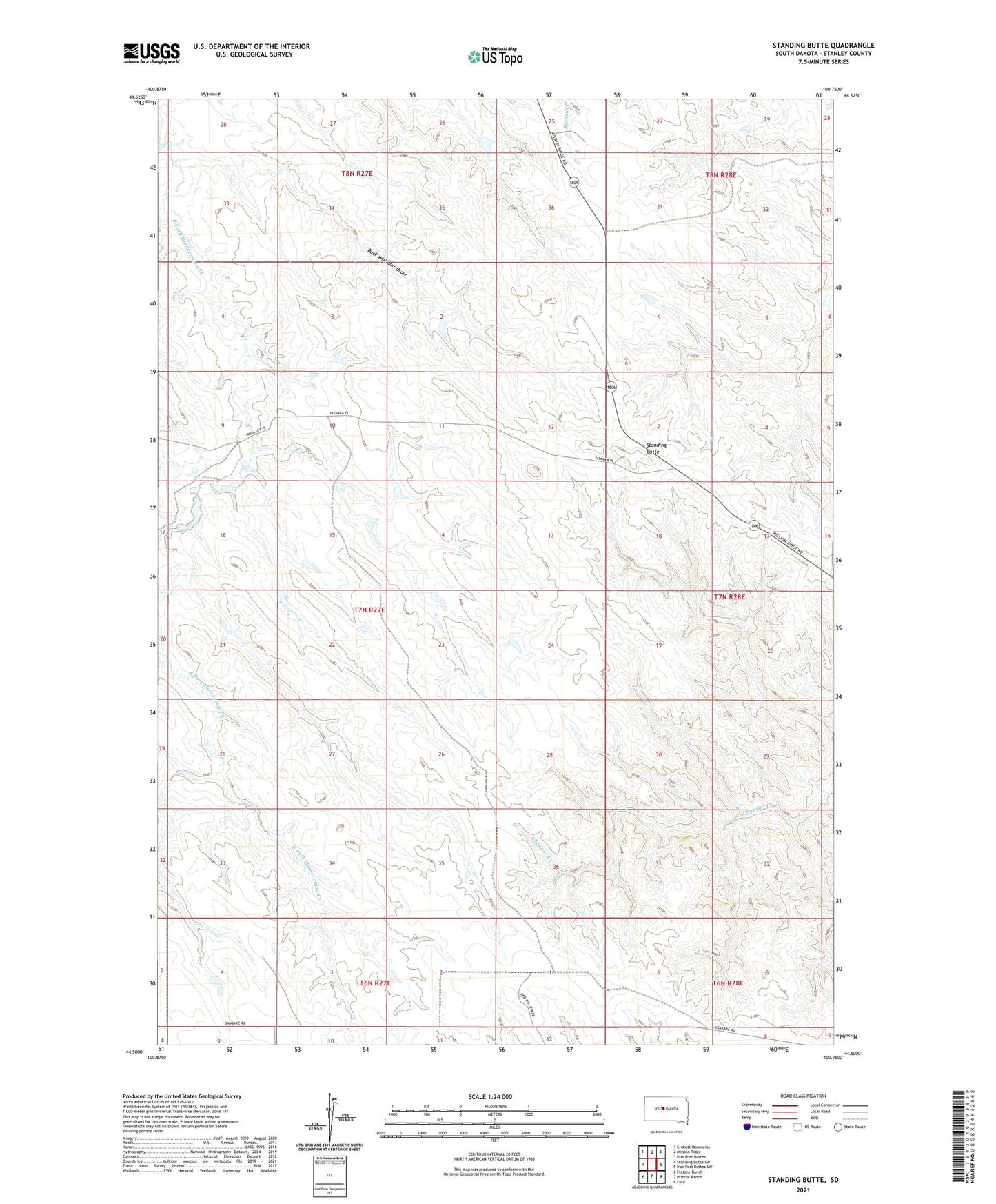
2021 topographic map quadrangle Standing Butte in the state of South Dakota. Scale: 1:24000. Based on the newly updated USGS 7.5' US Topo map series, this map is in the following counties: Stanley. The map contains contour data, water features, and other items you are used to seeing on USGS maps, but also has updated roads and other features. This is the next generation of topographic maps. Printed on high-quality waterproof paper with UV fade-resistant inks.
Quads adjacent to this one:
West: Standing Butte SW
Northwest: Crokett Mountains
North: Mission Ridge
Northeast: Iron Post Buttes
East: Iron Post Buttes SW
Southeast: Lacy
South: Princes Ranch
Southwest: Fratzke Ranch
This map covers the same area as the classic USGS quad with code o44100e7.
Contains the following named places: Buck Williams Draw, Deal Landing Strip, Standing Butte, Standing Butte Triple-U Buffalo Ranch, Unorganized Territory of North Stanley