MyTopo
Moreau NE South Dakota US Topo Map
Couldn't load pickup availability
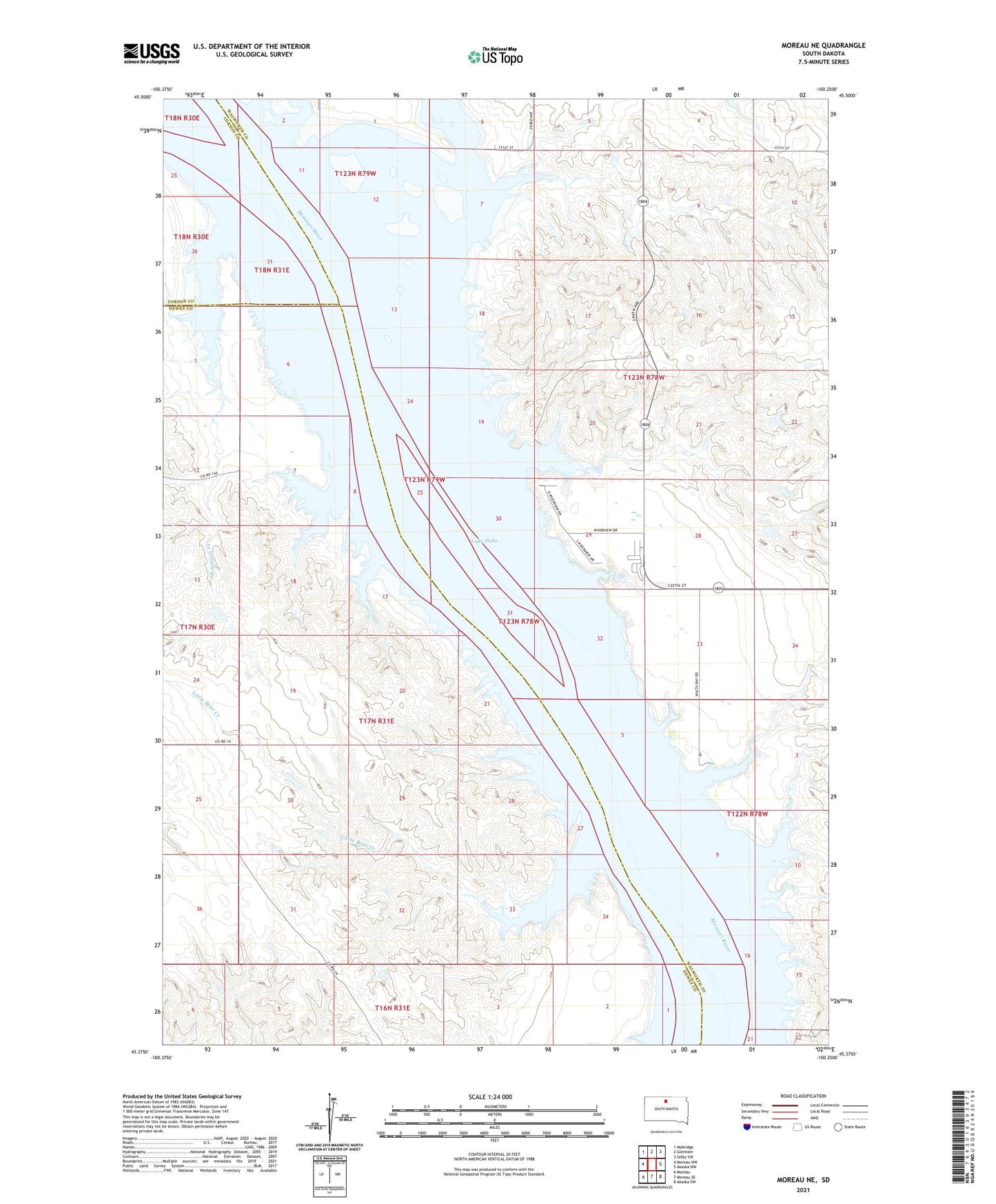
2021 topographic map quadrangle Moreau NE in the state of South Dakota. Scale: 1:24000. Based on the newly updated USGS 7.5' US Topo map series, this map is in the following counties: Walworth, Dewey, Corson. The map contains contour data, water features, and other items you are used to seeing on USGS maps, but also has updated roads and other features. This is the next generation of topographic maps. Printed on high-quality waterproof paper with UV fade-resistant inks.
Quads adjacent to this one:
West: Moreau NW
Northwest: Mobridge
North: Glenham
Northeast: Selby SW
East: Akaska NW
Southeast: Akaska SW
South: Moreau SE
Southwest: Moreau
Contains the following named places: Blue Blanket Creek, Blue Blanket Recreation Area, Bowdle Beach Recreation Area, Ed Berens Dam, Evarts, Evarts Cemetery, Fox Island, George Turner Dam, I Molstad Dam, John Liebelt Dam, Lake Evarts, Le Compte Creek, Lindia Sattler Dam, Little Bear Creek, Lyman Ranch, Ree Indian Village, Richard Walth Dam, Thomas Bay Recreation Area, Township of Kennedy, Walth Bay Recreation Area, Walworth