MyTopo
Nielson Ranch South Dakota US Topo Map
Couldn't load pickup availability
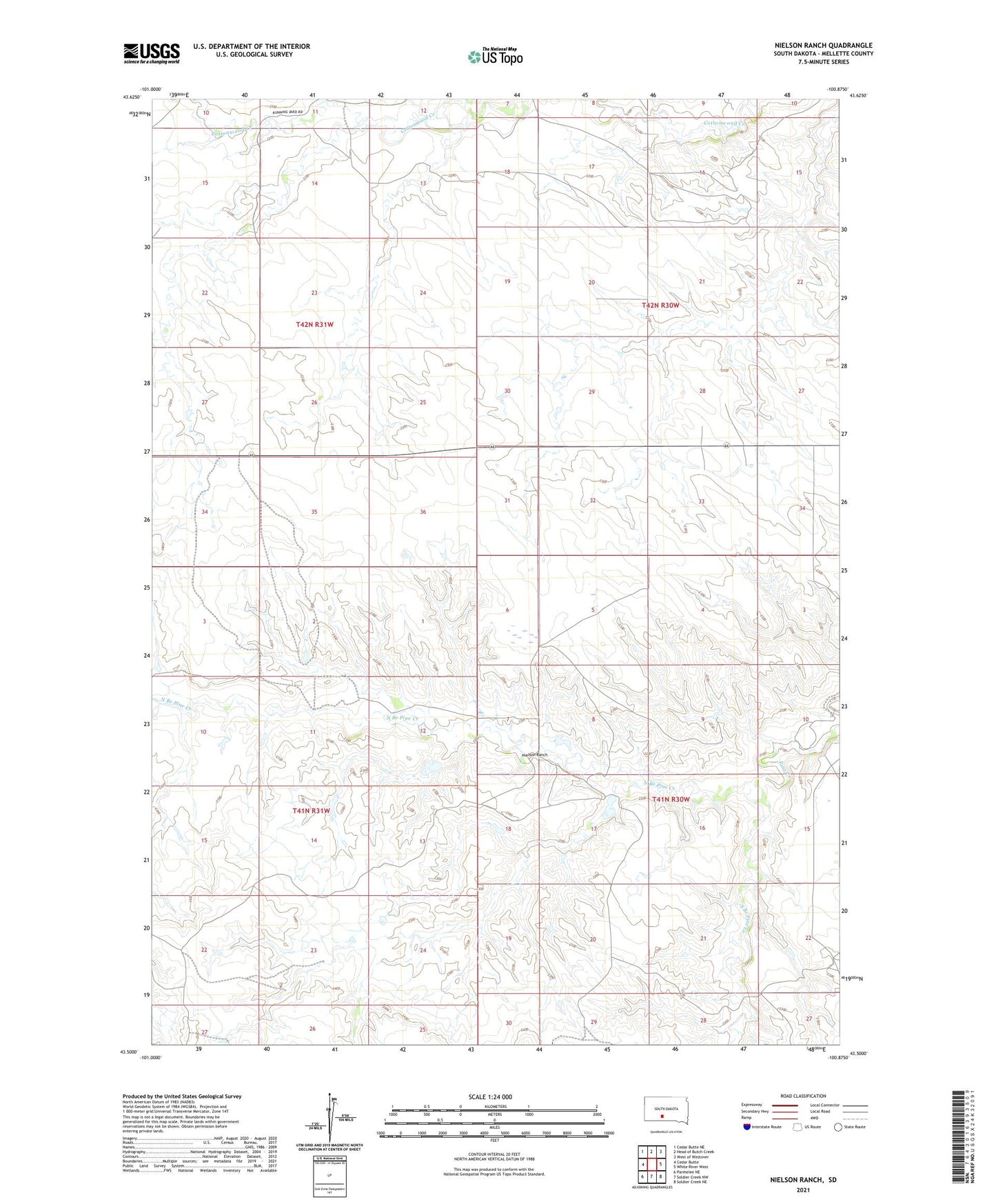
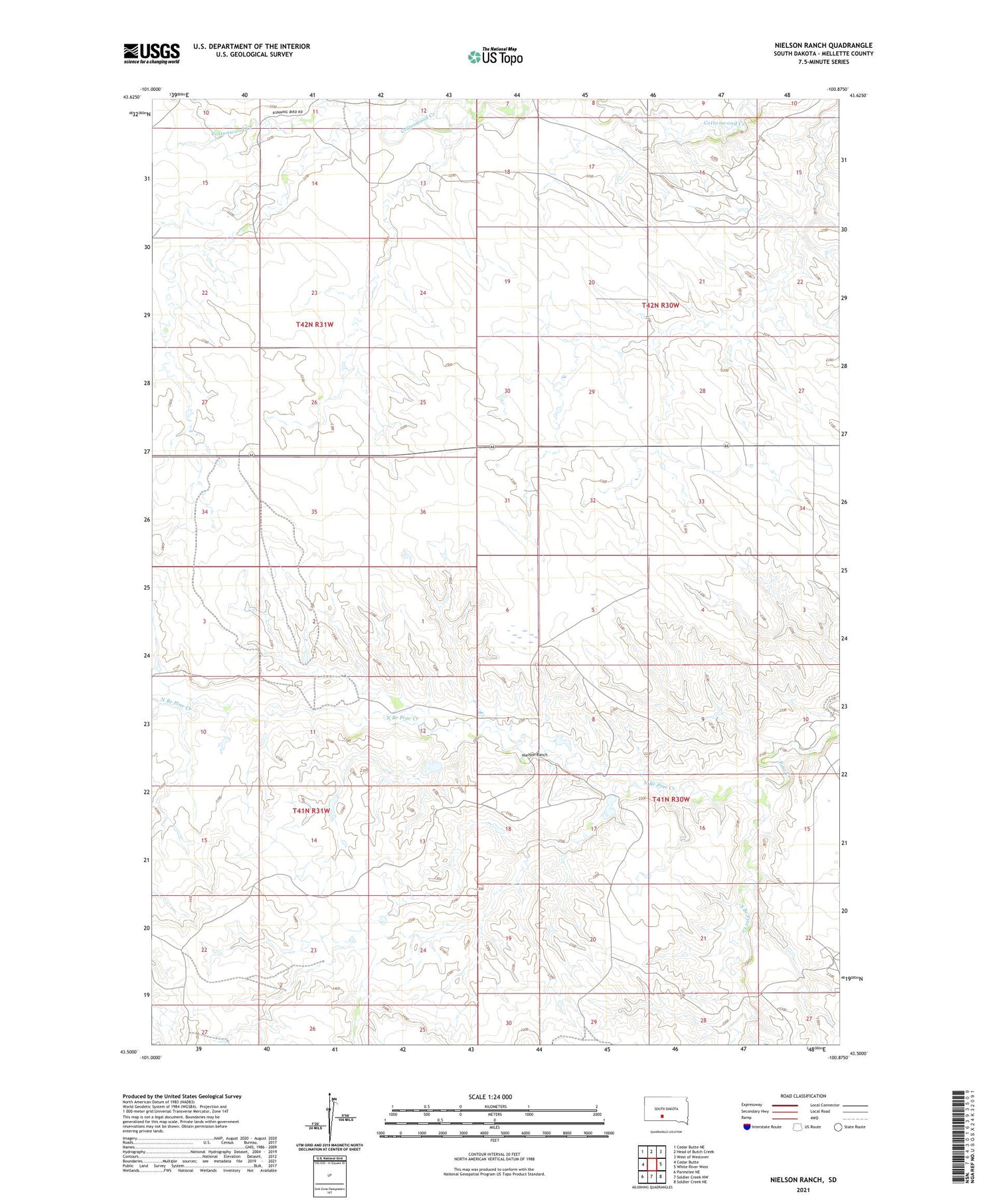
2021 topographic map quadrangle Nielson Ranch in the state of South Dakota. Scale: 1:24000. Based on the newly updated USGS 7.5' US Topo map series, this map is in the following counties: Mellette. The map contains contour data, water features, and other items you are used to seeing on USGS maps, but also has updated roads and other features. This is the next generation of topographic maps. Printed on high-quality waterproof paper with UV fade-resistant inks.
Quads adjacent to this one:
West: Cedar Butte
Northwest: Cedar Butte NE
North: Head of Butch Creek
Northeast: West of Westover
East: White River West
Southeast: Soldier Creek NE
South: Soldier Creek NW
Southwest: Parmelee NE
Contains the following named places: Carr Number 1 Dam, Carr Number 2 Dam, Carr Number 4 Dam, Carr Number 5 Dam, Charles Chamberlain Ranch, Harris Ranch, Jarl Knispel Ranch, Jarl Oswarld Number 2 Dam, John Catron Junior Number 3 Dam, Lyle Chamberlain Ranch, Marvin Chamberlain Ranch, Nielson Ranch, North Branch Pine Creek, Shouldis Ranch, South Branch Pine Creek, Township of Cottonwood Valley, Township of Pine Creek, Winchell Ranch