MyTopo
White River West South Dakota US Topo Map
Couldn't load pickup availability
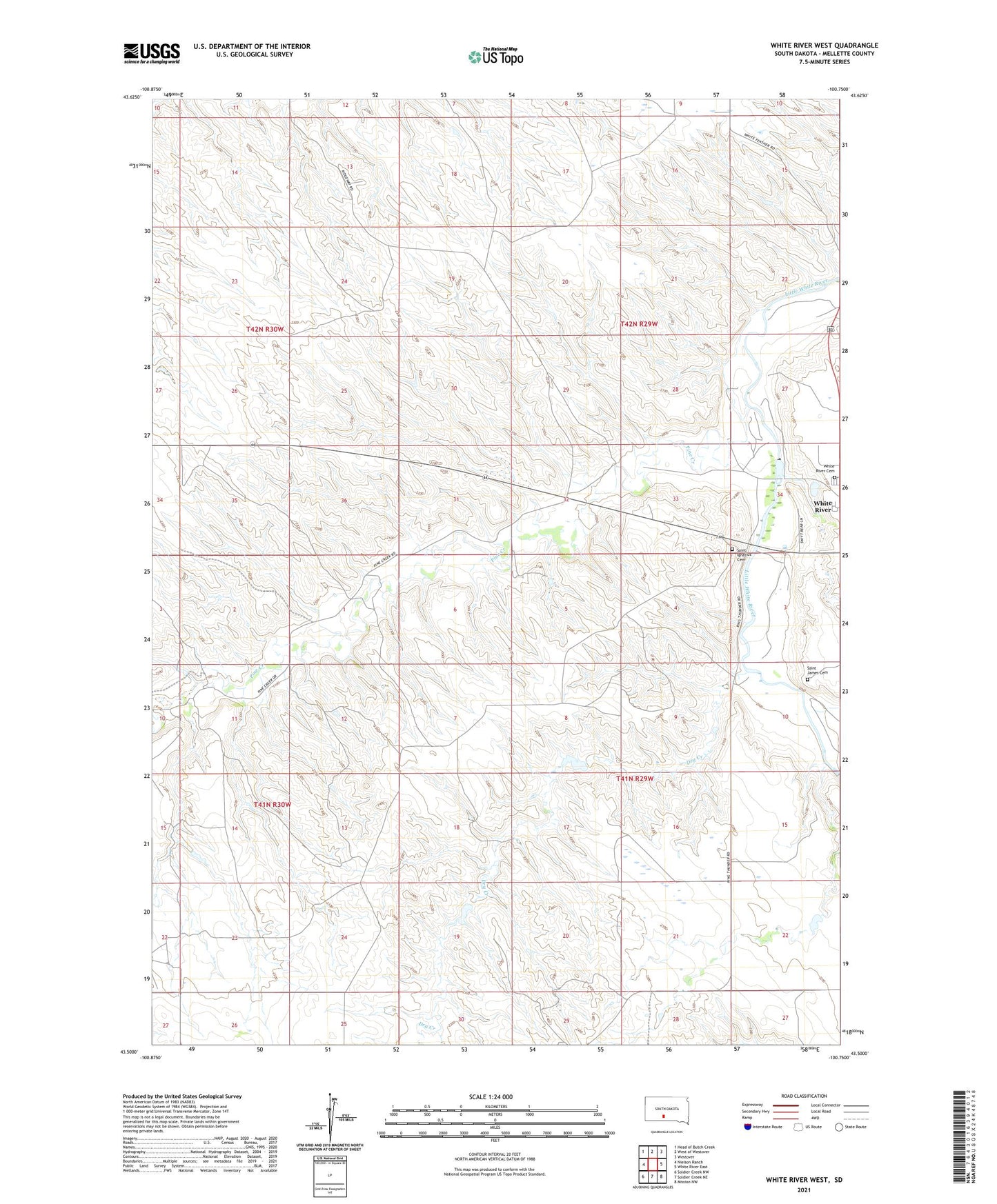
2021 topographic map quadrangle White River West in the state of South Dakota. Scale: 1:24000. Based on the newly updated USGS 7.5' US Topo map series, this map is in the following counties: Mellette. The map contains contour data, water features, and other items you are used to seeing on USGS maps, but also has updated roads and other features. This is the next generation of topographic maps. Printed on high-quality waterproof paper with UV fade-resistant inks.
Quads adjacent to this one:
West: Nielson Ranch
Northwest: Head of Butch Creek
North: West of Westover
Northeast: Westover
East: White River East
Southeast: Mission NW
South: Soldier Creek NE
Southwest: Soldier Creek NW
This map covers the same area as the classic USGS quad with code o43100e7.
Contains the following named places: Amber Ranch, Ambur Brothers Number 1 Dam, Andy Smith Ranch, Carl Gunner Number 1 Dam, Dry Creek, Gary Astleford Ranch, Gunner Ranch, Highway 44 Dam, Highway 44 Number 6 Dam, Highway Department Number 3 Dam, Iwan Number 1 Dam, Jensen Number 5 Dam, Jensen Number 7 Dam, Jensen Ranch, Ken Astleford Ranch, Krogman Number 4 Dam, Lawrence Krogman Ranch, Lolley Ranch, Mellette County, Pine Creek, Raffensperger Ranch, Risseeuw Ranch, Saint Ignatius Cemetery, Saint James Cemetery, Smith Andy Number 1 Dam, Stromer Ranch, Two Hawk Ranch, White River Cemetery, Winchell Brothers Number 1 Dam, ZIP Code: 57579