MyTopo
Head of Butch Creek South Dakota US Topo Map
Couldn't load pickup availability
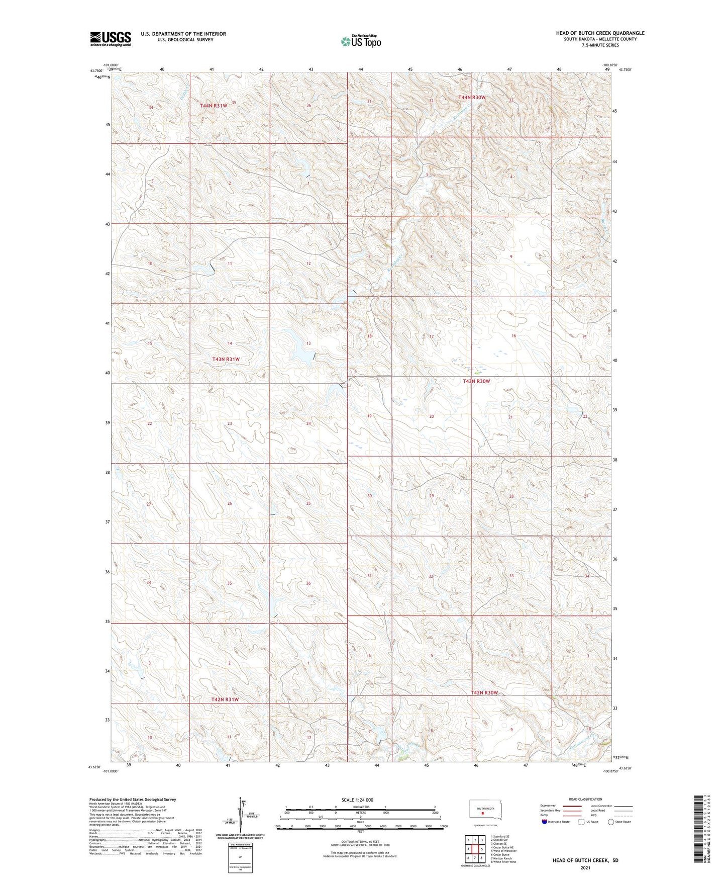
2021 topographic map quadrangle Head of Butch Creek in the state of South Dakota. Scale: 1:24000. Based on the newly updated USGS 7.5' US Topo map series, this map is in the following counties: Mellette. The map contains contour data, water features, and other items you are used to seeing on USGS maps, but also has updated roads and other features. This is the next generation of topographic maps. Printed on high-quality waterproof paper with UV fade-resistant inks.
Quads adjacent to this one:
West: Cedar Butte NE
Northwest: Stamford SE
North: Okaton SW
Northeast: Okaton SE
East: West of Westover
Southeast: White River West
South: Nielson Ranch
Southwest: Cedar Butte
This map covers the same area as the classic USGS quad with code o43100f8.
Contains the following named places: England Brothers Number 1 Dam, England Number 2 Dam, England Number 3 Dam, England Number 4 Dam, England Number 5 Dam, Greene Gene Number 2 Dam, Jarl Number 1 Dam, Jensen Number 1 Dam, Jensen Number 10 Dam, Jensen Number 9 Dam, Novey Joe Number 1 Dam, Swift Bear Segment, Township of Roundup, U P Ranch