
MyTopo
Oldham South Dakota US Topo Map
Couldn't load pickup availability
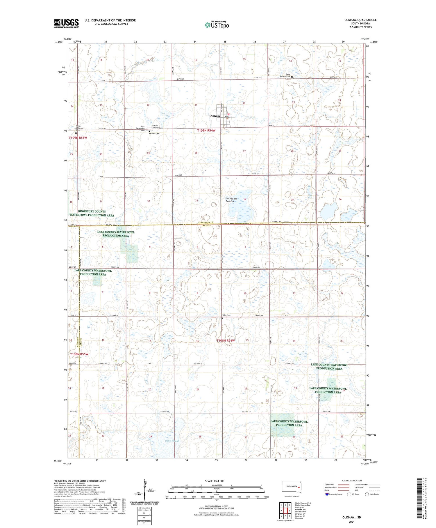
2021 topographic map quadrangle Oldham in the state of South Dakota. Scale: 1:24000. Based on the newly updated USGS 7.5' US Topo map series, this map is in the following counties: Lake, Kingsbury, Miner. The map contains contour data, water features, and other items you are used to seeing on USGS maps, but also has updated roads and other features. This is the next generation of topographic maps. Printed on high-quality waterproof paper with UV fade-resistant inks.
Quads adjacent to this one:
West: Oldham NW
Northwest: Lake Preston West
North: Lake Preston East
Northeast: Arlington
East: Madison NW
Southeast: Ramona
South: Oldham SE
Southwest: Oldham SW
Contains the following named places: City of Oldham, Davis Slough, Huffman, Loriks-Peterson Heritage House Museum, Oldham, Oldham Cemetery, Oldham City Hall, Oldham Lutheran Cemetery, Oldham Post Office, Oldham Volunteer Fire Department, Saint Andreas Cemetery, Saint Catherine's Cemetery, School Number 3, School Number 4, School Number 8, Toles Cemetery, Township of Bartlett, Township of Wayne, Trinity Church, Trinity Lutheran Cemetery, ZIP Codes: 57051, 57054


