MyTopo
Peever South Dakota US Topo Map
Couldn't load pickup availability
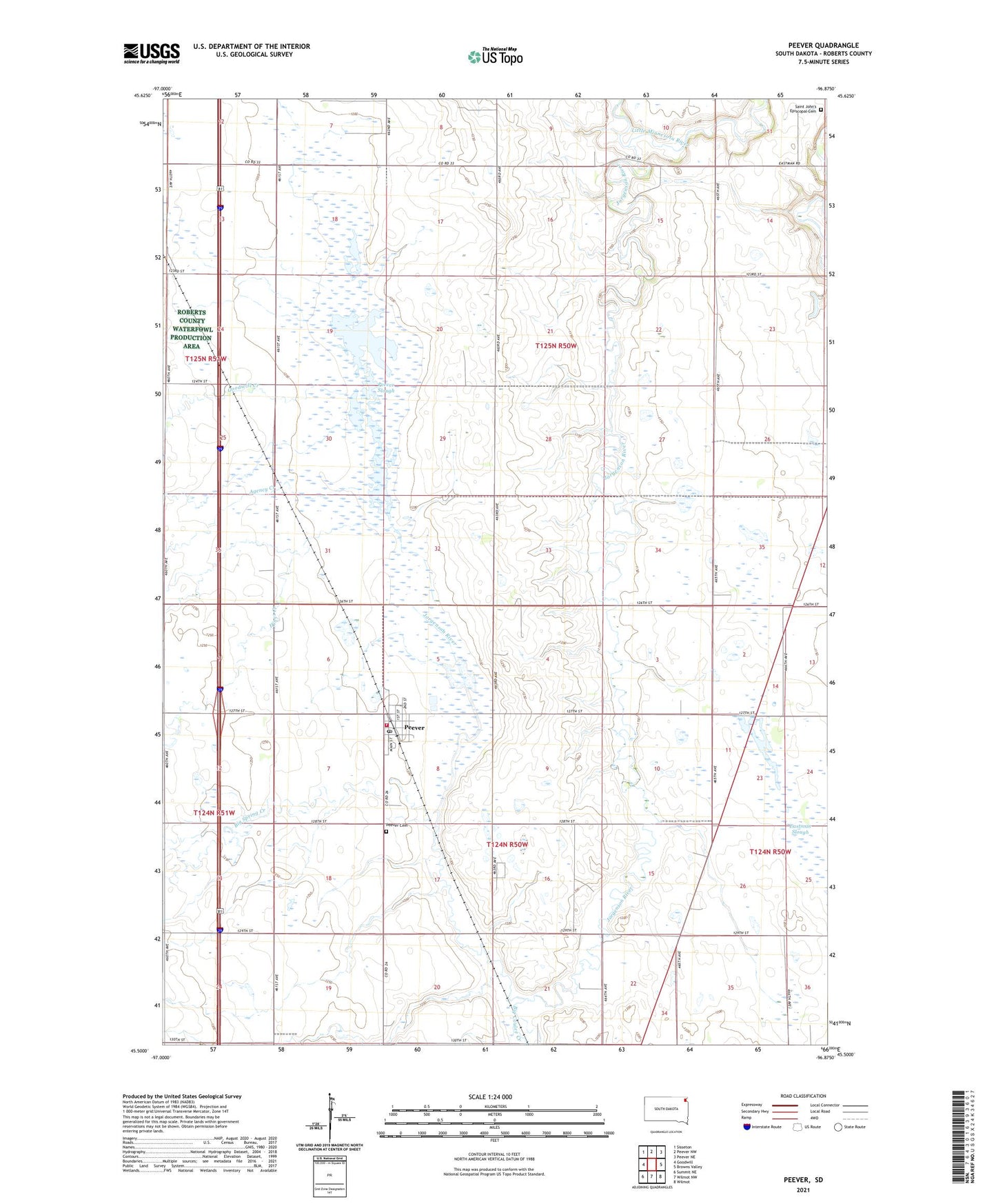
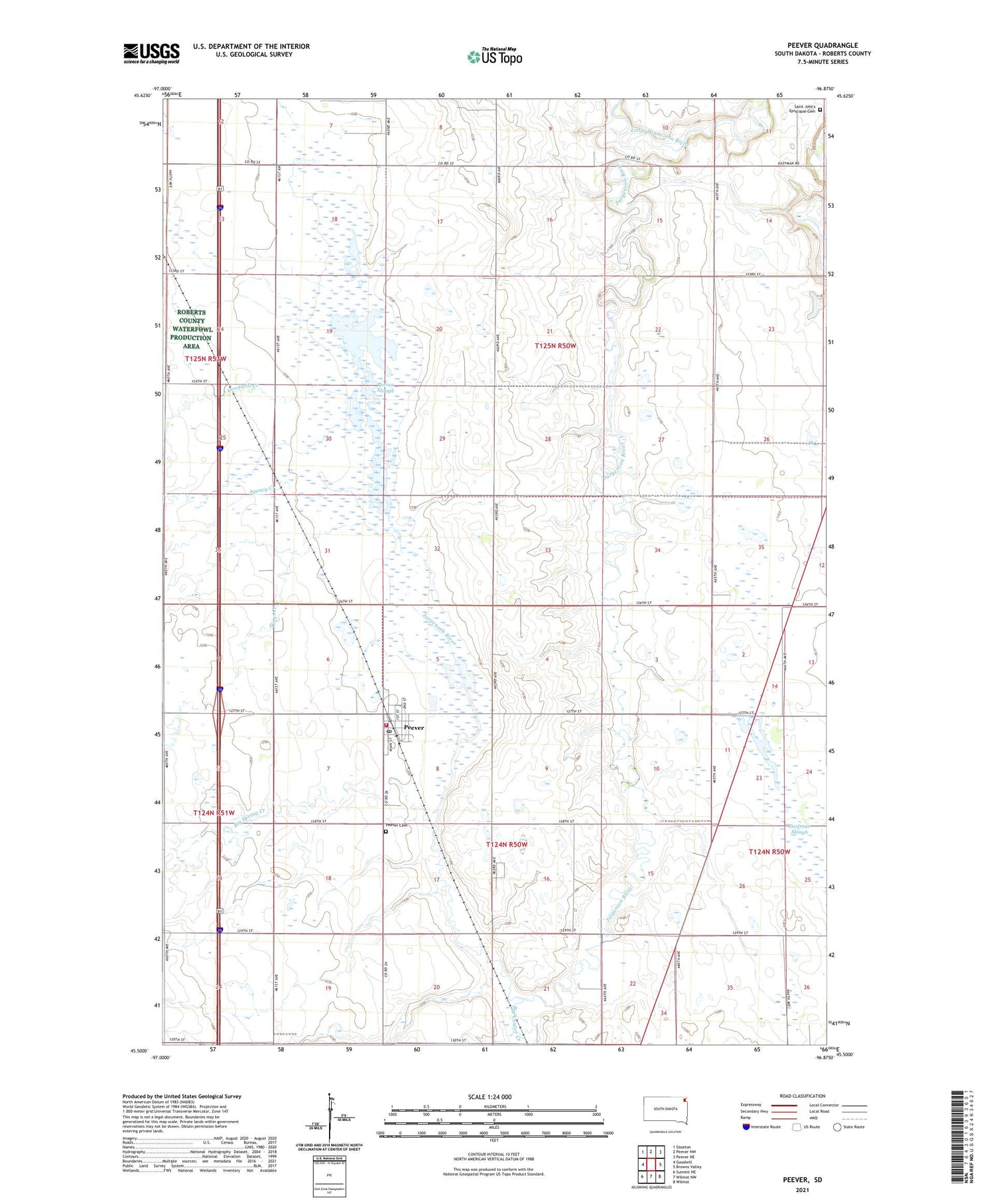
2021 topographic map quadrangle Peever in the state of South Dakota. Scale: 1:24000. Based on the newly updated USGS 7.5' US Topo map series, this map is in the following counties: Roberts. The map contains contour data, water features, and other items you are used to seeing on USGS maps, but also has updated roads and other features. This is the next generation of topographic maps. Printed on high-quality waterproof paper with UV fade-resistant inks.
Quads adjacent to this one:
West: Goodwill
Northwest: Sisseton
North: Peever NW
Northeast: Peever NE
Southeast: Wilmot
South: Wilmot NW
Southwest: Summit NE
Contains the following named places: Agency Creek, Big Coulee Creek, Big Spring Creek, Eastman Slough, Eastman State Wildlife Management Area, Goodwill Creek, Hines Creek, Jorgenson River, Lake Traverse District, Peever, Peever Cemetery, Peever Flats, Peever Flats Census Designated Place, Peever Post Office, Peever Slough, Peever Slough State Wildlife Management Area, Peever Volunteer Fire Department, Roberts County State Wildlife Management Area, Saint John's Episcopal Cemetery, School Number 1, School Number 2, Town of Peever, Township of Easter, Township of Lawrence