MyTopo
Wilmot NW South Dakota US Topo Map
Couldn't load pickup availability
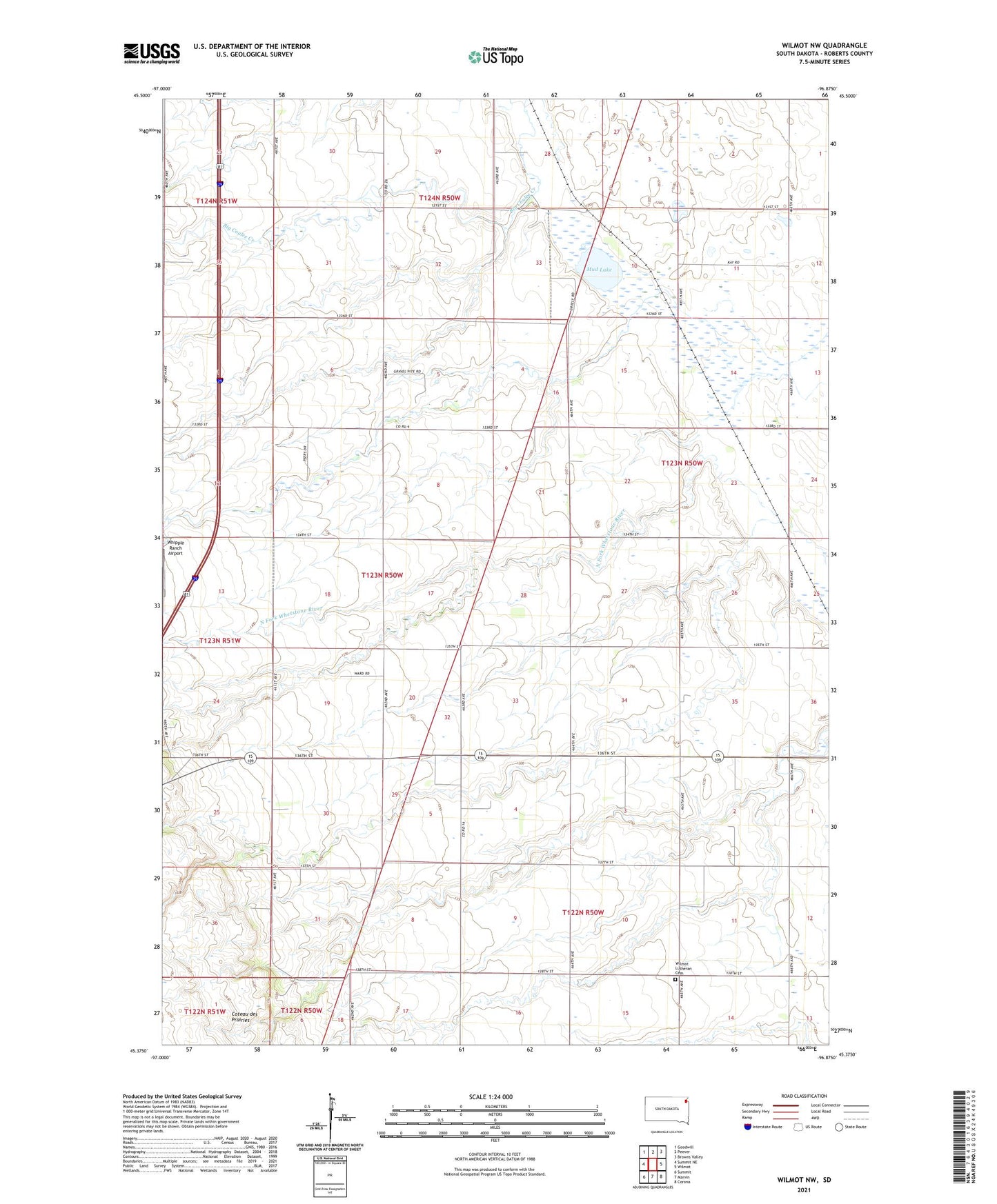
2021 topographic map quadrangle Wilmot NW in the state of South Dakota. Scale: 1:24000. Based on the newly updated USGS 7.5' US Topo map series, this map is in the following counties: Roberts. The map contains contour data, water features, and other items you are used to seeing on USGS maps, but also has updated roads and other features. This is the next generation of topographic maps. Printed on high-quality waterproof paper with UV fade-resistant inks.
Quads adjacent to this one:
West: Summit NE
Northwest: Goodwill
North: Peever
East: Wilmot
Southeast: Corona
South: Marvin
Southwest: Summit
This map covers the same area as the classic USGS quad with code o45096d8.
Contains the following named places: Big Coulee District, Lee Township Hall, Mud Lake, School Number 1, School Number 2, School Number 3, Township of Lee, Whipple Ranch Airport, Wilmot Lutheran Cemetery, ZIP Code: 57279